MyTopo
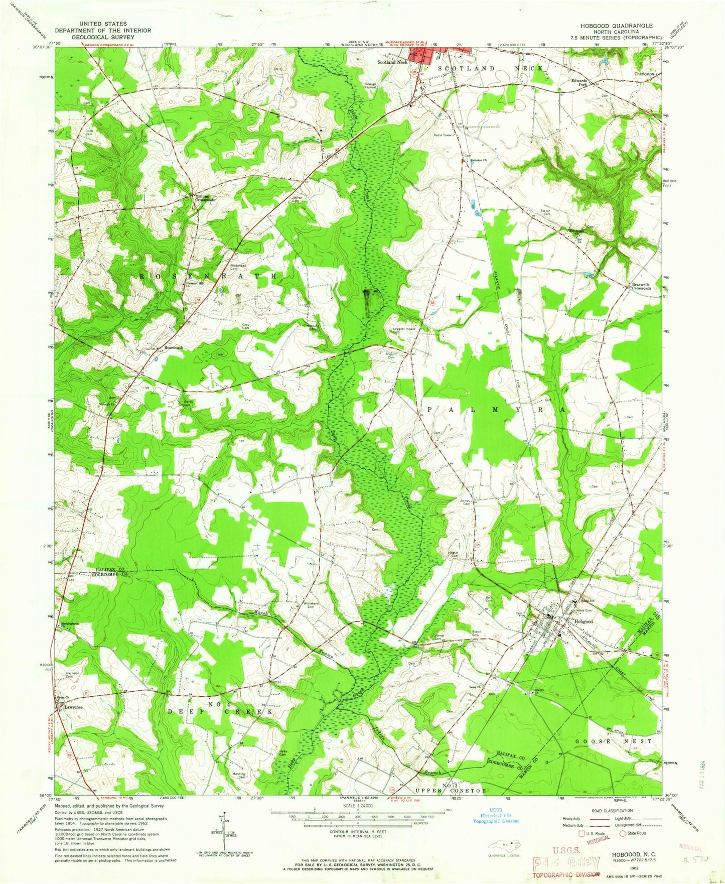
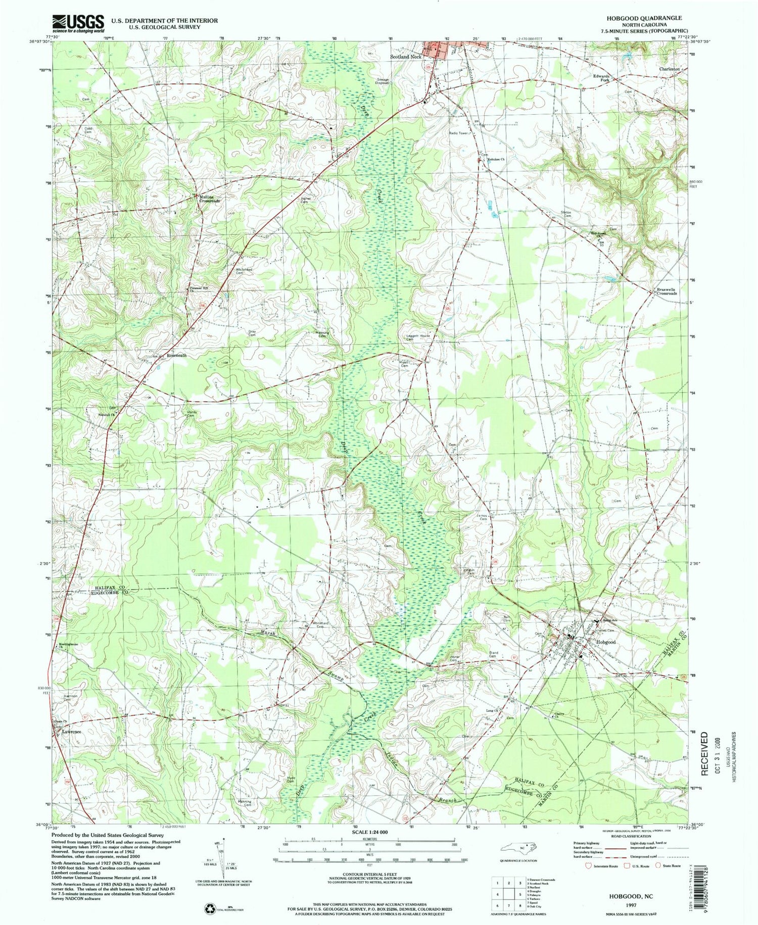
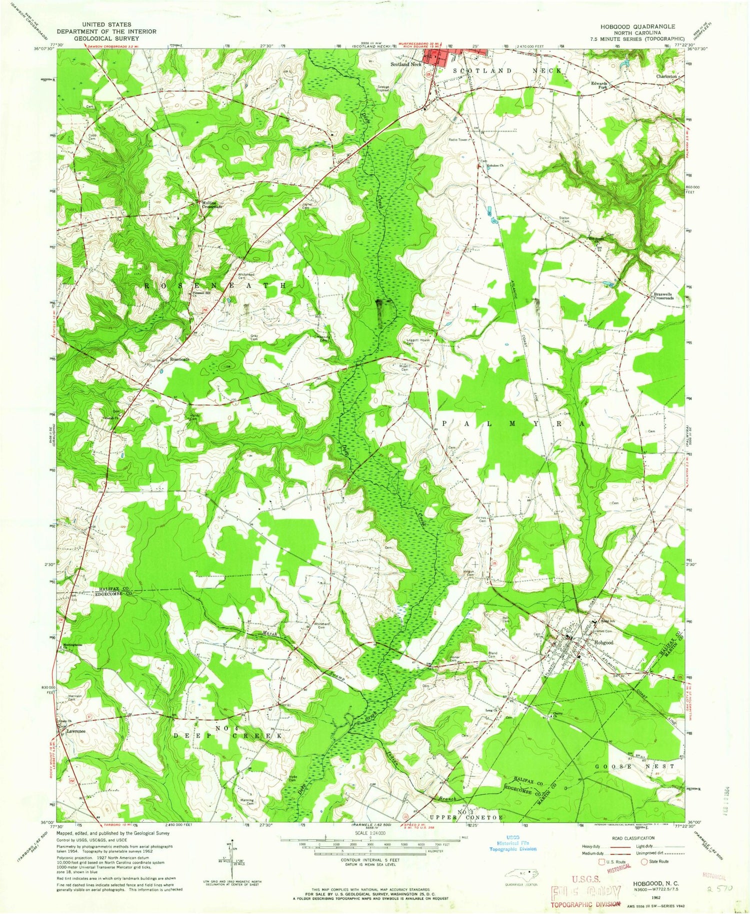
Classic USGS Hobgood North Carolina 7.5'x7.5' Topo Map
Couldn't load pickup availability
Historical USGS topographic quad map of Hobgood in the state of North Carolina. Map scale may vary for some years, but is generally around 1:24,000. Print size is approximately 24" x 27"
This quadrangle is in the following counties: Edgecombe, Halifax, Martin.
The map contains contour lines, roads, rivers, towns, and lakes. Printed on high-quality waterproof paper with UV fade-resistant inks, and shipped rolled.
Contains the following named places: Bell Cemetery, Bland Cemetery, Braswells Crossroads, Charleston, Cherry Church, Cobb Cemetery, East Pork Farms, Edwards Fork, Ellis Airport, End Street Church, Grace Church, Gray Cemetery, Hardy Cemetery, Harrison Cemetery, Hobgood, Hobgood Post Office, Hobgood Volunteer Fire Department, Hogun Cemetery, Hyde Cemetery, Indian Branch, James Cemetery, Joyner Cemetery, Kehukee Church, Lawrence, Leggett House Cemetery, Long Church, Manning Cemetery, Marsh Swamp, Meetinghouse Church, Mizell Cemetery, Mullins Crossroads, Nahalah Church, Pleasant Hill Church, Roseneath, Shield School, Staton Cemetery, Town of Hobgood, Township of Roseneath, Whitehead Cemetery