MyTopo
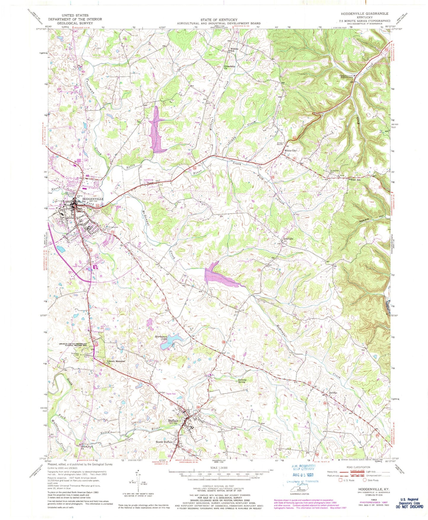
Classic USGS Hodgenville Kentucky 7.5'x7.5' Topo Map
Couldn't load pickup availability
Historical USGS topographic quad map of Hodgenville in the state of Kentucky. Map scale may vary for some years, but is generally around 1:24,000. Print size is approximately 24" x 27"
This quadrangle is in the following counties: Larue, Nelson.
The map contains contour lines, roads, rivers, towns, and lakes. Printed on high-quality waterproof paper with UV fade-resistant inks, and shipped rolled.
Contains the following named places: Abraham Lincoln Birthplace National Historical Park, Abraham Lincoln Boyhood Home, Beaver Dam Creek, Boundary Oak, Buffalo, Buffalo Census Designated Place, Buffalo Elementary School, Buffalo Fire and Rescue, Buffalo Methodist Church, Buffalo Post Office, Castleman Creek, City of Hodgenville, Craddy Creek, Fork Creek, Friendship Church, Hodgenville, Hodgenville Division, Hodgenville Fire Department, Hodgenville Police Department, Hodgenville Post Office, Jericho, Jericho Methodist Church, Jericho School, Kennedy School, Larue County, LaRue County Emergency Medical Services, Larue County Fire Department, Larue County Sheriff's Office, Leafdale, Leafdale Lookout Tower, Leafdale Post Office, Lincoln Farm Airport, Lincoln Memorial Baptist Church, McDougal Creek, McDougal Lake, Oak Grove Methodist Church, Oriska Post Office, Otter Post Office, Pleasant Grove Cemetery, Red Hill Cemetery, Reids Mill, Reids Mill Post Office, Saint Joachim Cemetery, Saint Joseph Catholic Church, Salem Creek, Salem Lake, School Number Sixteen, South Buffalo, South Fork Branch, South Fork Church, Sportsman Lake, Stonehouse School, Terhune Spring, Walters Creek, West School, White City, Wilkins Creek, Wilkins Mill, Wilkins Post Office, Wilkins School, Williams Airport, WXAM-AM (Buffalo), ZIP Code: 42748


