MyTopo
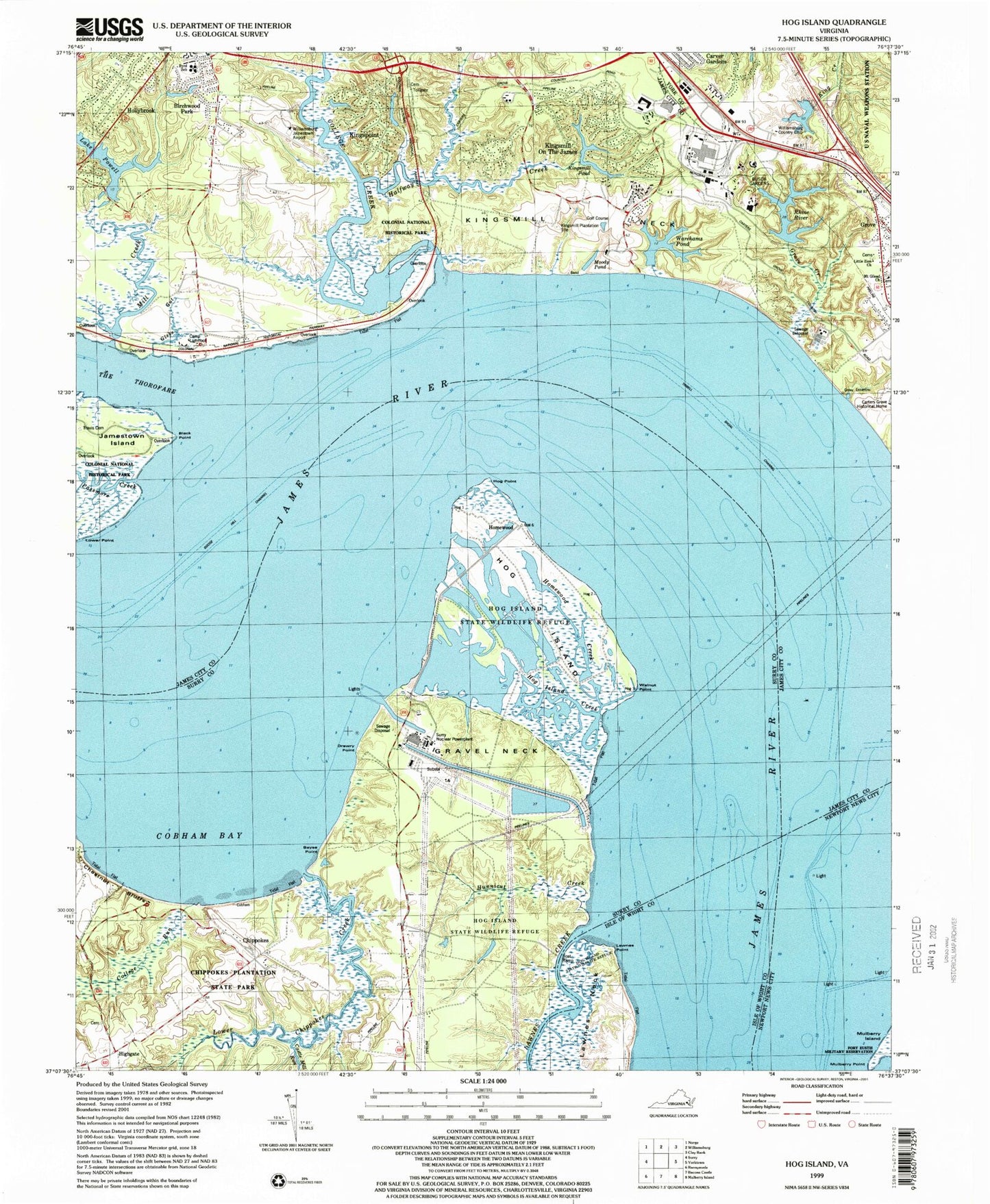
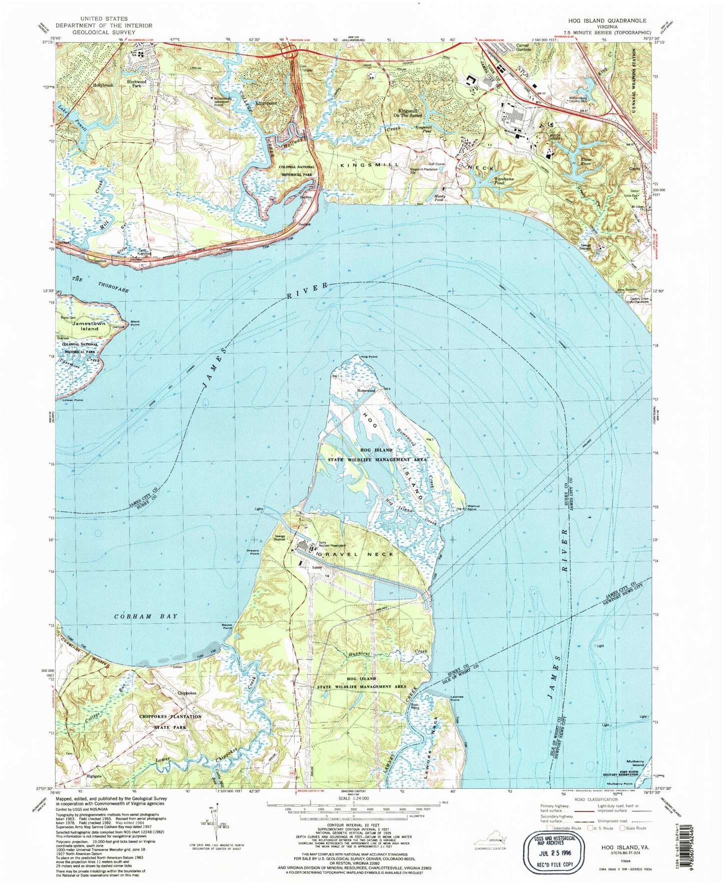
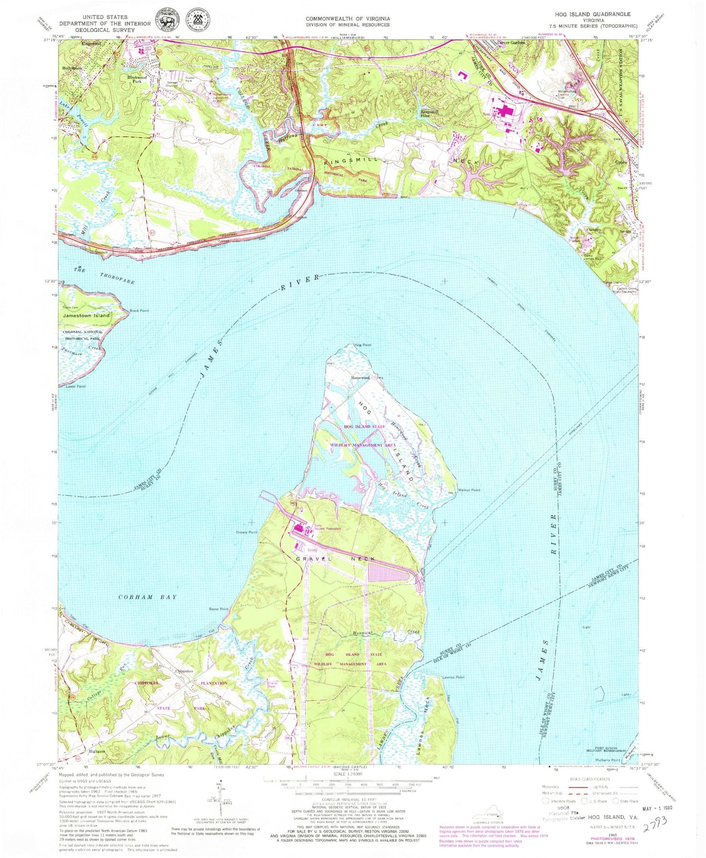
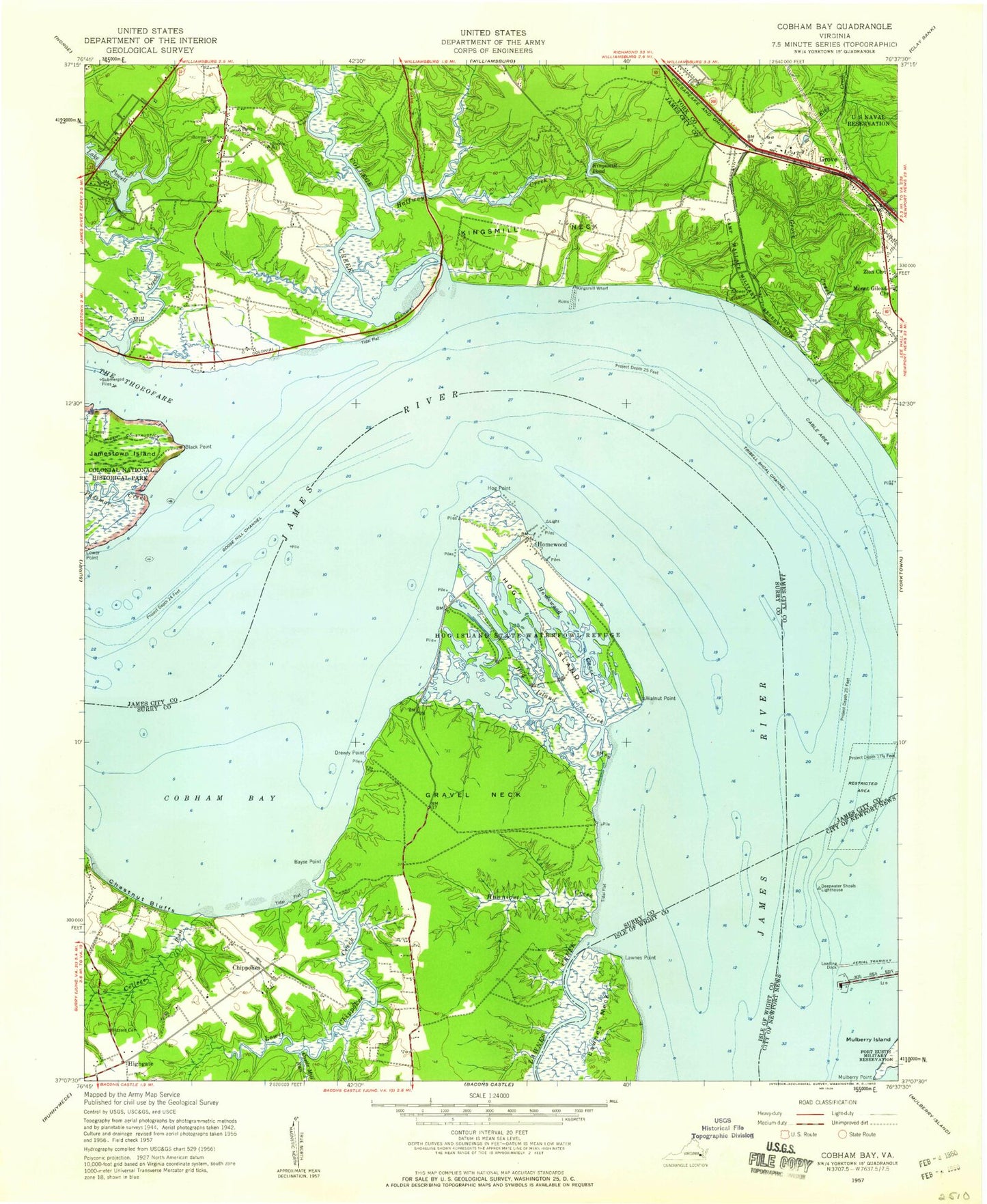
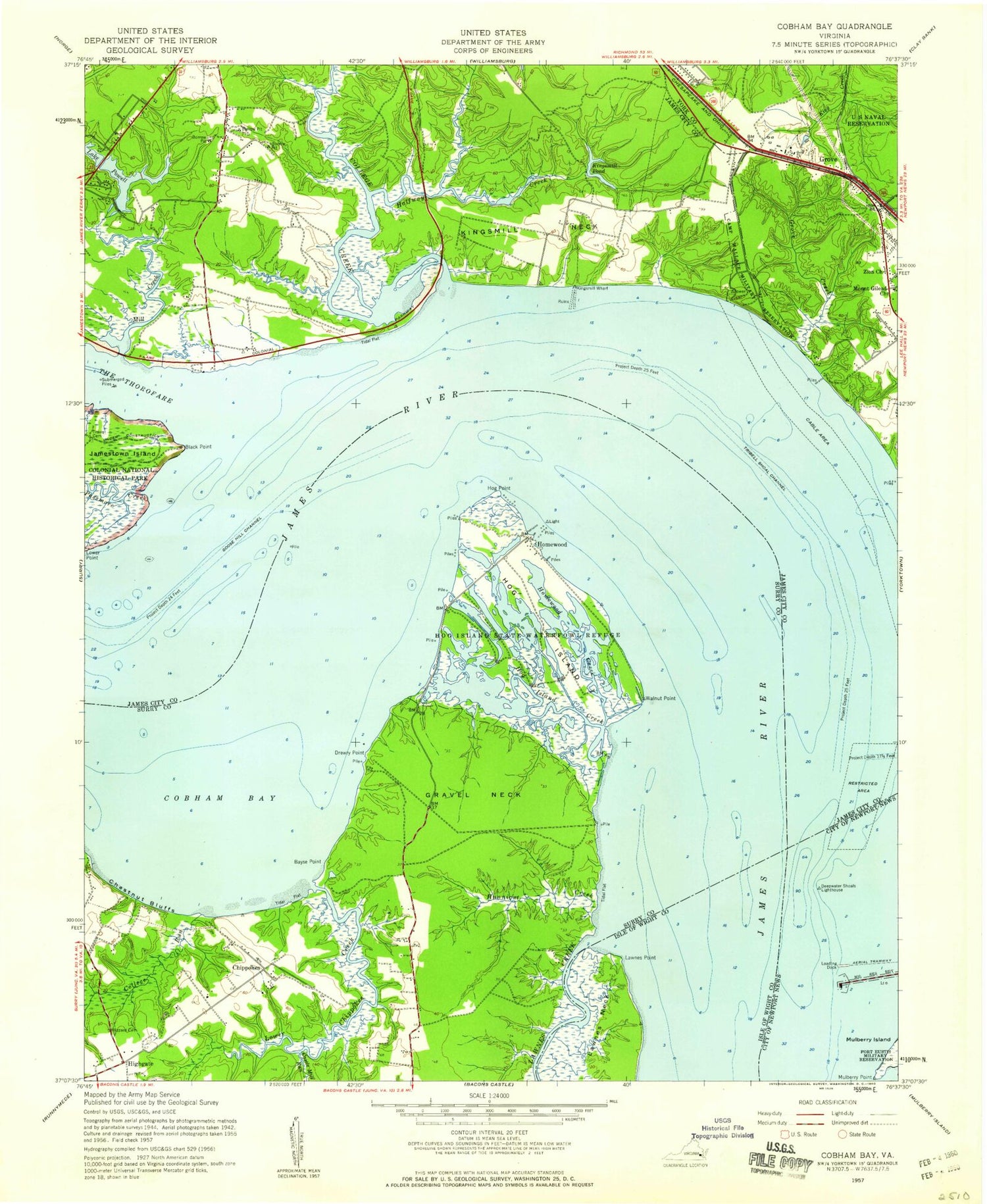
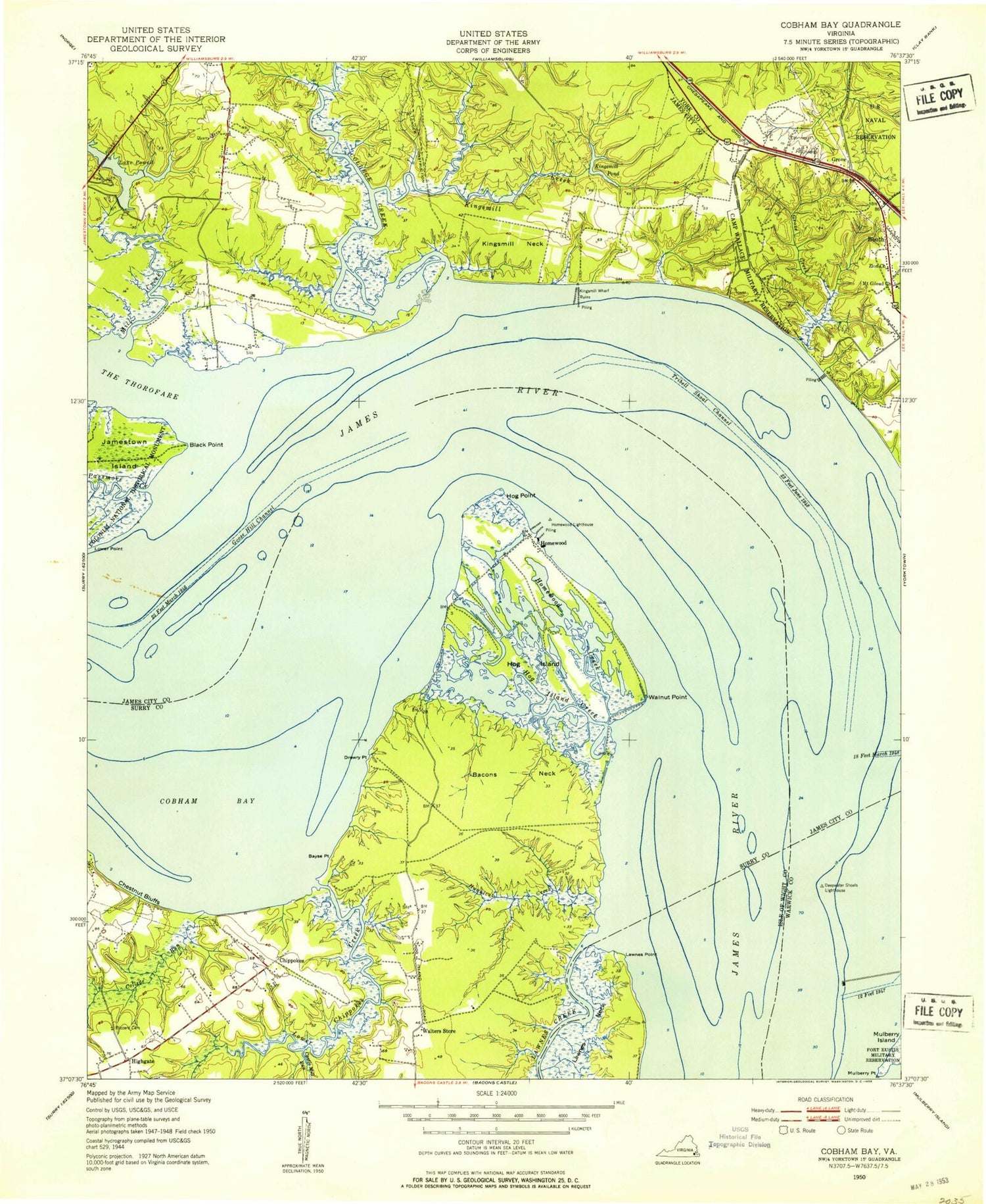
Classic USGS Hog Island Virginia 7.5'x7.5' Topo Map
Couldn't load pickup availability
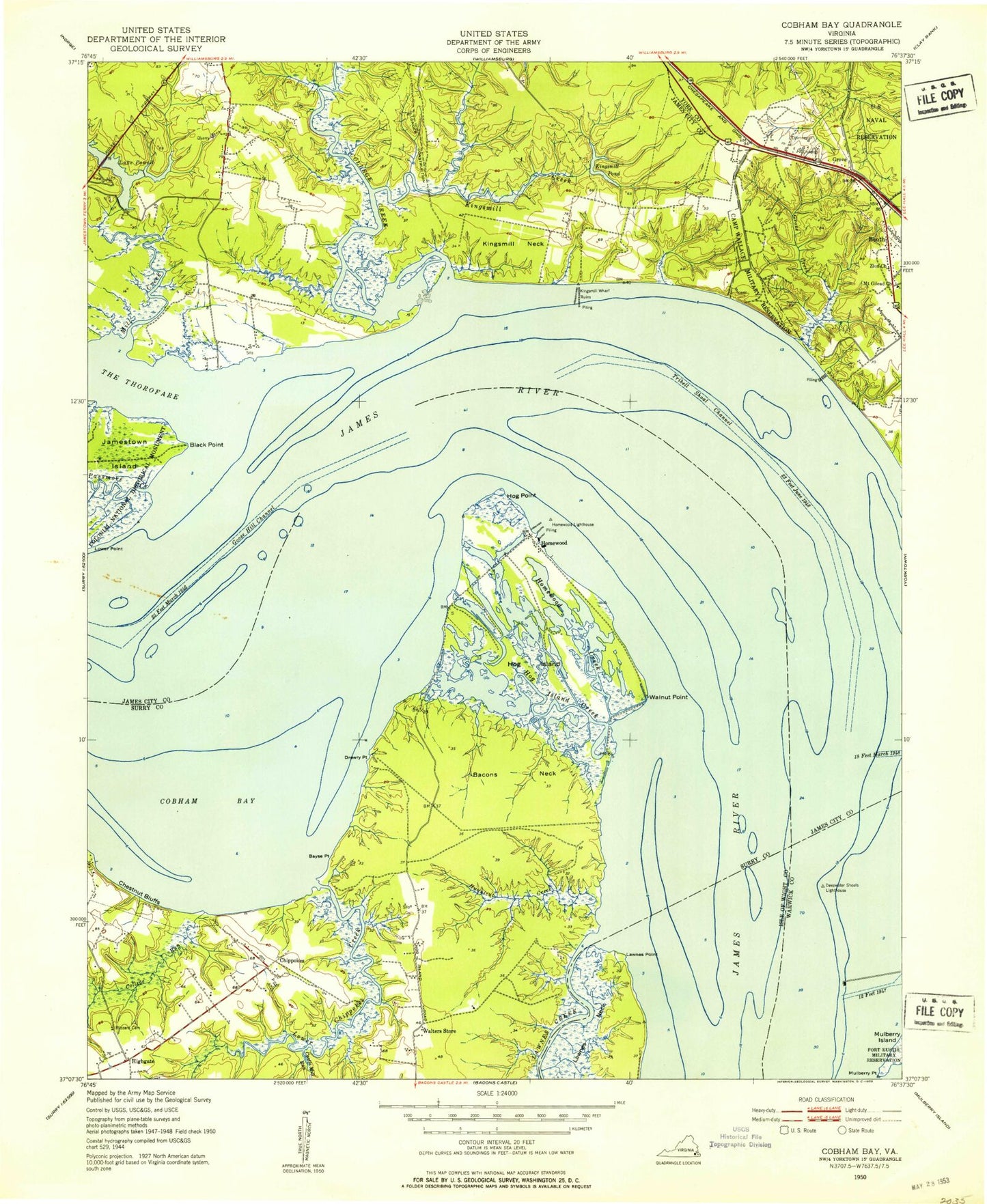
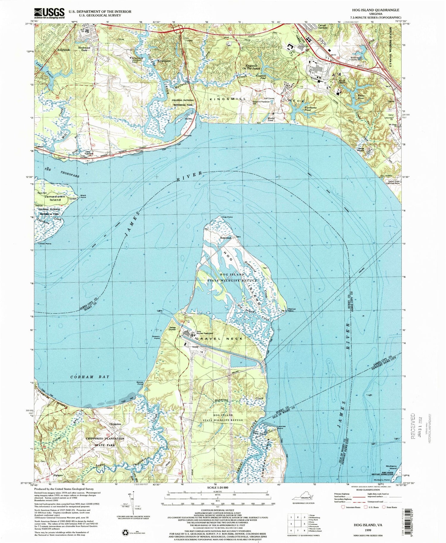
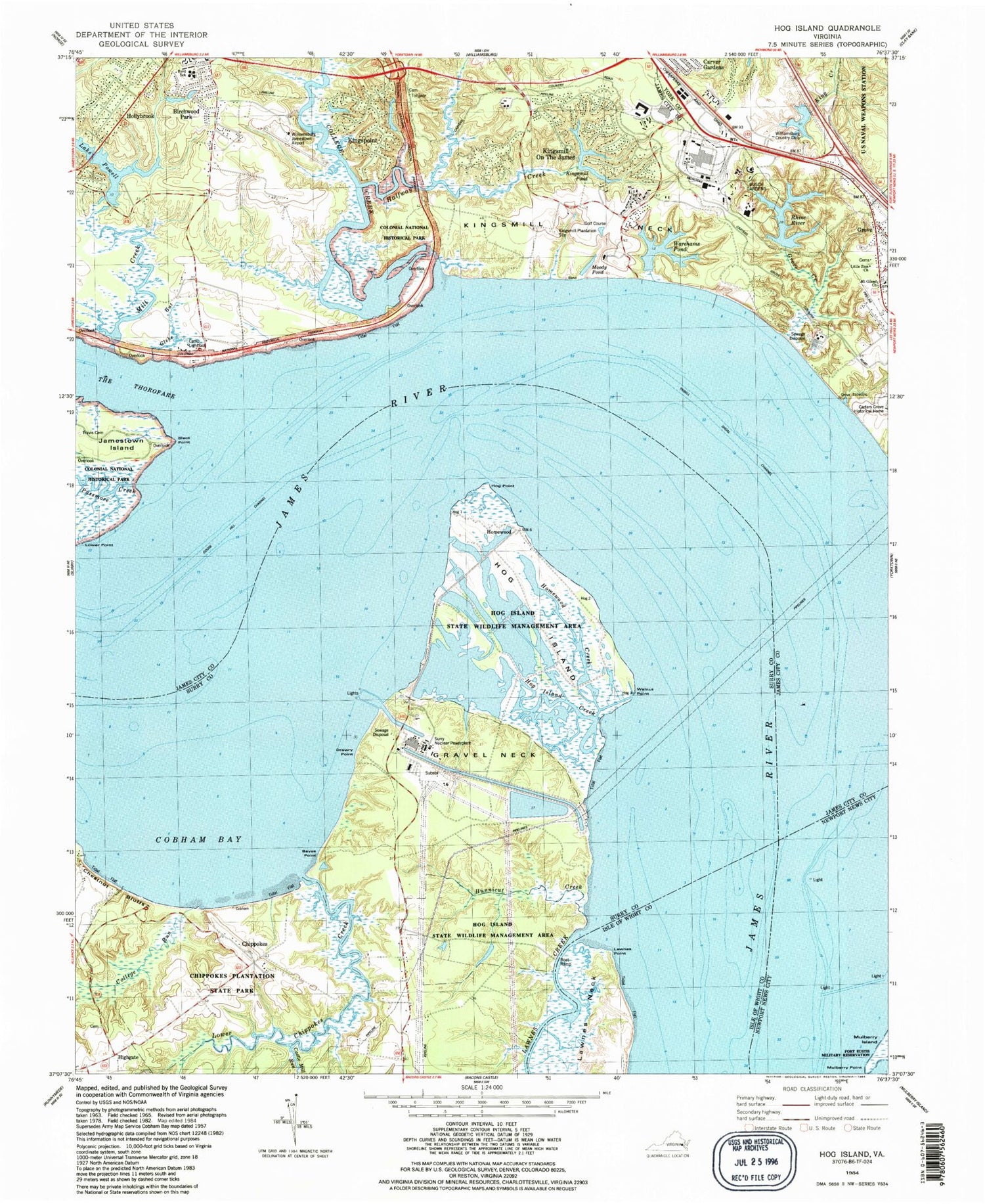
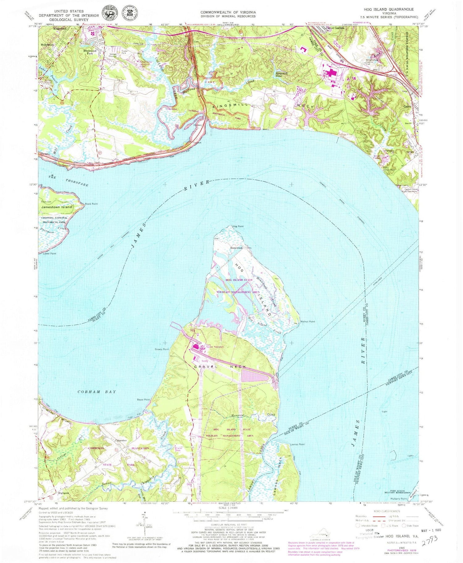
Historical USGS topographic quad map of Hog Island in the state of Virginia. Typical map scale is 1:24,000, but may vary for certain years, if available. Print size: 24" x 27"
This quadrangle is in the following counties: Isle of Wight, James City, Newport News (city), Surry, Williamsburg (city), York.
The map contains contour lines, roads, rivers, towns, and lakes. Printed on high-quality waterproof paper with UV fade-resistant inks, and shipped rolled.
Contains the following named places: Bayse Point, Blizzards Creek, Castle Mill Run, Chestnut Bluffs, Cobham Bay, College Run, Drewry Point, Gravel Neck, Hog Island, Hog Island Creek, Hog Island State Waterfowl Refuge, Hog Point, Homewood Creek, Hunnicut Creek, Lawnes Creek, Lawnes Point, Walnut Point, Homewood, Lower Chippokes Creek, Black Point, Camp James River, College Creek, Goose Hill Channel, Grove Creek, Halfway Creek, Kingsmill Neck, Lower Point, Mill Creek, Mulberry Point, Zion Church, The Thorofare, Travis Cemetery, Tribell Shoal Channel, Williamsburg-Jamestown Airport, Lake Powell Dam, Kingsmill Dam, Conference Center Dam, Brewery Road Dam, Rhine River, Williamsburg Country Club Dam, Williamsburg Country Club Lake, Williamsburg Country Club, Birchwood Park, Chippokes, Grove, Highgate, Hollybrook, Kingswood, Kingsmill Pond, Lake Powell, Chippokes Plantation, Chippokes Plantation State Park, Surry Nuclear Powerplant, Busch Gardens, Camp Lightfoot, Kingsmill on the James, Kingspoint, Little Zion Church, Moody Pond, Mount Gilead Church, Rawls Byrd Elementary School, The Market Place Shops Shopping Center, Warehams Pond, Roberts District, Chippokes Farm and Forestry Museum, James River Trail, College Run Trail, Forestry Trail, Lower Chippokes Creek Trail, Brown House, Osbourne House, Spratley House, Chippokes Mansion, Country Club Acres, Village Shops At Kingsmill Shopping Center, Busch Corporate Center, James City County Government Center, Kingsmill River Golf Course, The Colony, James City County Fire Department / Ambulance Station 2, James City County Fire Department Administration, Holloman Child Development and Education Center, Williamsburg Winery, Mount Gilead Christian Academy, Morningside of Williamsburg Assisted Living Facility, Williamsburg Landing Retirement Community, Hampton Roads Sanitation District Williamsburg Sewage Treatment Plant, Surry Nuclear Power Station Fire Service, Kingsmill Police Department, Bayse Point, Blizzards Creek, Castle Mill Run, Chestnut Bluffs, Cobham Bay, College Run, Drewry Point, Gravel Neck, Hog Island, Hog Island Creek, Hog Island State Waterfowl Refuge, Hog Point, Homewood Creek, Hunnicut Creek, Lawnes Creek, Lawnes Point, Walnut Point, Homewood, Lower Chippokes Creek, Black Point, Camp James River, College Creek, Goose Hill Channel, Grove Creek, Halfway Creek, Kingsmill Neck, Lower Point, Mill Creek, Mulberry Point, Zion Church, The Thorofare, Travis Cemetery, Tribell Shoal Channel, Williamsburg-Jamestown Airport, Lake Powell Dam, Kingsmill Dam, Conference Center Dam, Brewery Road Dam, Rhine River, Williamsburg Country Club Dam, Williamsburg Country Club Lake, Williamsburg Country Club, Birchwood Park, Chippokes, Grove, Highgate, Hollybrook, Kingswood, Kingsmill Pond, Lake Powell, Chippokes Plantation, Chippokes Plantation State Park, Surry Nuclear Powerplant, Busch Gardens, Camp Lightfoot, Kingsmill on the James, Kingspoint, Little Zion Church, Moody Pond, Mount Gilead Church, Rawls Byrd Elementary School, The Market Place Shops Shopping Center, Warehams Pond, Roberts District, Chippokes Farm and Forestry Museum, James River Trail, College Run Trail, Forestry Trail, Lower Chippokes Creek Trail, Brown House, Osbourne House, Spratley House, Chippokes Mansion, Country Club Acres, Village Shops At Kingsmill Shopping Center, Busch Corporate Center, James City County Government Center, Kingsmill River Golf Course, The Colony, James City County Fire Department / Ambulance Station 2, James City County Fire Department Administration, Holloman Child Development and Education Center, Williamsburg Winery, Mount Gilead Christian Academy, Morningside of Williamsburg Assisted Living Facility, Williamsburg Landing Retirement Community, Hampton Roads Sanitation District Williamsburg Sewage Treatment Plant, Surry Nuclear Power Station Fire Service, Kingsmill Police Department, Bayse Point, Blizzards Creek, Castle Mill Run, Chestnut Bluffs, Cobham Bay, College Run, Drewry Point, Gravel Neck, Hog Island, Hog Island Creek, Hog Island State Waterfowl Refuge, Hog Point, Homewood Creek, Hunnicut Creek, Lawnes Creek, Lawnes Point, Walnut Point, Homewood, Lower Chippokes Creek, Black Point, Camp James River, College Creek, Goose Hill Channel, Grove Creek, Halfway Creek, Kingsmill Neck, Lower Point, Mill Creek, Mulberry Point, Zion Church, The Thorofare, Travis Cemetery, Tribell Shoal Channel, Williamsburg-Jamestown Airport, Lake Powell Dam, Kingsmill Dam, Conference Center Dam, Brewery Road Dam, Rhine River, Williamsburg Country Club Dam, Williamsburg Country Club Lake, Williamsburg Country Club, Birchwood Park, Chippokes, Grove, Highgate, Hollybrook, Kingswood, Kingsmill Pond, Lake Powell, Chippokes Plantation, Chippokes Plantation State Park, Surry Nuclear Powerplant, Busch Gardens, Camp Lightfoot, Kingsmill on the James, Kingspoint, Little Zion Church
