MyTopo
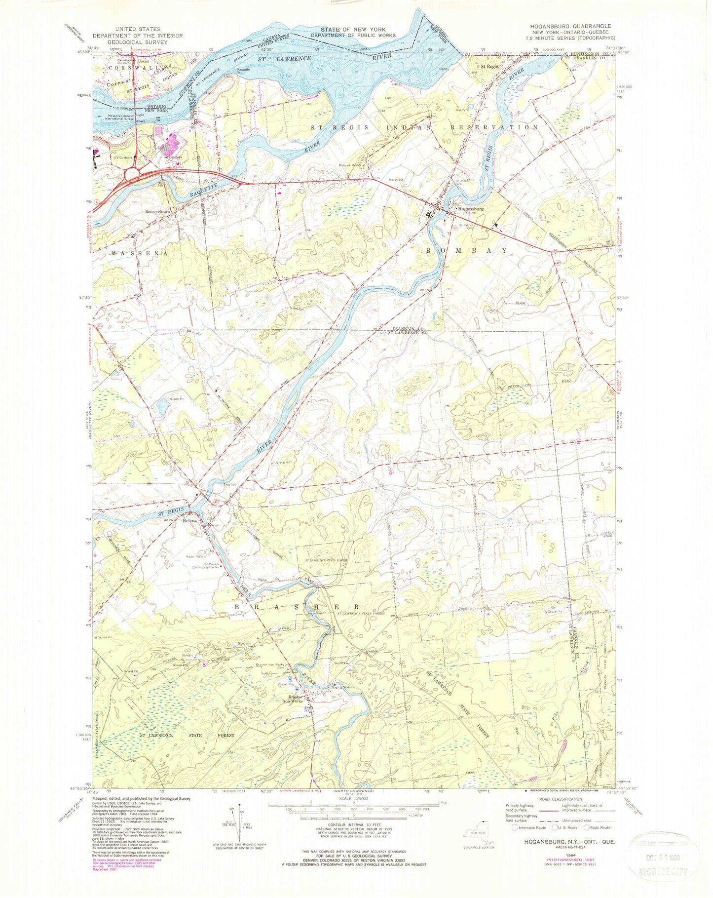
Classic USGS Hogansburg New York 7.5'x7.5' Topo Map
Couldn't load pickup availability
Historical USGS topographic quad map of Hogansburg in the state of New York. Map scale may vary for some years, but is generally around 1:24,000. Print size is approximately 24" x 27"
This quadrangle is in the following counties: Franklin, St. Lawrence.
The map contains contour lines, roads, rivers, towns, and lakes. Printed on high-quality waterproof paper with UV fade-resistant inks, and shipped rolled.
Contains the following named places: Akwesasne, Akwesasne Census Designated Place, Akwesasne Mohawk Casino, Brasher Iron Works, Brasher Iron Works Cemetery, Deer River, Deer River Bridge, Helena, Hogansburg, Hogansburg Akwesasne Volunteer Fire Department, Hogansburg Post Office, Ironton, Massena-Cornwall International Bridge, Mohawk Memorial Cemetery, Raquette Point, Raquette River, Rooseveltown, Rooseveltown Post Office, Saint Joseph Cemetery, Saint Patrick Cemetery, Saint Patrick Community Center, Saint Regis, Saint Regis Mohawk Reservation, Saint Regis Mohawk School, School Number 3, School Number 4, School Number 5, School Number 6, School Number 7, School Number 8, Three Nations Crossing, Town of Brasher, ZIP Code: 13655