MyTopo
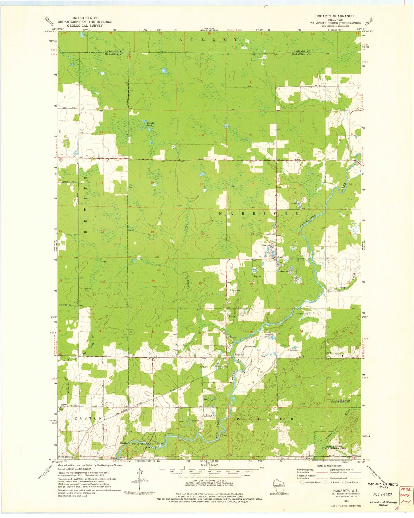
Classic USGS Hogarty Wisconsin 7.5'x7.5' Topo Map
Couldn't load pickup availability
Historical USGS topographic quad map of Hogarty in the state of Wisconsin. Map scale may vary for some years, but is generally around 1:24,000. Print size is approximately 24" x 27"
This quadrangle is in the following counties: Langlade, Marathon.
The map contains contour lines, roads, rivers, towns, and lakes. Printed on high-quality waterproof paper with UV fade-resistant inks, and shipped rolled.
Contains the following named places: Aniwa Lookout Tower, Bethany Cemetery, Bethany Church, Dells of the Eau Claire Park, Dells of the Eau Claire River State Natural Area, Fallows School, Harrison Townhall, Hogarty, Johnson, Nudell School, Plover River State Fishery Area, Skulen Creek, Snell, Spring Brook, Steinke Pond, Town of Harrison, Vogl Dells Dam, ZIP Code: 54408