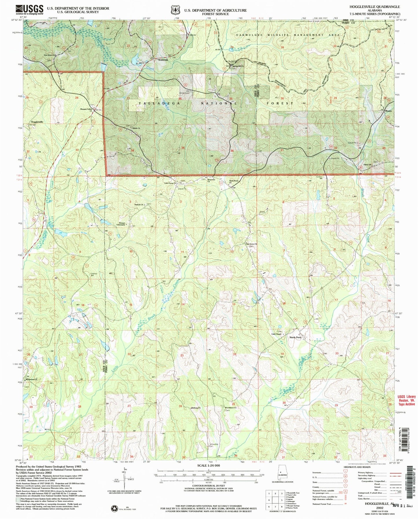
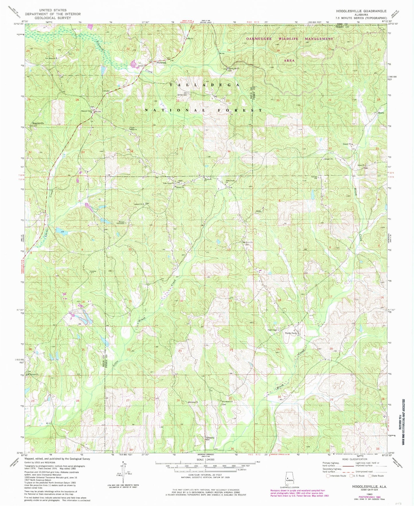
MyTopo
Classic USGS Hogglesville Alabama 7.5'x7.5' Topo Map
Couldn't load pickup availability
Historical USGS topographic quad map of Hogglesville in the state of Alabama. Map scale may vary for some years, but is generally around 1:24,000. Print size is approximately 24" x 27"
This quadrangle is in the following counties: Bibb, Hale, Perry.
The map contains contour lines, roads, rivers, towns, and lakes. Printed on high-quality waterproof paper with UV fade-resistant inks, and shipped rolled.
Contains the following named places: Antioch Baptist Church, Bethany Church, Brush Creek, Faith Chapel Baptist Church, Faith Chapel Cemetery, Fellowship Cemetery, Fellowship Church, Hogglesville, J B Thomas Dam, J B Thomas Lake, Joe Glover Dam, Joe Glover Lake, Lake Payne Church, Mike Wurm Dam, Morgan Tabernacle, Mount Herman Cemetery, Mount Herman Church, Mount Herman School, New Hope Cemetery, New Shiloh Cemetery, North Perry, North Perry Church, North Perry School, North Perry Volunteer Fire Department, Oak Grove Church, Old Shiloh Cemetery, Pleasant Valley Cemetery, Pleasant Valley Church, Providence Cemetery, Providence Methodist Church, Salem Church, Spring Hill Church, Thomas Lake, Valley School, Wateroak, Waycross Bible Methodist Church, Waycross Cemetery