MyTopo
Classic USGS Holbrook Canyon California 7.5'x7.5' Topo Map
Regular price
$16.95
Regular price
Sale price
$16.95
Unit price
per
Couldn't load pickup availability
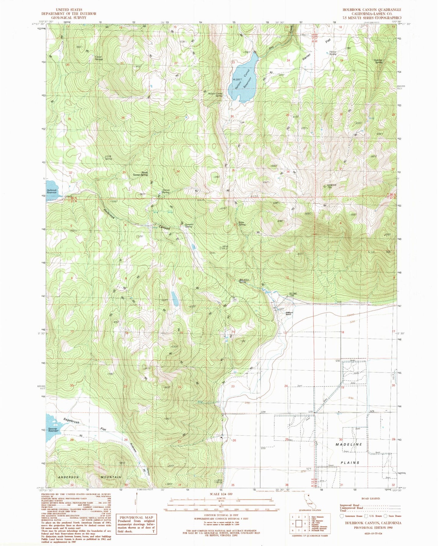
Historical USGS topographic quad map of Holbrook Canyon in the state of California. Map scale may vary for some years, but is generally around 1:24,000. Print size is approximately 24" x 27"
This quadrangle is in the following counties: Lassen.
The map contains contour lines, roads, rivers, towns, and lakes. Printed on high-quality waterproof paper with UV fade-resistant inks, and shipped rolled.
Contains the following named places: Bill Allen Spring, Clover Springs, Harter Flat, J O B Spring, Nelson Corral Reservoir, Nelson Corral Spring, Nelson Spring, North Tanner Spring, Outcrop Spring, Sagebrush Flat, Stipa Spring, Summit Spring, Tanner Spring, Williams Ranch, ZIP Code: 96119