MyTopo
Classic USGS Holcombe Wisconsin 7.5'x7.5' Topo Map
Couldn't load pickup availability
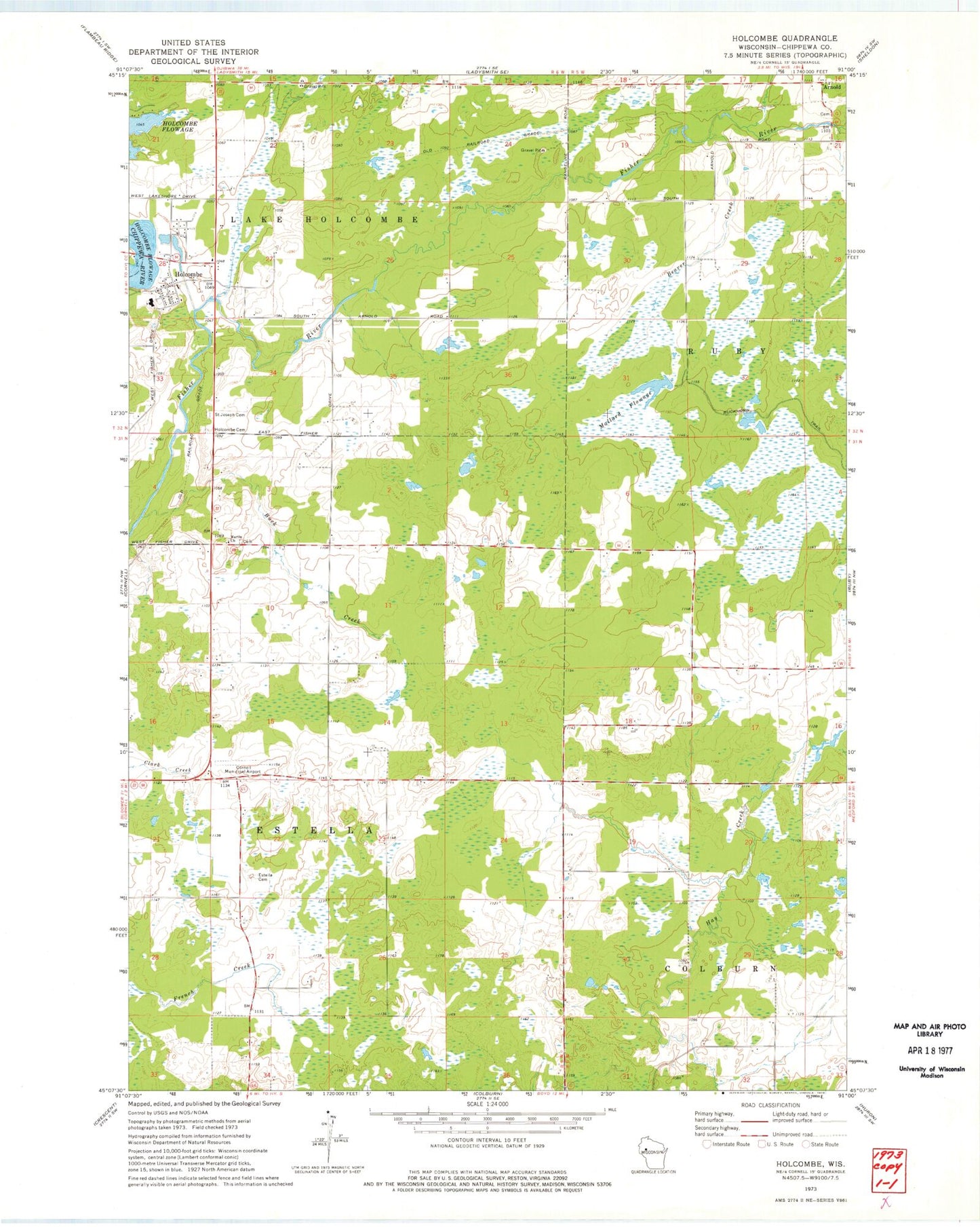
Historical USGS topographic quad map of Holcombe in the state of Wisconsin. Map scale may vary for some years, but is generally around 1:24,000. Print size is approximately 24" x 27"
This quadrangle is in the following counties: Chippewa.
The map contains contour lines, roads, rivers, towns, and lakes. Printed on high-quality waterproof paper with UV fade-resistant inks, and shipped rolled.
Contains the following named places: Amish Parochial School, Arnold, Beaver Creek, Buck Creek, Cornell Municipal Airport, County Forest Crop Land 6 G 1137.1 Dam, Enterprise School, Estella School, Estella Union Cemetery, Hillebrand Farms, Holcombe, Holcombe Cemetery, Holcombe Census Designated Place, Holcombe Elementary School, Holcombe Post Office, Lake Holcombe School, Mallard Flowage, Martin Church, Saint Joseph's Catholic Cemetery, Town of Estella, Town of Lake Holcombe