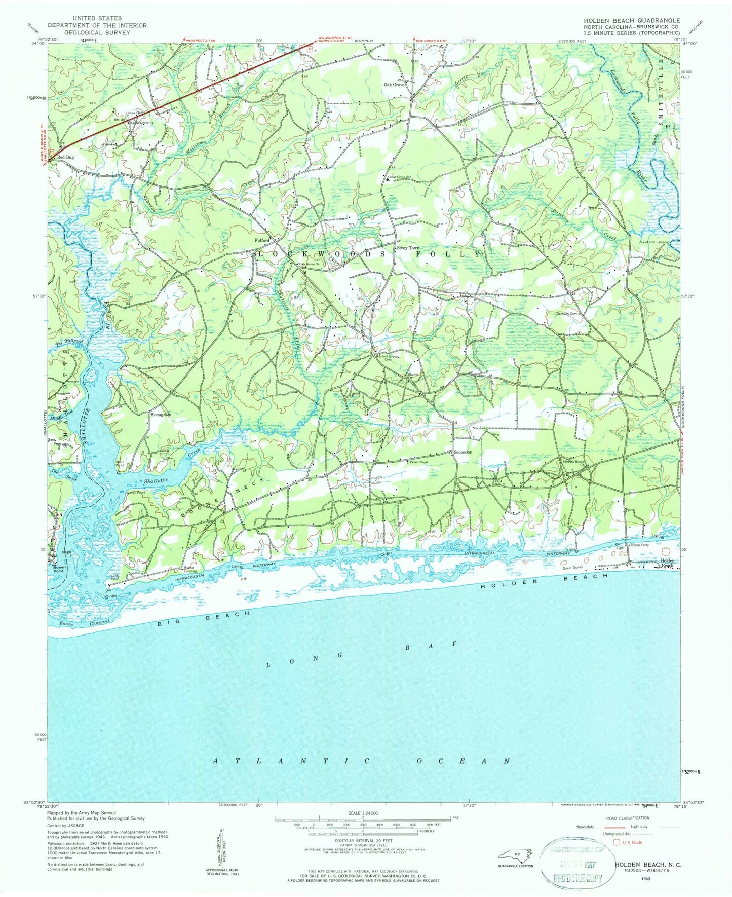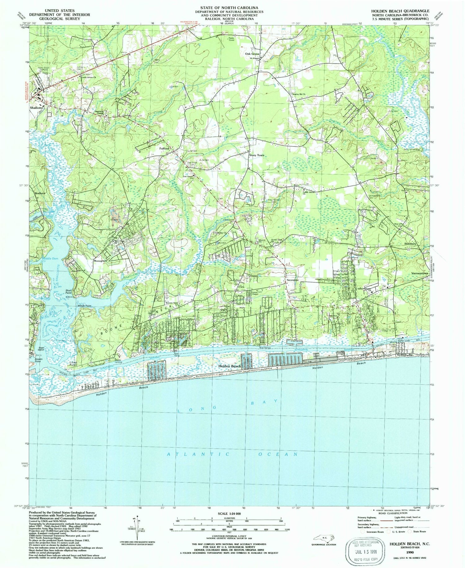

MyTopo
Classic USGS Holden Beach North Carolina 7.5'x7.5' Topo Map
Couldn't load pickup availability
Historical USGS topographic quad map of Holden Beach in the state of North Carolina. Map scale may vary for some years, but is generally around 1:24,000. Print size is approximately 24" x 27"
This quadrangle is in the following counties: Brunswick.
The map contains contour lines, roads, rivers, towns, and lakes. Printed on high-quality waterproof paper with UV fade-resistant inks, and shipped rolled.
Contains the following named places: Bacon Inlet, Bell Swamp, Big Beach, Boone Channel, Boone Landing, Boone Neck, Boones Neck Church, Bowen Point, Cedar Grove Church, Cedar Grove School, Chapel Hill Cemetery, Civietown Volunteer Fire Department, Coastline Volunteer Rescue Squad, Fulford, Galloway Swamp, Georgetown Cemetery, Gibbs Creek, Hewett Marina, Holden Beach, Holden Beach Marina, Holden Beach Police Department, Holden Beach Post Office, Holden Ferry, Lettis Grove Church, Long Point, Marys Inlet, Middle Dam Creek, Monogram, Mount Pisgah Church, New Life Church, Oak Grove, Oak Grove Cemetery, Oak Grove Church, Ocean View Church, Ox Pen Swamp, Pamlico Creek, Pine Swamp, Red Bug, Sabbath Home Church, Sage Island, Sand Hill Landing, Sandy Branch, Secession, Shallotte Chapel, Shallotte Creek, Sharon Church, Sharron Creek, Shell Point, Shell Point Acres, Shell Point Church, Silent Grove Cemetery, Sivey Town, Stanburry Bay, Stanley Road Church, The Millpond, The Swash, Town of Holden Beach, Tri - Beach Volunteer Fire Department Station 1, Tri - Beach Volunteer Fire Department Station 2, Tri - Beach Volunteer Fire Department Station 3, Turkey Trap Swamp, Union Chapel, Williams Branch, Windy Point