MyTopo
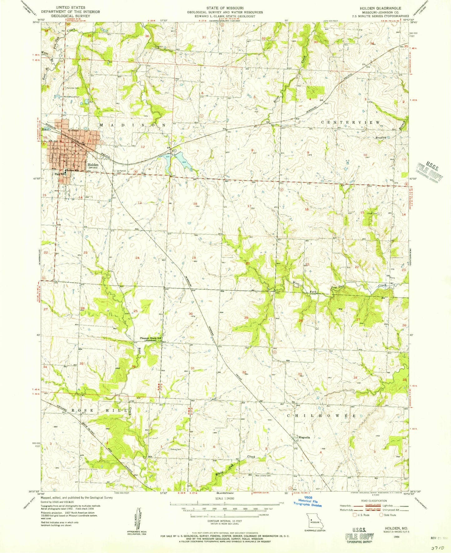
Classic USGS Holden Missouri 7.5'x7.5' Topo Map
Couldn't load pickup availability
Historical USGS topographic quad map of Holden in the state of Missouri. Map scale may vary for some years, but is generally around 1:24,000. Print size is approximately 24" x 27"
This quadrangle is in the following counties: Johnson.
The map contains contour lines, roads, rivers, towns, and lakes. Printed on high-quality waterproof paper with UV fade-resistant inks, and shipped rolled.
Contains the following named places: Borthick School, City of Holden, Doak School, Doran, East Pin Oak Creek, Elliott Cemetery, F-2 Lake, Fairview Cemetery, Ferguson Cemetery, Flynn School, Holden, Holden Elementary School, Holden Fire Department, Holden High School, Holden Intermediate School, Holden Middle School, Holden Post Office, Holden Reservoir East Dam, Holden Reservoir West Dam, Johnson County Fire Protection District 2 Station 3 Madison, King School, Magnolia, Miller Mausoleum, New Liberty Cemetery, Number 199 Reservoir, Number 203 Reservoir, Outon Cemetery, Pleasant Shade School, Saint Patrick Cemetery, South Fork Blackwater River Watershed Dam F-21, Sunny Point School, Township of Madison, West Pin Oak Creek, White Oak Creek, Wilson Lake Dam, ZIP Code: 64040