MyTopo
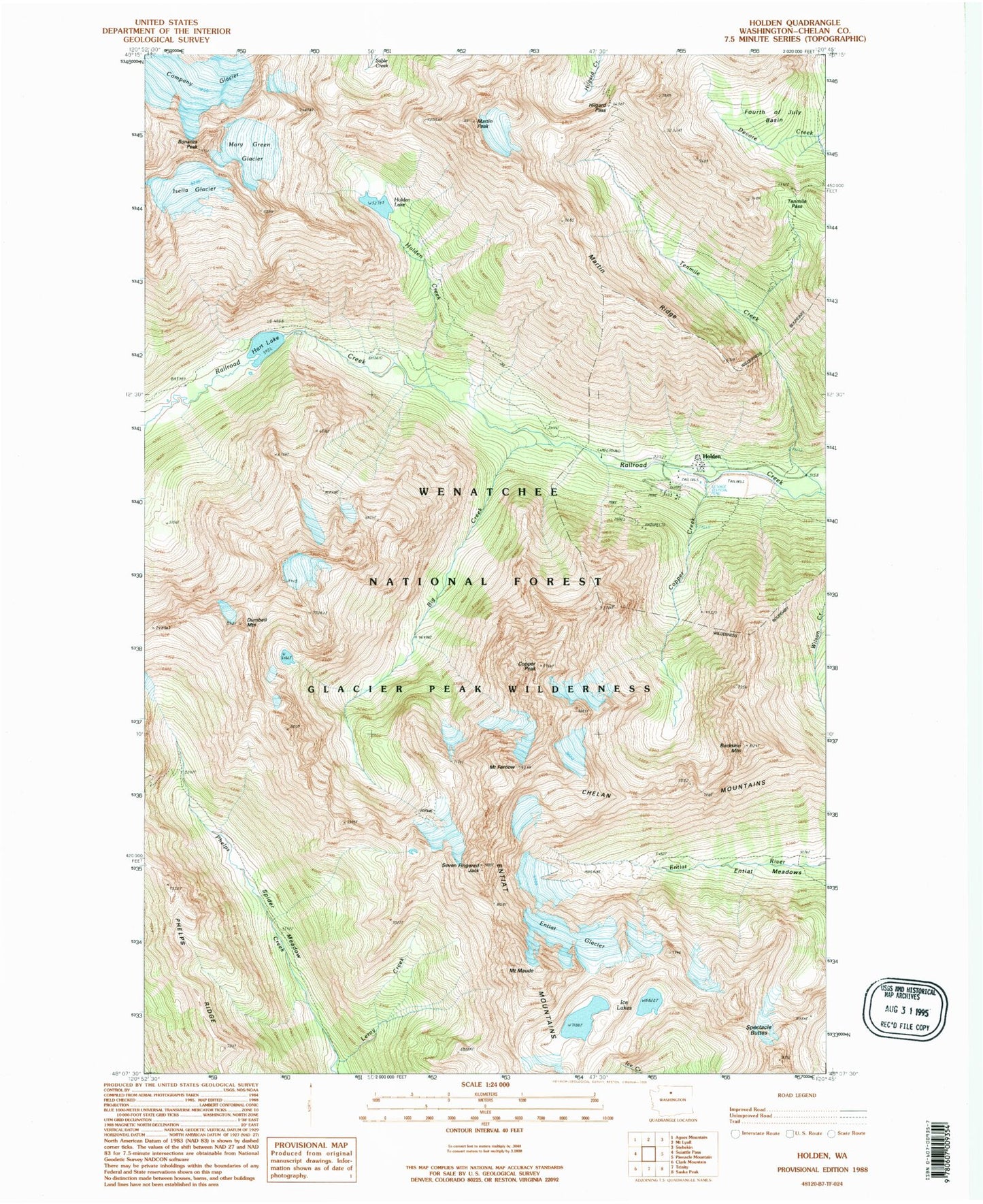
Classic USGS Holden Washington 7.5'x7.5' Topo Map
Couldn't load pickup availability
Historical USGS topographic quad map of Holden in the state of Washington. Typical map scale is 1:24,000, but may vary for certain years, if available. Print size: 24" x 27"
This quadrangle is in the following counties: Chelan.
The map contains contour lines, roads, rivers, towns, and lakes. Printed on high-quality waterproof paper with UV fade-resistant inks, and shipped rolled.
Contains the following named places: Big Creek, Bonanza Peak, Buckskin Mountain, Company Glacier, Copper Creek, Copper Peak, Dumbell Mountain, Entiat Glacier, Mount Fernow, Fourth of July Basin, Grou Camp (historical), Hart Lake, Holden (historical), Holden Creek, Holden Lake, Holden Mine (historical), Ice Lakes, Isella Glacier, Leroy Creek, Martin Peak, Martin Ridge, Mary Green Glacier, Mount Maude, McKensie Camp (historical), Seven Fingered Jack, Spectacle Buttes, Spider Meadow, Tenmile Creek, Tenmile Pass, North Spectacle Butte, South Spectacle Butte, Hilgard Pass, Holden Campground, Entiat Ranger District, Holden Village Post Office (historical), Holden Village, Holden Village School