MyTopo
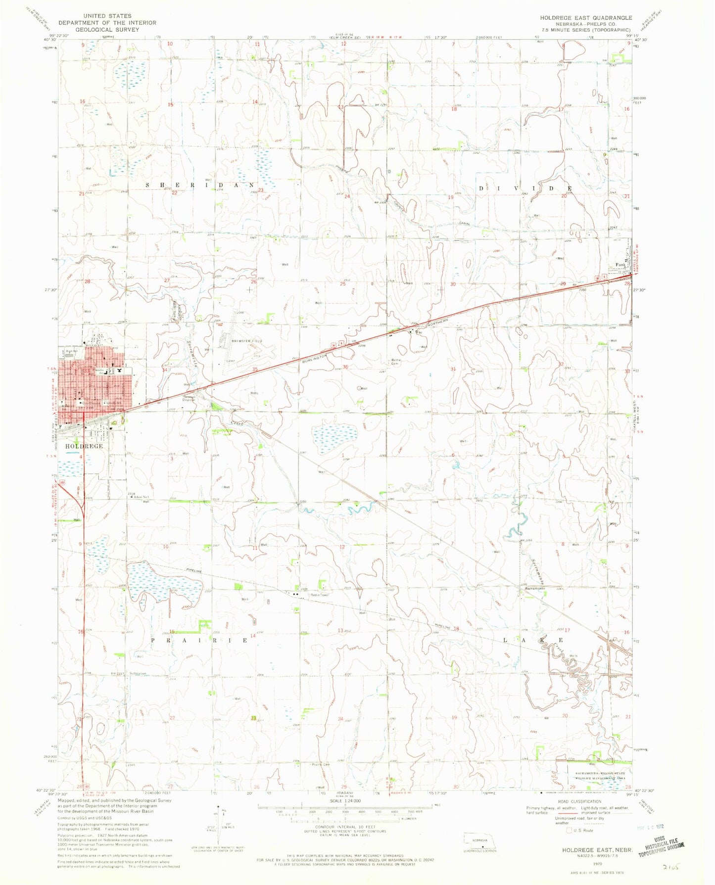
Classic USGS Holdrege East Nebraska 7.5'x7.5' Topo Map
Couldn't load pickup availability
Historical USGS topographic quad map of Holdrege East in the state of Nebraska. Map scale may vary for some years, but is generally around 1:24,000. Print size is approximately 24" x 27"
This quadrangle is in the following counties: Phelps.
The map contains contour lines, roads, rivers, towns, and lakes. Printed on high-quality waterproof paper with UV fade-resistant inks, and shipped rolled.
Contains the following named places: All Saints Catholic Church, Bethel Cemetery, Bethel Lutheran Church, Brewster Field, Cargill Elevator, Central Community College, Dewaynes Trailer Court, Election Precinct 10, Election Precinct 11, Election Precinct 6, Family Medical Specialties, First Presbyterian Church, First United Methodist Church of Holdrege, Franklin Elementary School, Funk Post Office, Holdrege, Holdrege City Campground, Holdrege Fire Department, Holdrege High School, Holdrege Medical Clinic, Holdrege Middle School, Holdrege Police Department, Holdrege Post Office, Holdrege Public Library, Holdrege Rural Fire Protection District 6, Keifer Field, Lincoln Elementary School, Methodist Memorial Homes, Mount Calvary Lutheran Church, Phelps County Courthouse, Phelps County Fairgrounds, Phelps County Historical Marker, Phelps County Sheriff's Office, Philps District R 7 School, Prairie Cemetery, Prairie Hill Landfill, Prairie Home Cemetery, Roosevelt School, Sacramento, Sacramento Post Office, Saint Elizabeths Episcopal Church, School Number 10, Seventh Day Adventist Church, Site of Old Sacramento Historical Marker, South Central Co-op Elevator, Township of Prairie, Township of Sheridan, Trinity Evangelical Free Church, Village of Funk, Wac, Westside Plaza Mobile Home Park