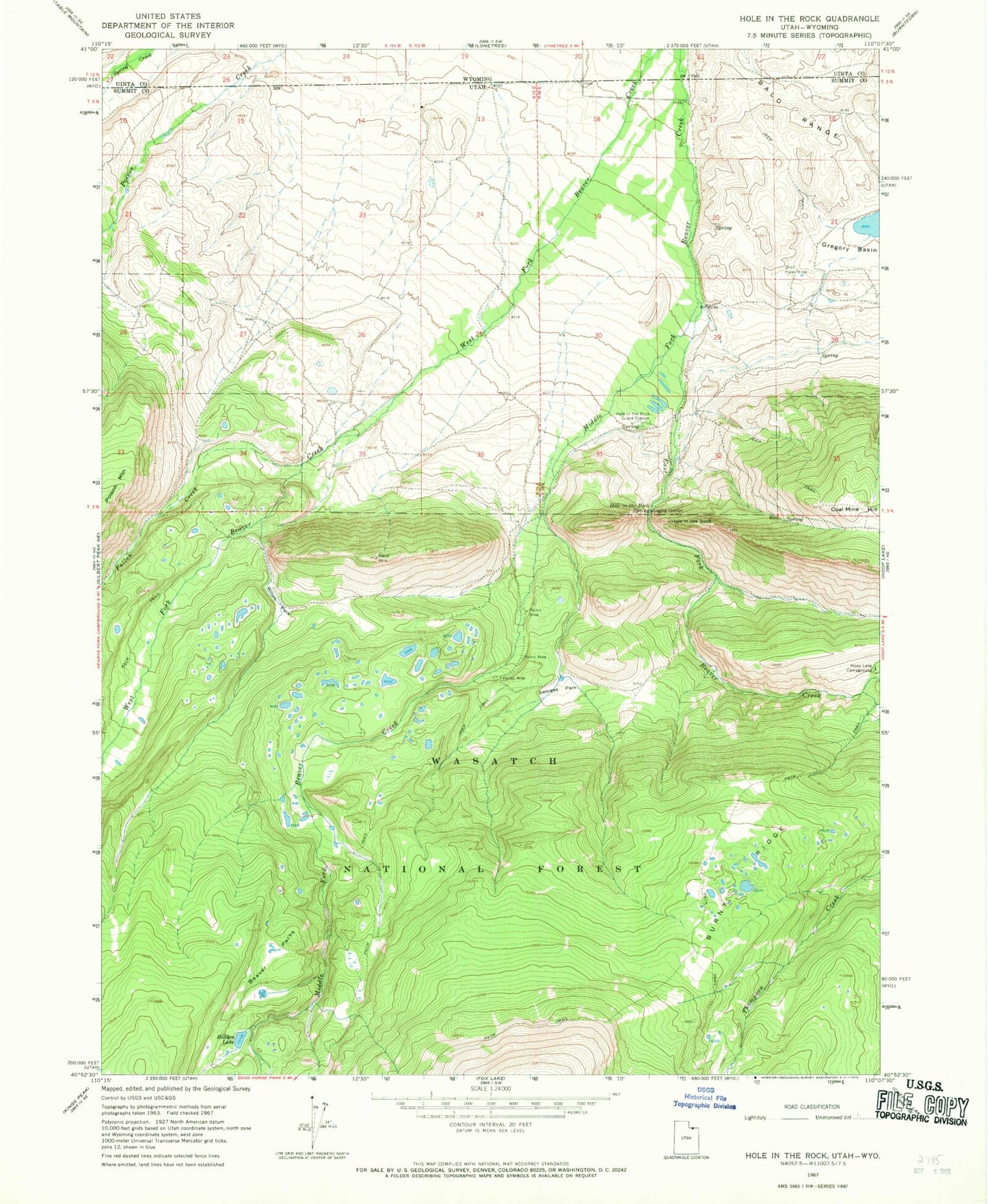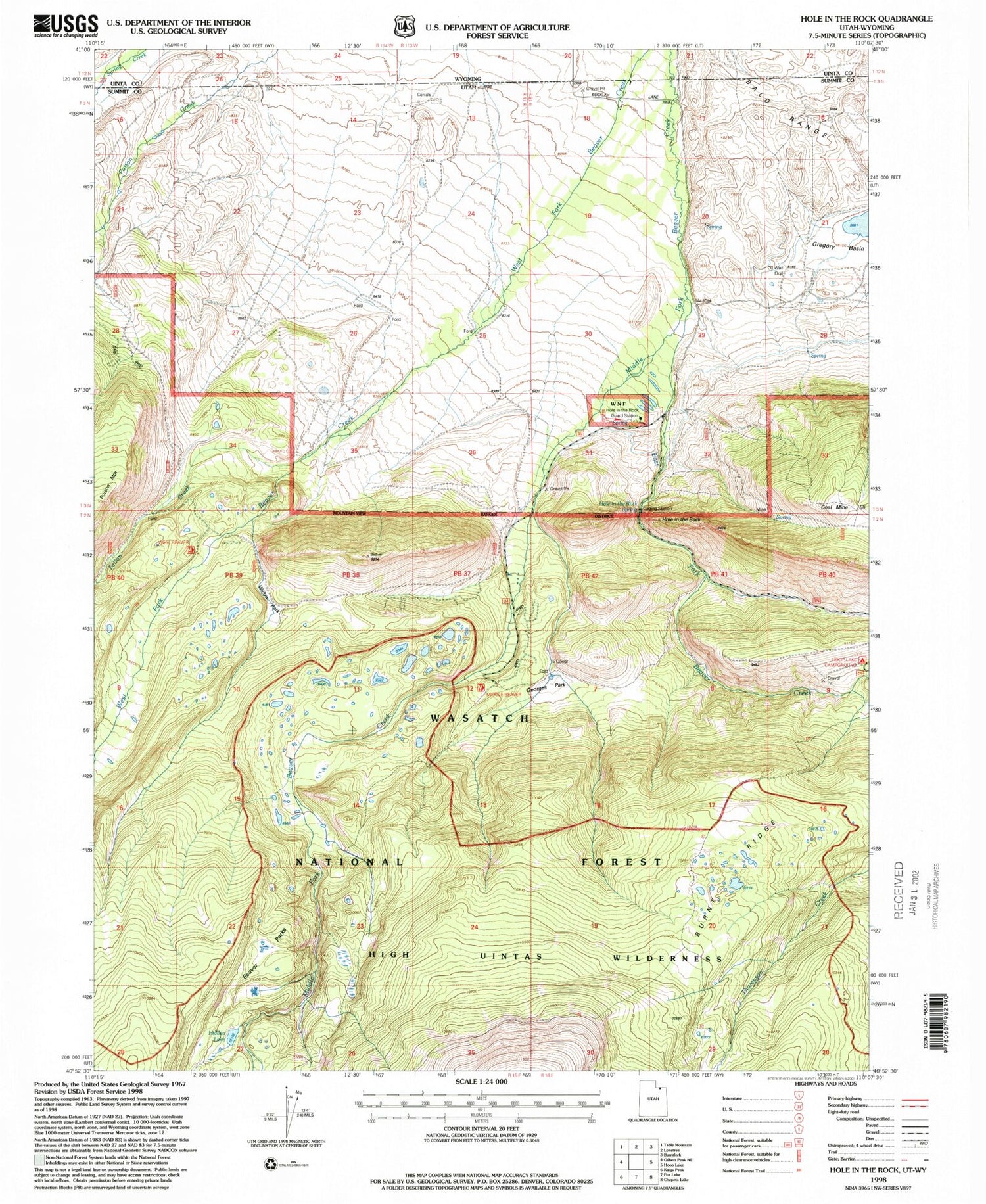

MyTopo
Classic USGS Hole In The Rock Utah 7.5'x7.5' Topo Map
Regular price
$16.95
Regular price
Sale price
$16.95
Unit price
per
Couldn't load pickup availability
Historical USGS topographic quad map of Hole In The Rock in the state of Utah. Typical map scale is 1:24,000, but may vary for certain years, if available. Print size: 24" x 27"
This quadrangle is in the following counties: Summit, Uinta.
The map contains contour lines, roads, rivers, towns, and lakes. Printed on high-quality waterproof paper with UV fade-resistant inks, and shipped rolled.
Contains the following named places: Beaver Parks, Burnt Ridge, Coal Mine Hill, East Fork Beaver Creek, Georges Park, Hole in the Rock, Hole in the Rock Guard Station, Hole in the Rock Spring, Willow Park, Hoop Lake Dam, Fallon Creek, Middle Fork Beaver Creek, Hidden Lake