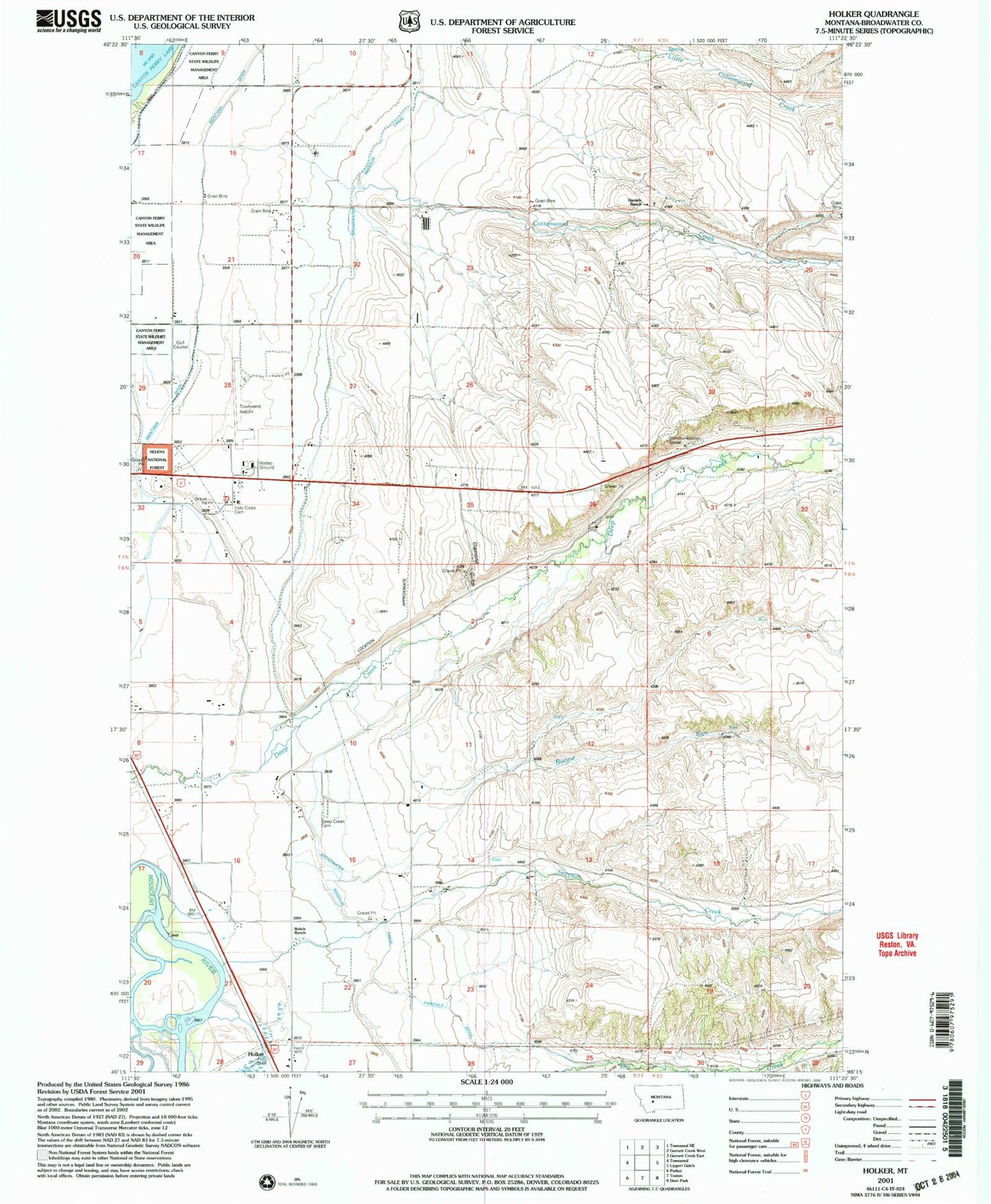
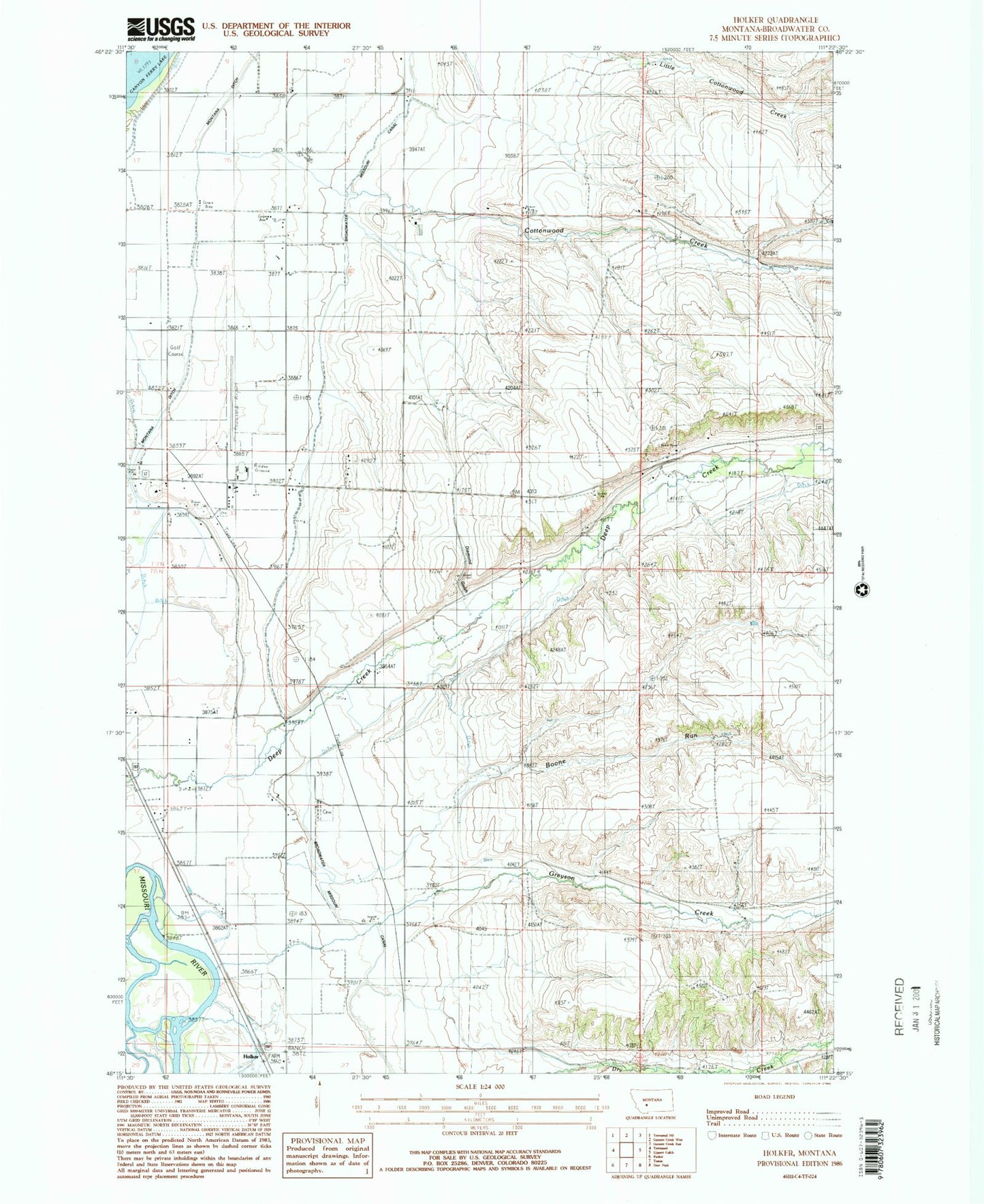
MyTopo
Classic USGS Holker Montana 7.5'x7.5' Topo Map
Couldn't load pickup availability
Historical USGS topographic quad map of Holker in the state of Montana. Map scale may vary for some years, but is generally around 1:24,000. Print size is approximately 24" x 27"
This quadrangle is in the following counties: Broadwater.
The map contains contour lines, roads, rivers, towns, and lakes. Printed on high-quality waterproof paper with UV fade-resistant inks, and shipped rolled.
Contains the following named places: 06N02E02AA__01 Well, 06N02E02CA__01 Well, 06N02E02DB__01 Well, 06N02E03DD__01 Well, 06N02E04AC__01 Well, 06N02E04BC__01 Well, 06N02E04BD__01 Well, 06N02E04CD__01 Well, 06N02E04CD__02 Well, 06N02E04DB__01 Well, 06N02E05DA__01 Well, 06N02E08AACC01 Well, 06N02E09BA__01 Well, 06N02E09BA__02 Well, 06N02E09BA__03 Well, 06N02E09BACD01 Well, 06N02E09BB__01 Well, 06N02E09BB__02 Well, 06N02E09BC__01 Well, 06N02E09CB__01 Well, 06N02E09CC__01 Well, 06N02E09CD__01 Well, 06N02E09DD__01 Well, 06N02E09DD__02 Well, 06N02E10BA__01 Well, 06N02E11BB__01 Well, 06N02E12AA__01 Well, 06N02E14CA__01 Well, 06N02E14CC__01 Well, 06N02E15BB__01 Well, 06N02E15DC__01 Well, 06N02E16AA__01 Well, 06N02E16BB__01 Well, 06N02E16BBAA01 Well, 06N02E16CD__01 Well, 06N02E16DB__01 Well, 06N02E17AD__01 Well, 06N02E21AB__01 Well, 06N02E21DAAA01 Well, 06N02E22AB__01 Well, 06N02E22BB__01 Well, 06N02E22BB__02 Well, 06N02E23ABAB01 Well, 06N02E23DBCA01 Well, 06N02E27BB__01 Well, 06N02E27BB__02 Well, 06N02E28AA__01 Well, 06N02E28AA__02 Well, 07N02E08DD__01 Well, 07N02E09CC__01 Well, 07N02E09CC__02 Well, 07N02E09CC__03 Well, 07N02E09CD__01 Well, 07N02E10CC__01 Well, 07N02E15CB__01 Well, 07N02E15CBAB01 Well, 07N02E15CC__01 Well, 07N02E16BA__01 Well, 07N02E16BB__01 Well, 07N02E16CC__01 Well, 07N02E16CD__01 Well, 07N02E17AA__01 Well, 07N02E17DA__01 Well, 07N02E20DD__01 Well, 07N02E20DDCD01 Well, 07N02E21CC__01 Well, 07N02E21DCDD01 Well, 07N02E22BB__01 Well, 07N02E22CB__01 Well, 07N02E27CC__01 Well, 07N02E28AD__01 Well, 07N02E28BC__01 Well, 07N02E29DDCD01 Well, 07N02E32DA__01 Well, 07N02E33ABCD01 Well, 07N02E33CBBC01 Well, 07N02E33CD__01 Well, 07N02E33CD__02 Well, 07N02E33CD__03 Well, 07N02E33CDDA01 Well, 07N02E34ABBD01 Well, 07N02E36DB__01 Well, 07N03E07BBBC01 Well, 07N03E29CC__01 Well, 07N03E31BB__01 Well, 07N03E31BB__02 Well, 07N03E31BB__03 Well, Boone Run, Broadwater County, Broadwater County Fair and Rodeo Grounds, Broadwater County Rest Home, Cottonwood Creek, Daniels Ranch, Deep Creek, Deep Creek Cemetery, Deep Dale Fishing Access Site, Deepdale Post Office, Diamond Gulch, Fairchild Ditch, Greyson Creek, Holker, Holy Cross Cemetery, Manley Ditch, Old Baldy Golf Course, Townsend Airport, Townsend Reservoir, Townsend Valley, Welch Ranch, Yorks Islands