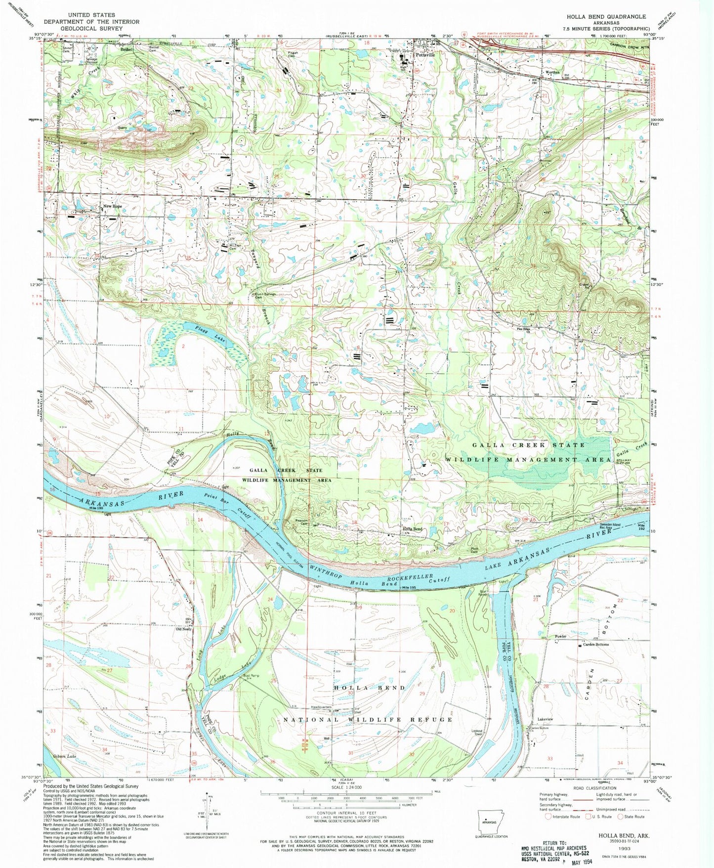
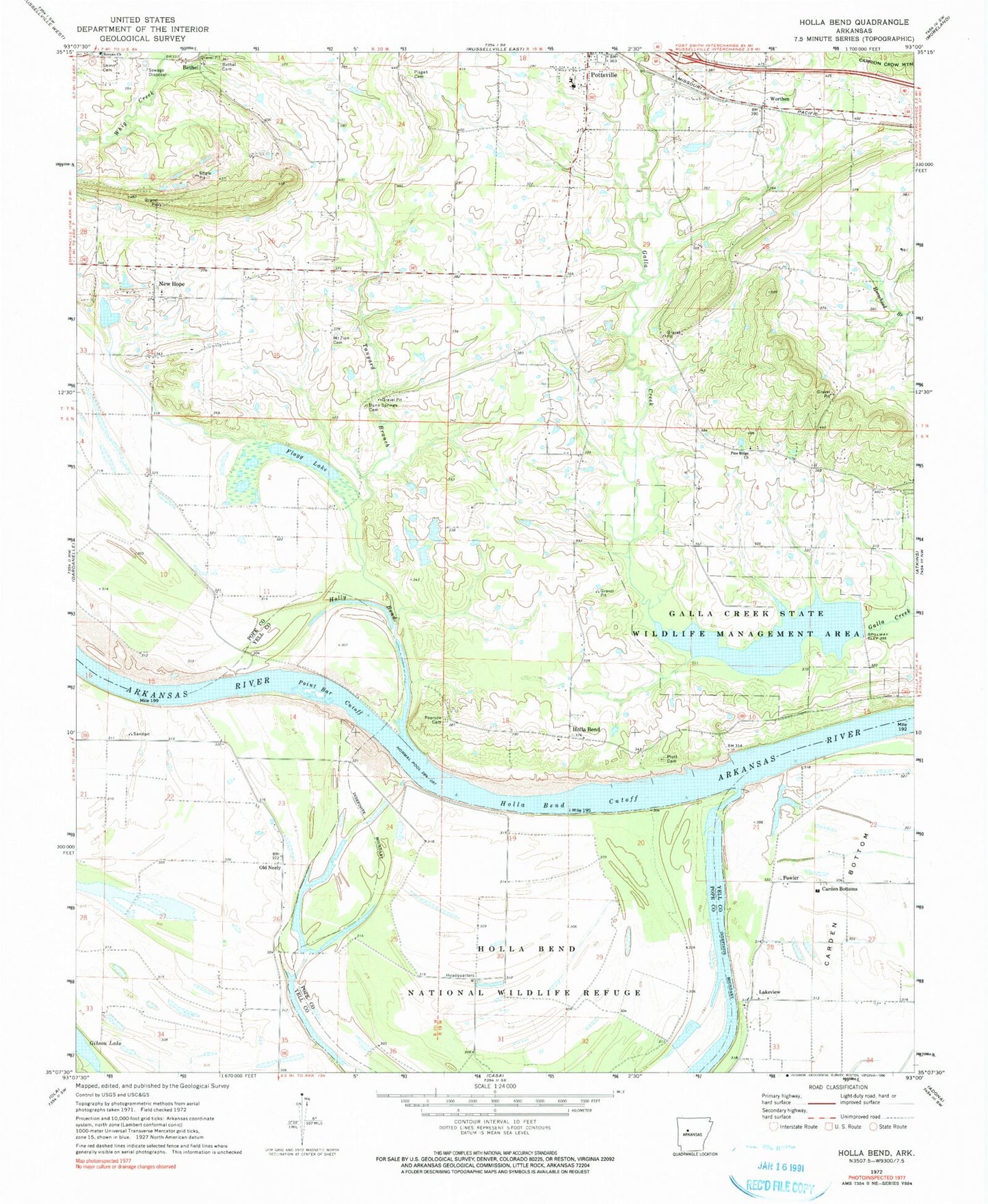
MyTopo
Classic USGS Holla Bend Arkansas 7.5'x7.5' Topo Map
Couldn't load pickup availability
Historical USGS topographic quad map of Holla Bend in the state of Arkansas. Map scale may vary for some years, but is generally around 1:24,000. Print size is approximately 24" x 27"
This quadrangle is in the following counties: Pope, Yell.
The map contains contour lines, roads, rivers, towns, and lakes. Printed on high-quality waterproof paper with UV fade-resistant inks, and shipped rolled.
Contains the following named places: Bethany Church, Bethany School, Bethel, Bethel Cemetery, Bethel Church, Carden Bottom Church, Carden Bottoms, City of Pottsville, Coopers Store, Dunn Springs Cemetery, Flagg Lake, Fowler, Galla Creek State Wildlife Lake Dam, Galla Creek State Wildlife Management Area, Galla Creek Wildlife Lake, Holla Bend, Holla Bend Cutoff, Holla Bend National Wildlife Refuge, Howells Bend, Jones Lake, Jones Lake Dam, Lake Irvin, Lake Irvin Dam, Lakeview, Lakeview School, Lodge Lake, Long Lake, Luther Lake, Mount Zion Cemetery, Mount Zion Church, Neely School, Neelys Bend, New Hope, Old Neely, Open Slough, Pearson Cemetery, Pine Ridge Church, Pisgah, Pisgah Cemetery, Pisgah School, Pleasant Grove Church, Pleasant Grove School, Plott Cemetery, Point Bar Cutoff, Pottsville, Pottsville Elementary School, Pottsville Fire Department, Pottsville High School, Pottsville Junior High School, Pottsville Middle Grades School, Pottsville Police Department, Reeds Ferry, Rocky Point School, Shinn Cemetery, Shinn School, Sweeden Island Park, Tanyard Branch, Township of Galla, Township of Holla Bend, United States Fish and Wildlife Holla Bend National Wildlife Refuge Park Security, Winthrop Rockefeller Lake, Worthen, ZIP Code: 72858