MyTopo
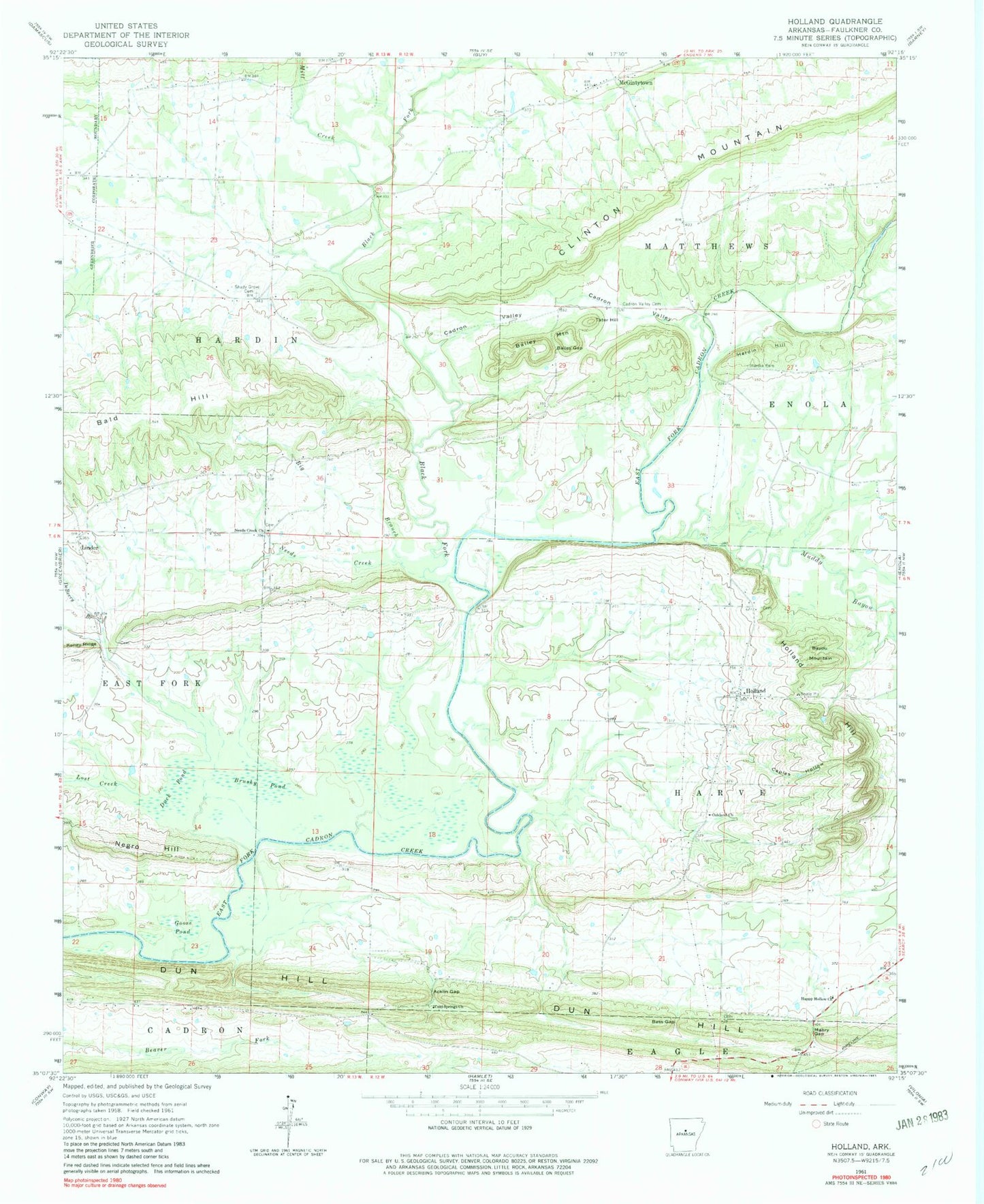
Classic USGS Holland Arkansas 7.5'x7.5' Topo Map
Couldn't load pickup availability
Historical USGS topographic quad map of Holland in the state of Arkansas. Map scale may vary for some years, but is generally around 1:24,000. Print size is approximately 24" x 27"
This quadrangle is in the following counties: Faulkner.
The map contains contour lines, roads, rivers, towns, and lakes. Printed on high-quality waterproof paper with UV fade-resistant inks, and shipped rolled.
Contains the following named places: Acklin Gap, Acklin Graveyard, Antioch Cemetery, Arkavalley Airport, Bailey Gap, Bailey Mountain, Baileys Chapel, Bald Hill, Bass Gap, Bayou Mountain, Big Branch, Black Fork, Brushy Pond, Cadron Valley, Cadron Valley Cemetery, Cantrell Farms Airport, Caples Hollow, City of Holland, Clinton Mountain, Cold Springs Church, Cow Ford, DeBerry Branch, Duck Pond, Dun Hill, Faulkner County, Goose Pond, Happy Hollow Baptist Church, Happy Hollow School, Happy Valley, Hardin Bridge, Hardin Cemetery, Hardin Hill, Harve Creek, Henderson Cemetery, Holland, Holland Fire Department, Holland Hill, Holland Methodist Church, Hopewell Church, Linder, Lost Creek, Mabry Gap, McGinty Town Cemetery, McGintytown, McGintytown Assembly of God Church, Melrose School, Mill Creek, Muddy Bayou, Needs Creek, Needs Creek Baptist Church, Needs Creek Cemetery, Negro Hill, New Hope School, Oakland Cemetery, Oakland Methodist Church, Oakland School, Old Salem Church, Prairie Creek, Shady Grove Baptist Church, Shady Grove Cemetery, Shady Grove School, Tarkington Creek, Tater Hill, Township of Hardin, Township of Harve, Township of Matthews, ZIP Code: 72058