MyTopo
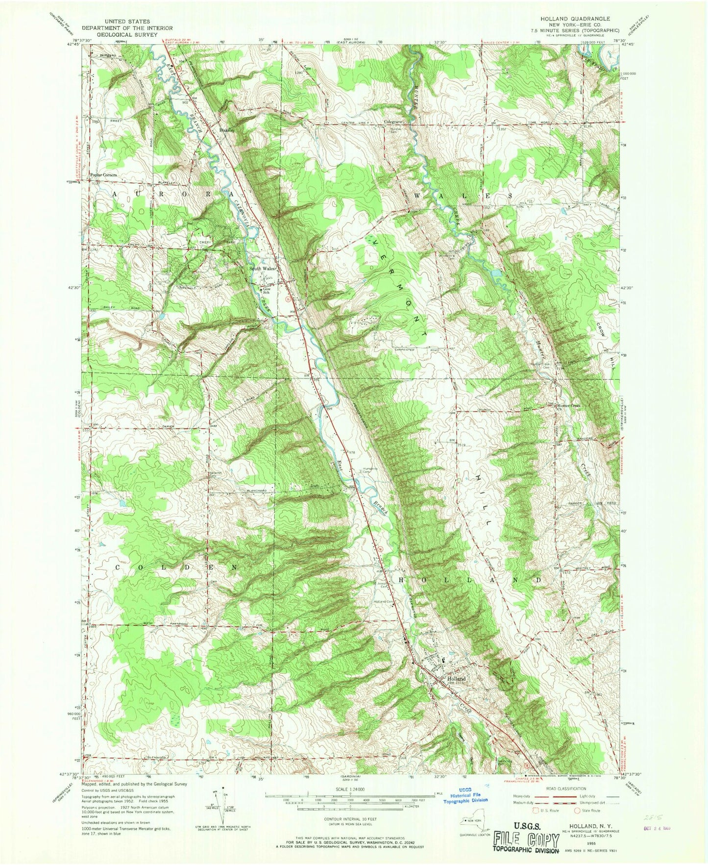
Classic USGS Holland New York 7.5'x7.5' Topo Map
Couldn't load pickup availability
Historical USGS topographic quad map of Holland in the state of New York. Typical map scale is 1:24,000, but may vary for certain years, if available. Print size: 24" x 27"
This quadrangle is in the following counties: Erie.
The map contains contour lines, roads, rivers, towns, and lakes. Printed on high-quality waterproof paper with UV fade-resistant inks, and shipped rolled.
Contains the following named places: Blakeley, Emery Park, Gears Gulf, Goodleberg Cemetery, Gow School, Holland, Holland Cemetery, Holmes Hill Cemetery, Humphrey Cemetery, Hunter Creek Cemetery, Hunters Creek Bible Baptist Church, Neischel Cemetery, Poplar Corners, Saint Joseph Cemetery, South Wales, Vermont Hill, Colegrave, WGR-FM (Buffalo), WGRZ-TV (Buffalo), WKBW-TV (Buffalo), Town of Holland, Town of Wales, Holland Census Designated Place, Field Of Dreams Farm, Holland Fire District Station 1, South Wales Volunteer Fire Company, Holland Volunteer Fire Department, Colden Fire District, Kramer Farms, Holland Post Office, South Wales Post Office, East Aurora High School, Harold O Brumsted Elementary School, Holland High School, Holland Middle School, First Baptist Church of Holland, Holland United Methodist Church, Kingdom Hall of Jehovah's Witnesses, Saint Joseph Roman Catholic Church, South Wales Presbyterian Church, Aurora Mobile Home Park, Circle B Courts Mobile Home Park, Holland Hills Country Club, Holland Town Hall, Mountain Meadow Park Sewage Treatment Plant, New York State Police Troop A Zone 2 Holland Station