MyTopo
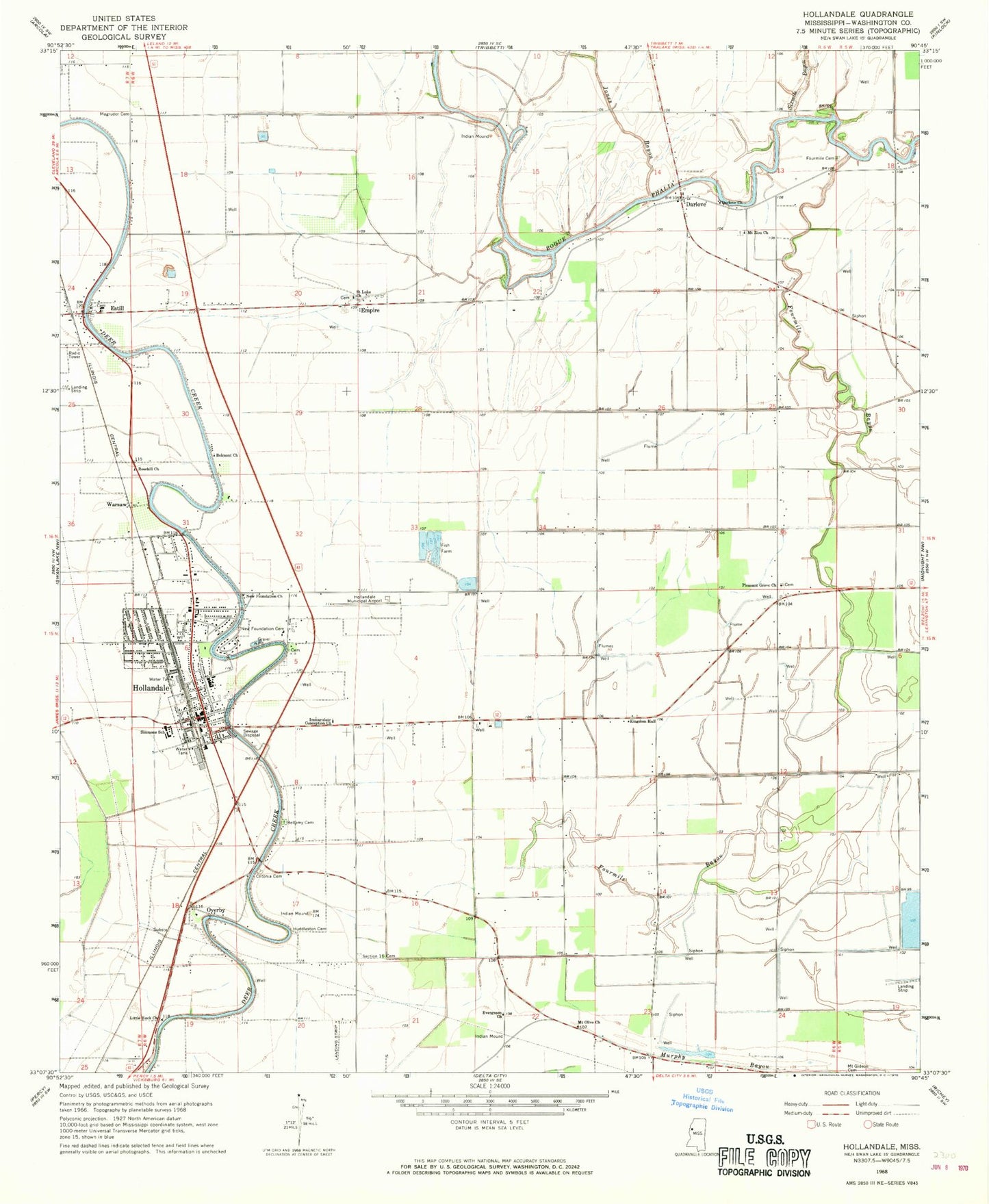
Classic USGS Hollandale Mississippi 7.5'x7.5' Topo Map
Couldn't load pickup availability
Historical USGS topographic quad map of Hollandale in the state of Mississippi. Map scale may vary for some years, but is generally around 1:24,000. Print size is approximately 24" x 27"
This quadrangle is in the following counties: Washington.
The map contains contour lines, roads, rivers, towns, and lakes. Printed on high-quality waterproof paper with UV fade-resistant inks, and shipped rolled.
Contains the following named places: Bellamy Cemetery, Belmont Church, Bucker Catfish Pond Dam, Bucker Catfish Ponds Dam, City of Hollandale, Cletonia, Clitonia Cemetery, Darlove, Darlove Church, Dave Jones Catfish Ponds Dam, Deep Slough, Empire, Estill, Evergreen Church, First Baptist Church, Fourmile Bayou, Fourmile Cemetery, Grier Brothers Lake Dam, Hollandale, Hollandale Baptist Church, Hollandale Municipal Airport, Hollandale Police Department, Hollandale Post Office, Hollandale School, Hollandale United Methodist Church, Hollandale Volunteer Fire Department, Holt Collier National Wildlife Refuge, Huddleston Cemetery, Immaculate Conception Church, J H Collie Catfish Ponds Dam, Jones Bayou, Little Rock Church, Magruder Cemetery, Mount Gideon Cemetery, Mount Olive Church, Mount Zion Church, New Foundation Baptist Church, New Foundation Cemetery, New Foundation Church, New Hope Baptist Church, Overby, Pleasant Grove Church, Rosehill Church, Saint Luke Church, Section 16 Cemetery, Simmons Elementary School, Sixmile Bayou, South Washington County Hospital, Supervisor District 5, Warsaw