MyTopo
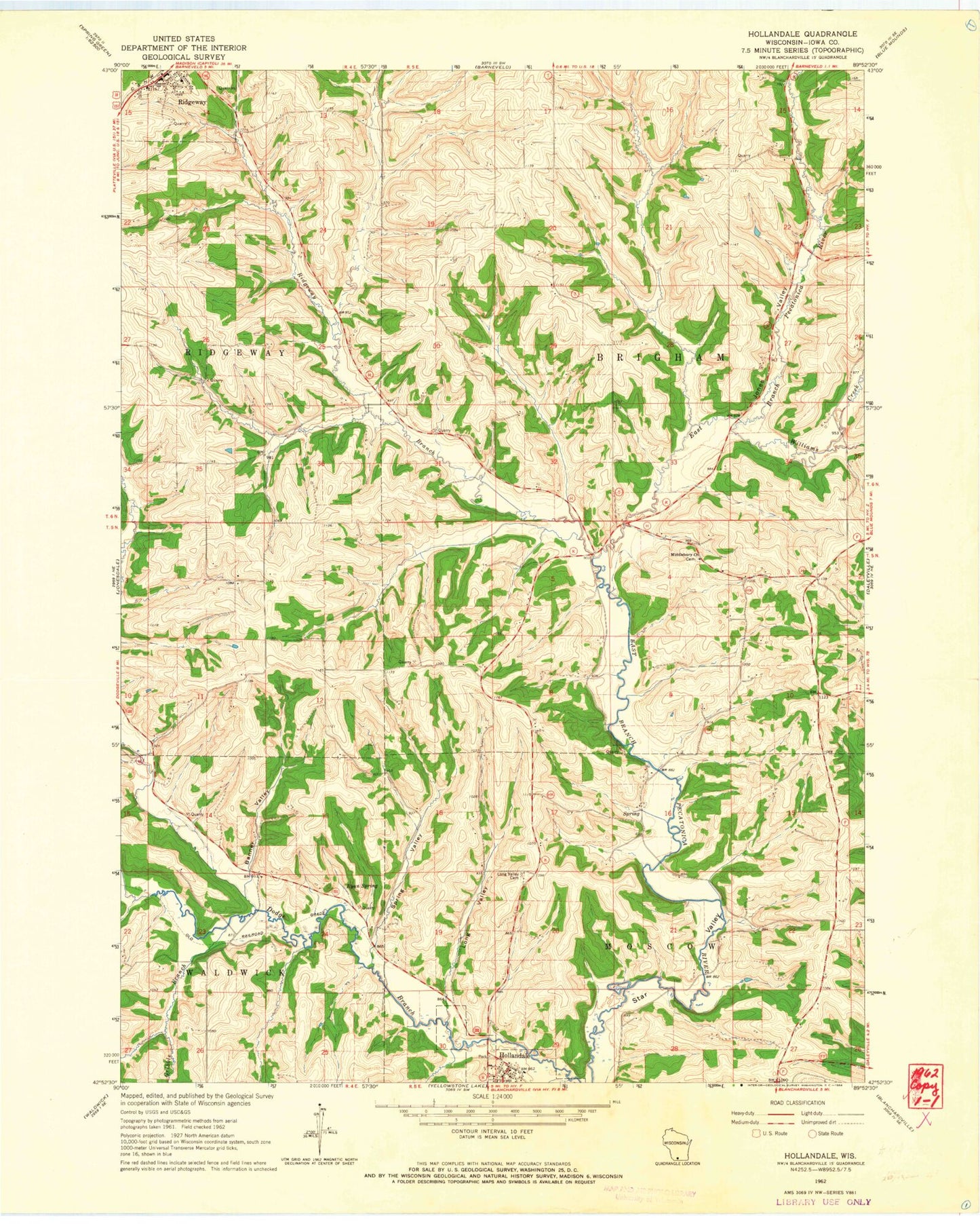
Classic USGS Hollandale Wisconsin 7.5'x7.5' Topo Map
Couldn't load pickup availability
Historical USGS topographic quad map of Hollandale in the state of Wisconsin. Map scale may vary for some years, but is generally around 1:24,000. Print size is approximately 24" x 27"
This quadrangle is in the following counties: Iowa.
The map contains contour lines, roads, rivers, towns, and lakes. Printed on high-quality waterproof paper with UV fade-resistant inks, and shipped rolled.
Contains the following named places: 0.5 Reservoir, 1 Reservoir, 53507, 53544, Adamsville, Banner Valley, Conley Lewis Creek, Desmet Airport, Hollandale, Hollandale Post Office, Jones Valley, Long Valley, Long Valley Cemetery, Long Valley Creek, Middlebury, Middlebury Church, Nelson G 7414 Dam, Ridgeway Elementary School, Ridgeway Marshal's Office, Ridgeway Post Office, Ryan Spring, Smith Conley Creek, Spring Valley, Star Valley, Town of Brigham, Town of Ridgeway, Urnus Creek, Village of Hollandale, Village of Ridgeway, Warzyn G-8862 Dam, Whitford Creek, Williams-Barneveld Creek