MyTopo
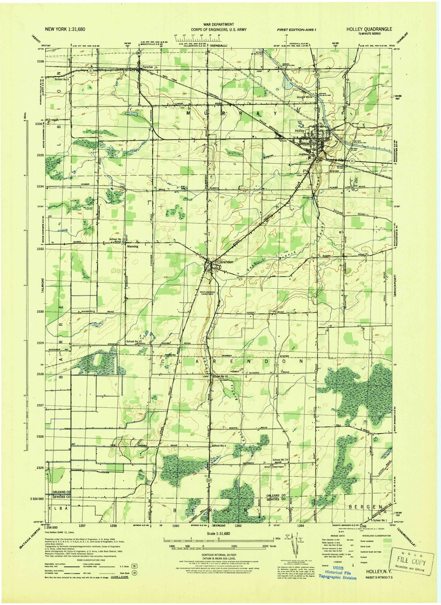
Classic USGS Holley New York 7.5'x7.5' Topo Map
Couldn't load pickup availability
Historical USGS topographic quad map of Holley in the state of New York. Map scale may vary for some years, but is generally around 1:24,000. Print size is approximately 24" x 27"
This quadrangle is in the following counties: Genesee, Orleans.
The map contains contour lines, roads, rivers, towns, and lakes. Printed on high-quality waterproof paper with UV fade-resistant inks, and shipped rolled.
Contains the following named places: Bennetts Corners, Brockport Country Club, Christopher Farm, Clarendon, Clarendon Post Office, Clarendon Quarry, Clarendon Volunteer Fire Company, Community Free Library, County Line Mobile Home Park, Disciples United Methodist Church, East Avenue Gulf Road Bridge, Erie Canal Bridge, Fancher, Fancher Post Office, First Baptist Church, First Presbyterian Church, Glidden Burial Ground, Groth Road Bridge, Hickory Ridge Golf and Country Club, Hillside Cemetery, Holley, Holley Elementary School, Holley Junior - Senior High School, Holley Post Office, Holley Volunteer Fire Company, Holy Cross Cemetery, Honest Hill, Kateland Farms, Manning, Maple Grove Farm, Maplewood Cemetery, Maxon Field, McCargo Lake, Mele Farms, New Covenant Worship Center, Old Paths Baptist Church, Pettinghill Cemetery, Piedmonte Garlic Farm, Pioneer Cemetery, Robinson Burial Ground, Robinson Hill School, Root Cemetery, Saint Mary's Roman Catholic Church, Saint Pauls Episcopal Church, School Number 1, School Number 11, School Number 12, School Number 14, School Number 4, School Number 9, Sixth Day Farm, Sprague Cemetery, Thomas Estates West, Town of Clarendon, Village of Holley, ZIP Code: 14470