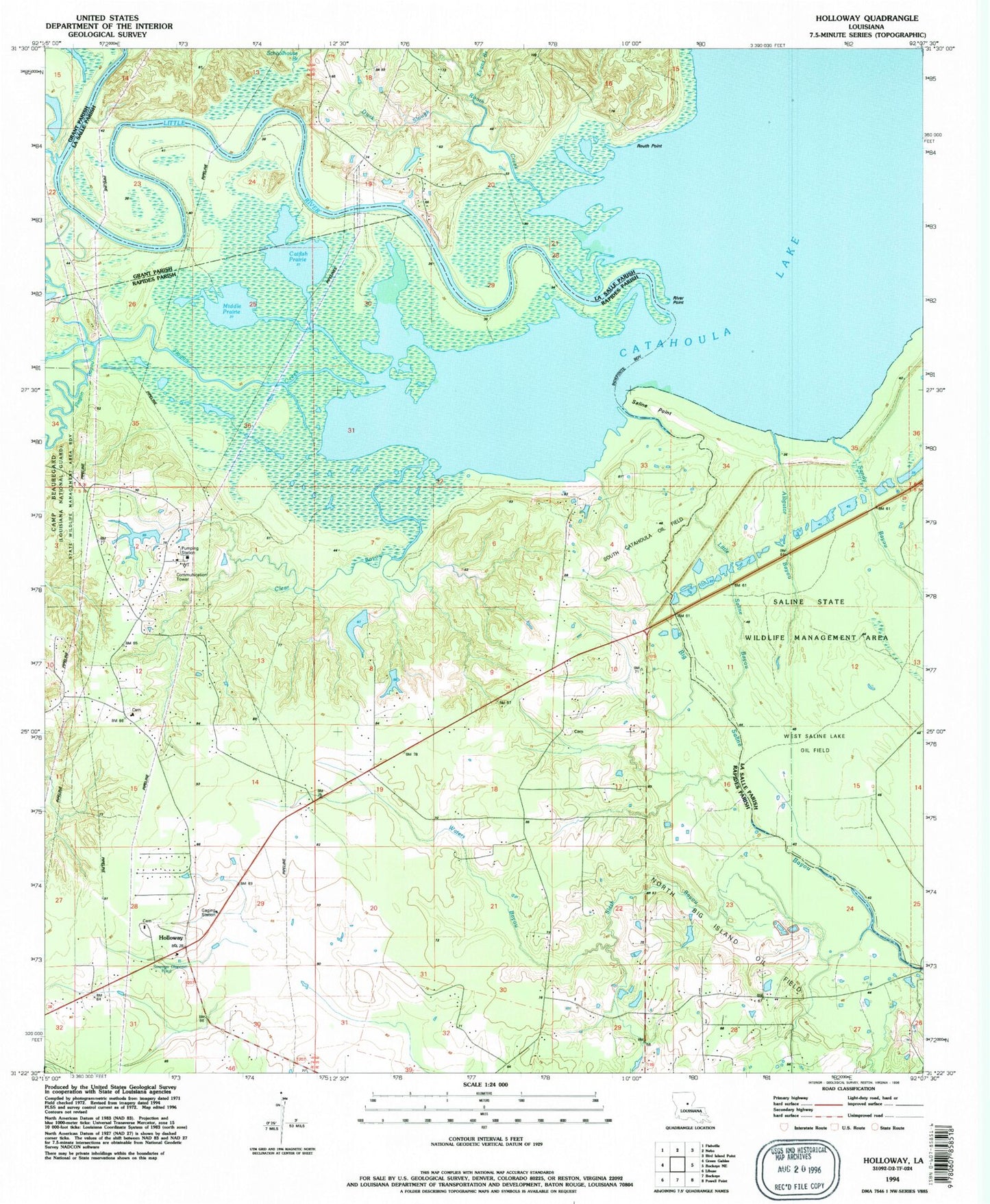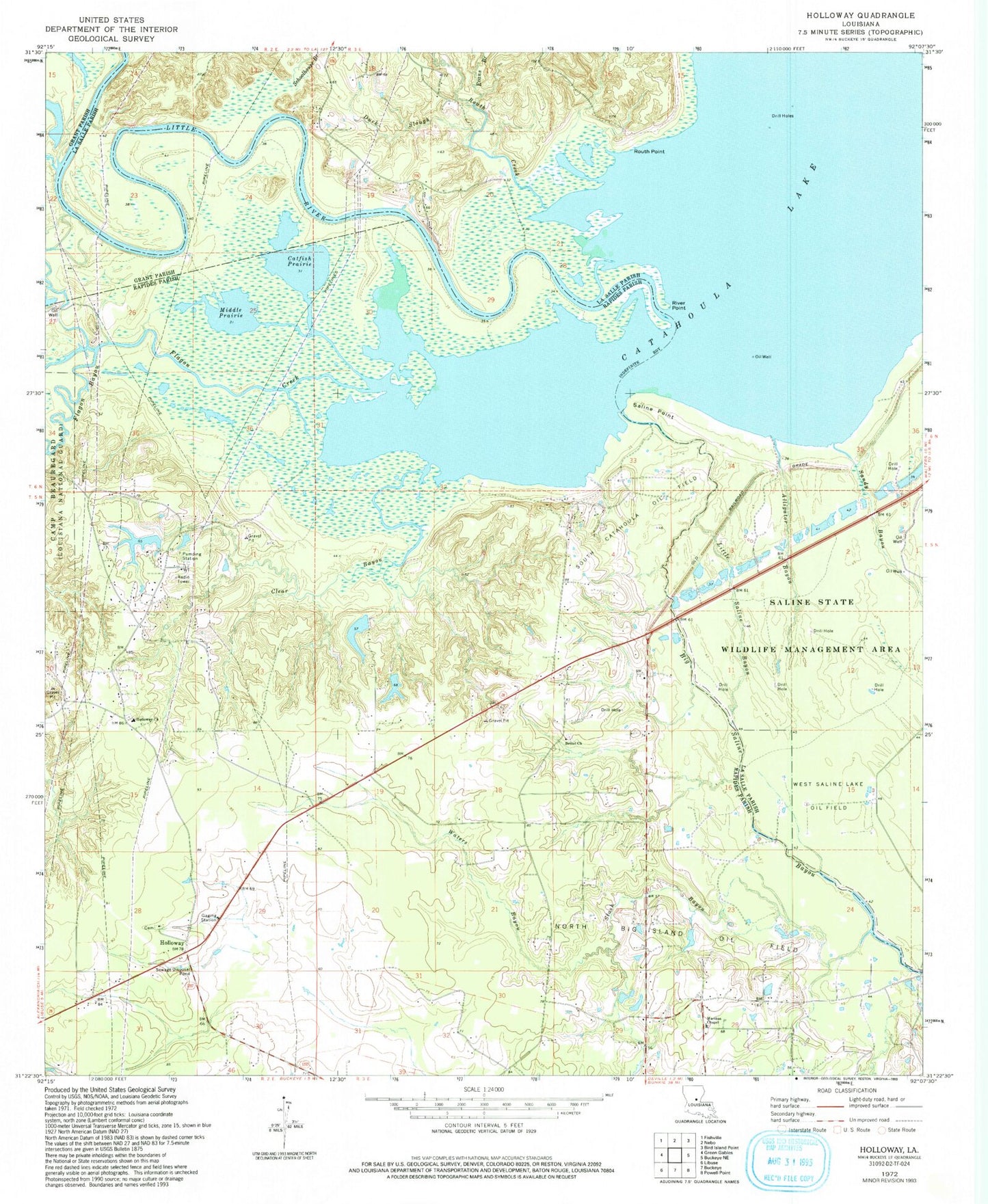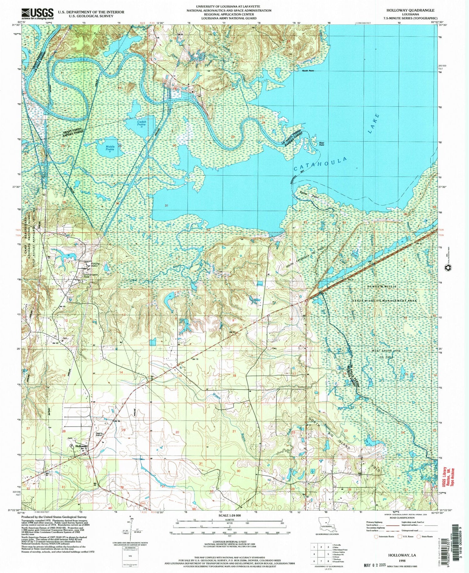


MyTopo
Classic USGS Holloway Louisiana 7.5'x7.5' Topo Map
Couldn't load pickup availability
Historical USGS topographic quad map of Holloway in the state of Louisiana. Map scale may vary for some years, but is generally around 1:24,000. Print size is approximately 24" x 27"
This quadrangle is in the following counties: Grant, LaSalle, Rapides.
The map contains contour lines, roads, rivers, towns, and lakes. Printed on high-quality waterproof paper with UV fade-resistant inks, and shipped rolled.
Contains the following named places: Alligator Bayou, Bethel Church, Carr Hollow, Catfish Prairie, Clear Bayou, Deville Volunteer Fire Department, Duck Slough, Evans Branch, Flagon Bayou, Flagon Creek, Holloway, Holloway Church, Holloway Prairie, Holloway School, Little Saline Bayou, Martha Chapel Free Methodist Church, Middle Prairie, North Big Island Oil Field, River Point, Routh Creek, Routh Point, Saline Point, Schoolhouse Branch, Slash Bayou, Slash Bayou School, South Catahoula Oil Field, Waters Bayou