


MyTopo
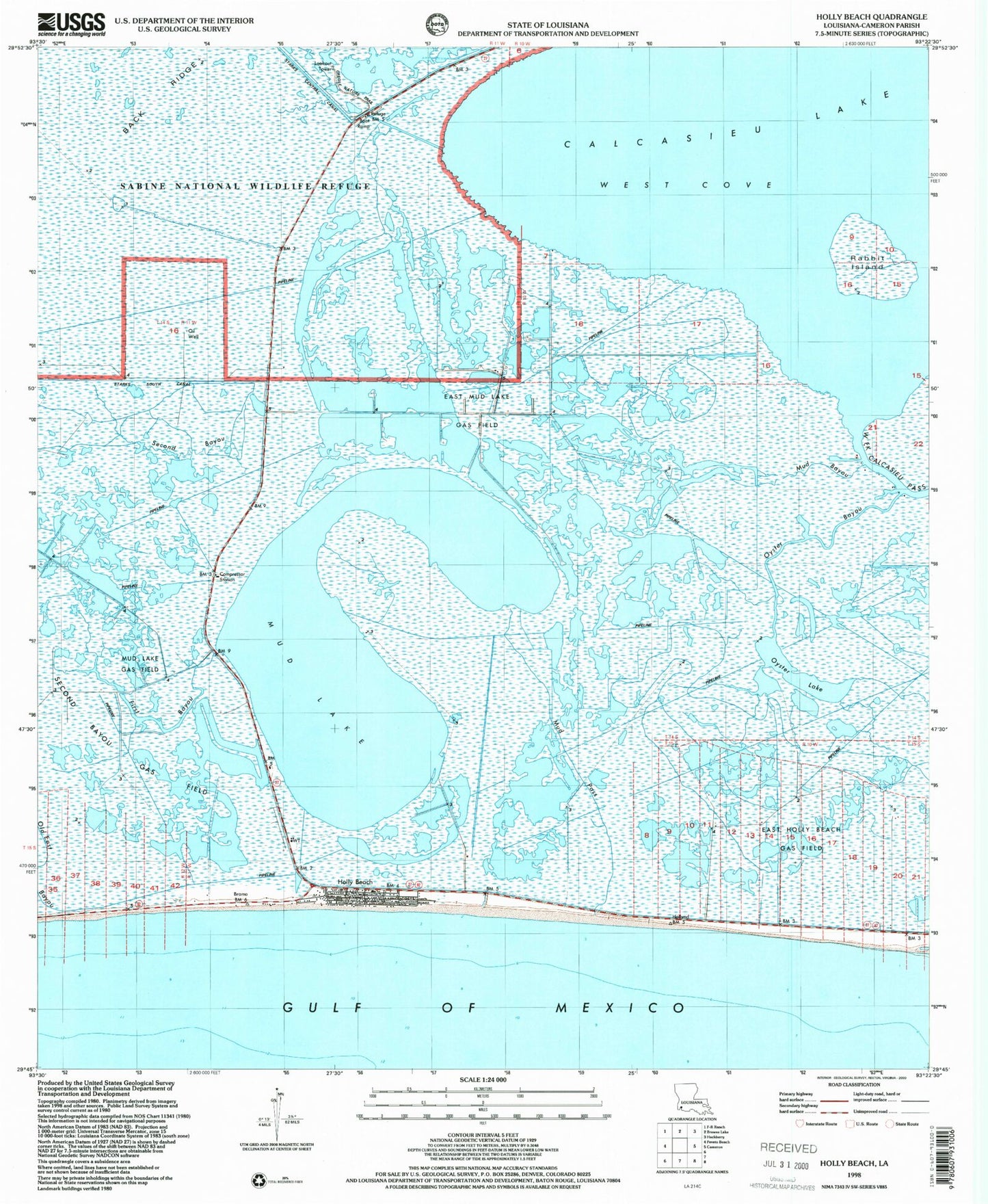
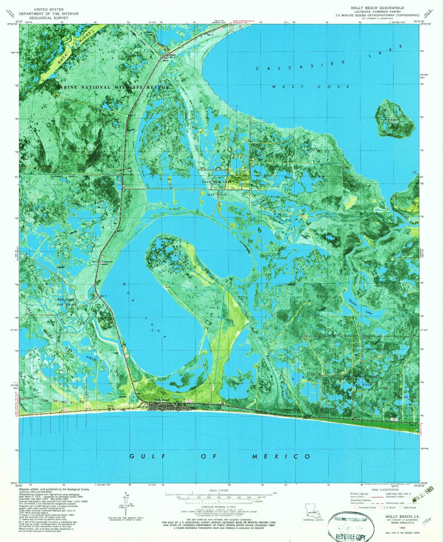
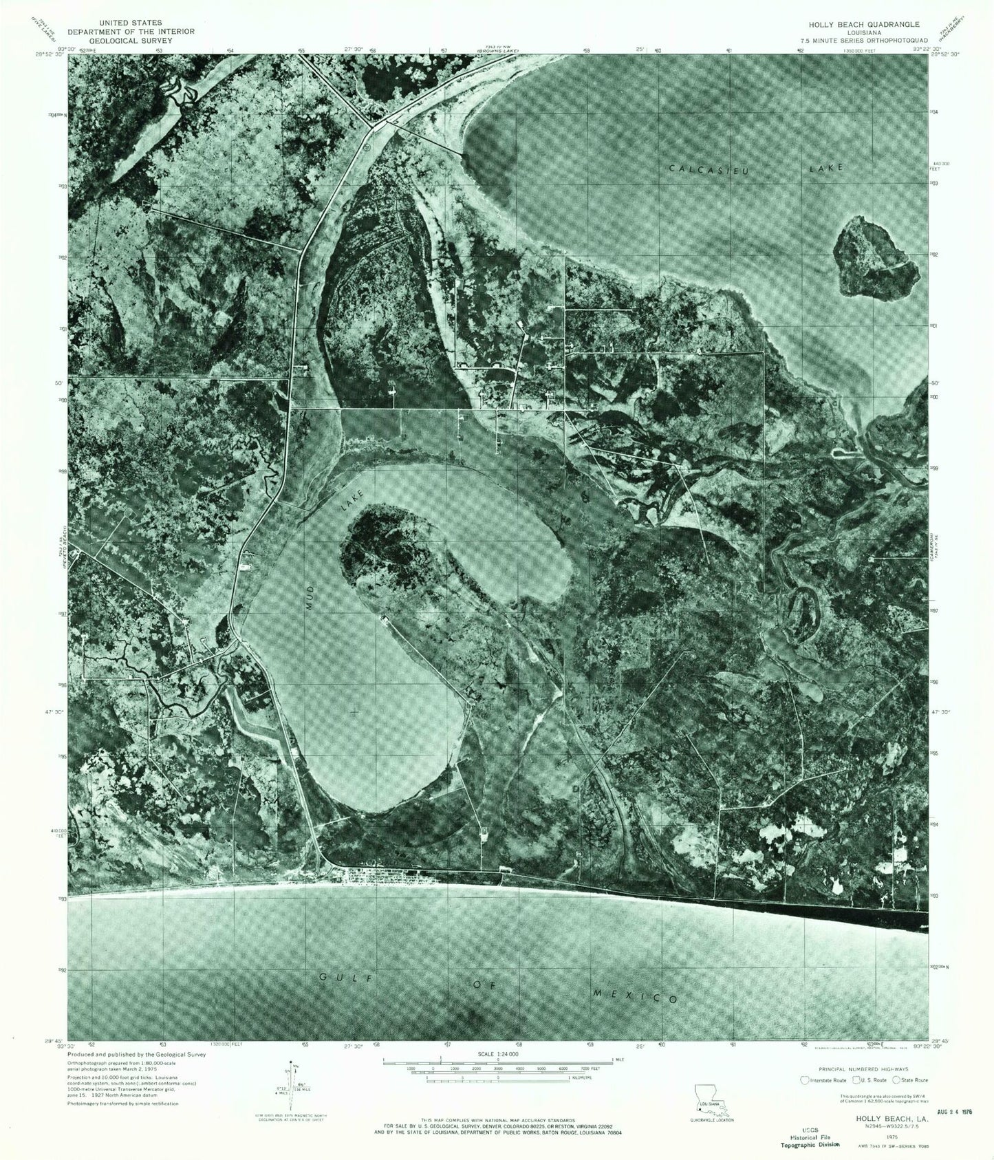
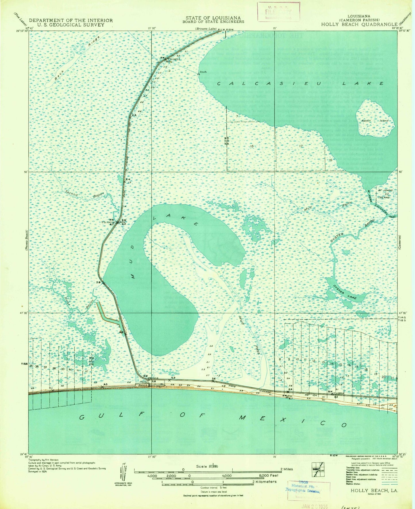
Classic USGS Holly Beach Louisiana 7.5'x7.5' Topo Map
Regular price
$16.95
Regular price
Sale price
$16.95
Unit price
per
Couldn't load pickup availability
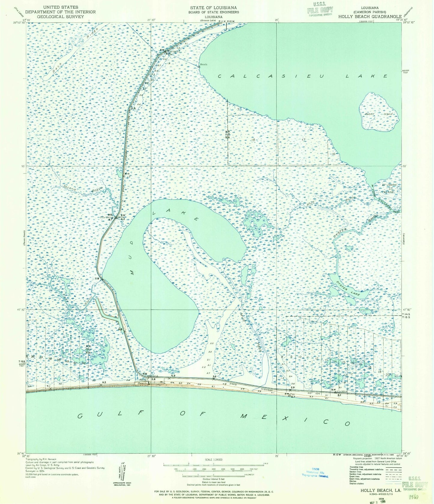
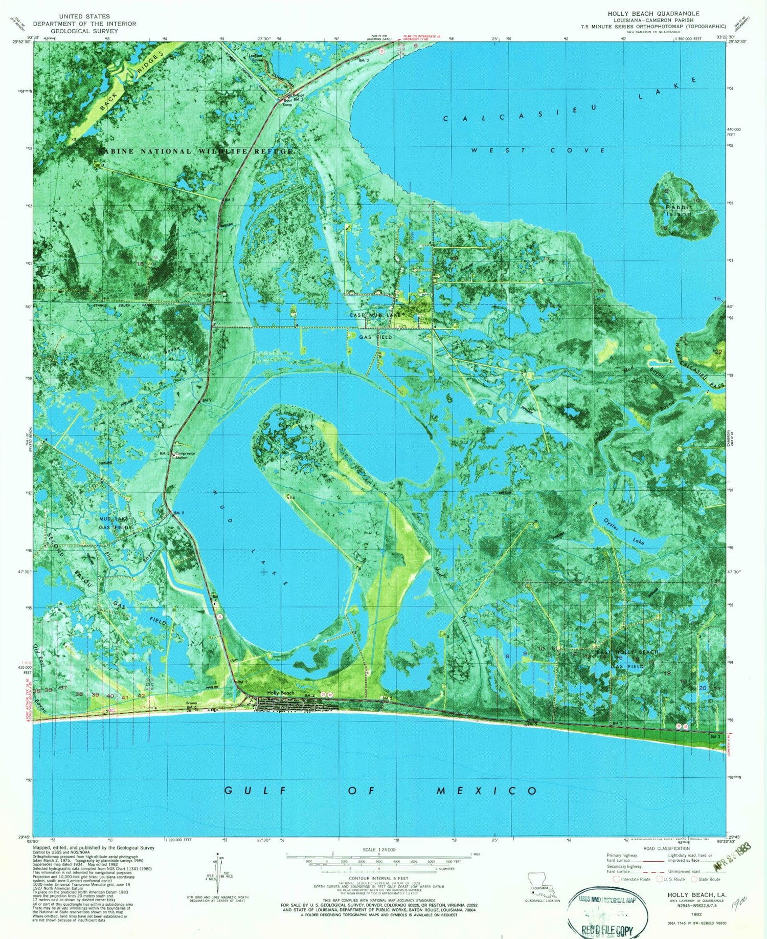
Historical USGS topographic quad map of Holly Beach in the state of Louisiana. Map scale may vary for some years, but is generally around 1:24,000. Print size is approximately 24" x 27"
This quadrangle is in the following counties: Cameron.
The map contains contour lines, roads, rivers, towns, and lakes. Printed on high-quality waterproof paper with UV fade-resistant inks, and shipped rolled.
Contains the following named places: Creole Nature Trail, East Holly Beach Gas Field, East Mud Lake Gas Field, First Bayou, Holly Beach, Holly Beach Fire Station District 10, Mud Bayou, Mud Lake, Mud Lake Gas Field, Mud Pass, Oyster Bayou, Oyster Lake, Rabbit Island, Second Bayou, West Cove