MyTopo
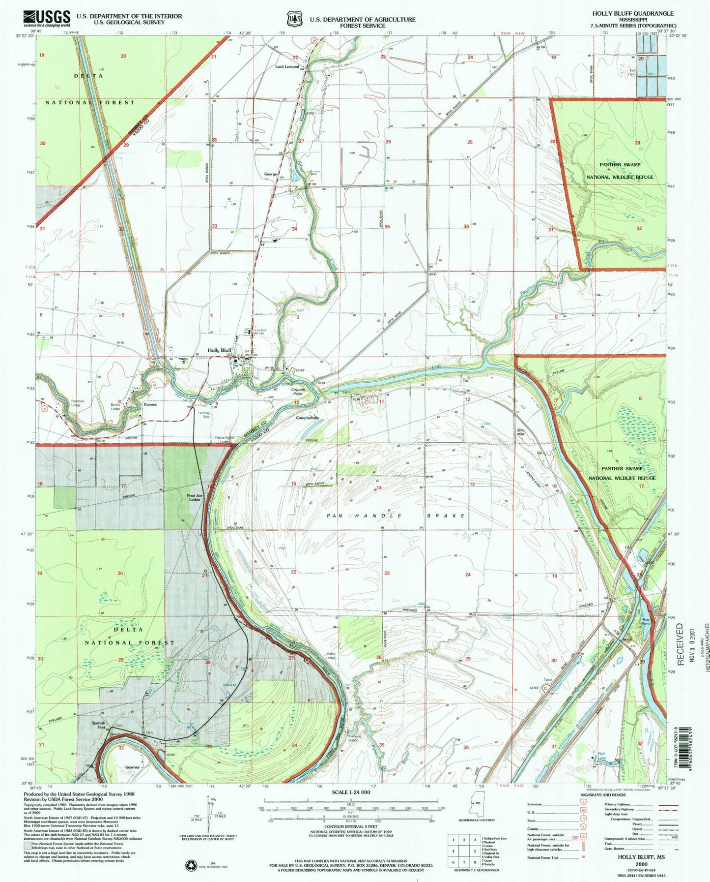
Classic USGS Holly Bluff Mississippi 7.5'x7.5' Topo Map
Couldn't load pickup availability
Historical USGS topographic quad map of Holly Bluff in the state of Mississippi. Map scale may vary for some years, but is generally around 1:24,000. Print size is approximately 24" x 27"
This quadrangle is in the following counties: Sharkey, Yazoo.
The map contains contour lines, roads, rivers, towns, and lakes. Printed on high-quality waterproof paper with UV fade-resistant inks, and shipped rolled.
Contains the following named places: Bonny Lodge, Campbellsville Cemetery, Campbellsville Chapel, Campbellville, Crippen Point, Fifteen Mile Bayou, Fifteen Mile Island, Fish Lake, Future Home Lodge, George, Holly Bluff, Holly Bluff Fire Department, Holly Bluff Line Attendance Center, Holly Bluff Post Office, Jeffery Cemetery, Kearney, Kettleman Cemetery, Loch Lomond, Mabin Island, Mabin Lodge, Millers Chapel, New Zion Church, Oak Grove Church, Pan Handle Brake, Panther Creek, Panther Valley Plantation, Patmos, Poor Joe Larkin, Roanoke Lodge, Shannon Cemetery, Silver Creek, Spanish Fort, Tanglewood Cemetery, Tanglewood Plantation, ZIP Code: 39088