MyTopo
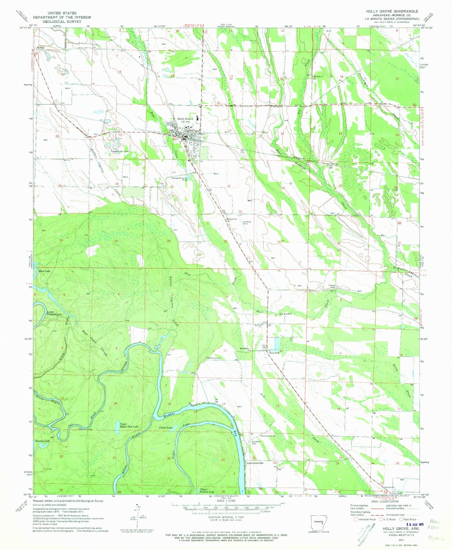
Classic USGS Holly Grove Arkansas 7.5'x7.5' Topo Map
Couldn't load pickup availability
Historical USGS topographic quad map of Holly Grove in the state of Arkansas. Map scale may vary for some years, but is generally around 1:24,000. Print size is approximately 24" x 27"
This quadrangle is in the following counties: Monroe.
The map contains contour lines, roads, rivers, towns, and lakes. Printed on high-quality waterproof paper with UV fade-resistant inks, and shipped rolled.
Contains the following named places: Adams Bayou, Ash Slash, Bear Camp Slough, Big Slash, Big Star Church, Boat Gunwale Slash, Carr Cemetery, City of Holly Grove, Cooter Lake, Cut Bluff Slough, Deep Elm, Dial Creek, First Saint John Church, Franks Cemetery, Goodwin Cemetery, Green Bayou, Holly Grove, Holly Grove Elementary School, Holly Grove Fire Department, Holly Grove High School, Holly Grove Municipal Airport, Holly Grove Police Department, Holly Grove Post Office, Lawrenceville, Lawrenceville Church, Macedonia Cemetery, Maddox Bay Volunteer Fire Department, Mount Pleasant Church, Mount Zion Cemetery, Mount Zion Church, Mud Lake, Pryor Lake, Redmans Cemetery, Township of Duncan, Township of Jackson, Travelers Rest Cemetery, Upper Eagle Nest Lake, Walker Cypress Creek, ZIP Code: 72069