
MyTopo
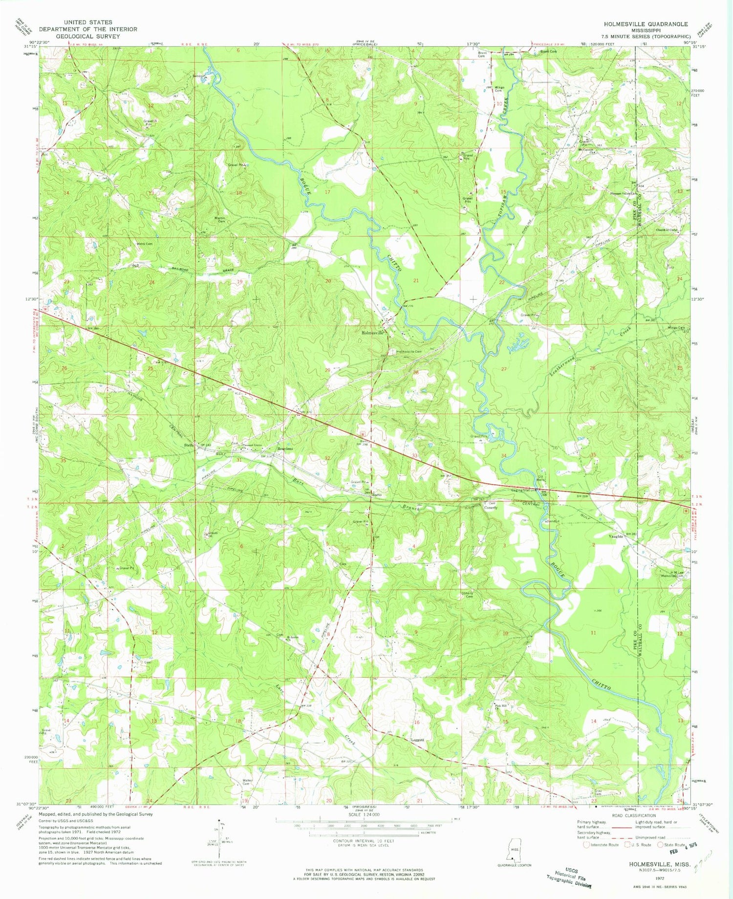
Classic USGS Holmesville Mississippi 7.5'x7.5' Topo Map
Couldn't load pickup availability
Historical USGS topographic quad map of Holmesville in the state of Mississippi. Map scale may vary for some years, but is generally around 1:24,000. Print size is approximately 24" x 27"
This quadrangle is in the following counties: Pike, Walthall.
The map contains contour lines, roads, rivers, towns, and lakes. Printed on high-quality waterproof paper with UV fade-resistant inks, and shipped rolled.
Contains the following named places: Alford Cemetery, Andrews-Bickam-Quin Cemetery, Bars Branch, Barto, Beardens, Brent Cemetery, Brent School, Bridges, Brumfield Cemetery, Charles Young Cemetery, Church of Christ, Conerly, Conerly Cemetery, Connally Cemetery, Ellzey Cemetery, Gray Cemetery, Hardscrabble Plantation, HM Lee Memorial Cemetery, Holmesville, Holmesville Baptist Church, Holmesville Cemetery, House of Prayer Church, Howell Lake Dam, Kaigler Cemetery, Leatherwood Creek, Leatherwood School, Leggett, Leggett Cemetery, Martin - McNabb Cemetery, Martin Cemetery, Martins School, Mount Cannon Church, New Holmesville, Parker Lake Dam, Pink Hill Church, Pleasant Grove Church, Pleasant Valley Church of God in Christ, Rills Cemetery, Saint James Church, Sibley School, Stella, Supervisor District 3, Thomas Cemetery, Topisaw Creek, Vaughts, Walker Cemetery, Warner Cemetery, Webb Cemetery, Wingo Cemetery


