MyTopo
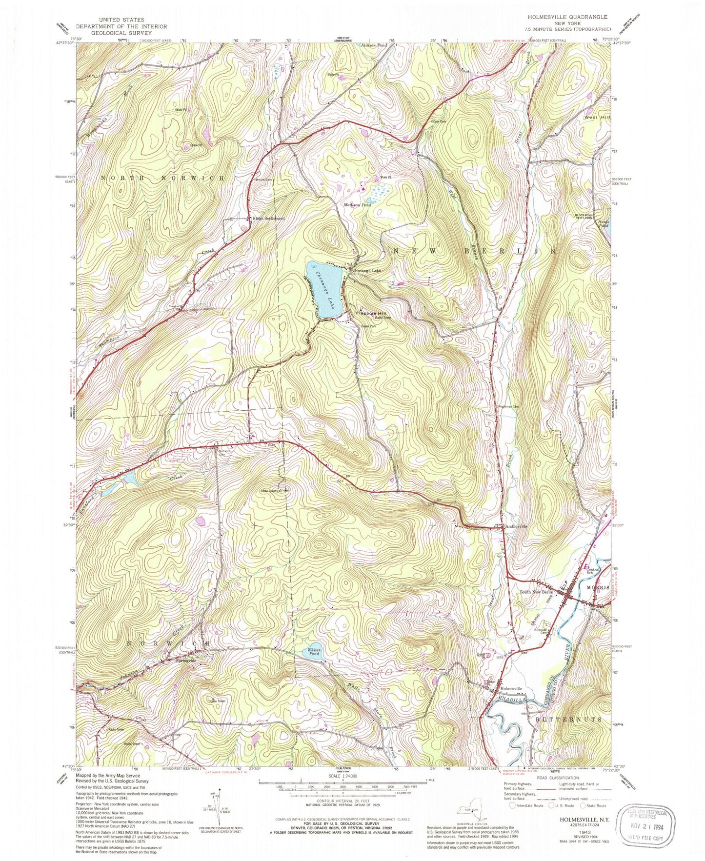
Classic USGS Holmesville New York 7.5'x7.5' Topo Map
Couldn't load pickup availability
Historical USGS topographic quad map of Holmesville in the state of New York. Map scale may vary for some years, but is generally around 1:24,000. Print size is approximately 24" x 27"
This quadrangle is in the following counties: Chenango, Otsego.
The map contains contour lines, roads, rivers, towns, and lakes. Printed on high-quality waterproof paper with UV fade-resistant inks, and shipped rolled.
Contains the following named places: Alishauskas Dairy, Amblerville, Amblerville Cemetery, Bloom Cemetery, Burwell Corners, Central School, Chenango Lake, Ditch Road Bridge, Dyer Cemetery, Edmonds Cemetery, Flagpole Hill, Great Brook, Hidden Ponds Stables, Holmesville, Holmesville Cemetery, King Settlement Cemetery, Kings Settlement, Madison Pond, Norwich Cemetery, Riverside Cemetery, School Number 11, School Number 2, School Number 6, School Number 7, South New Berlin, South New Berlin Free Library, South New Berlin Post Office, South New Berlin Volunteer Fire Department, Springvale, Town of New Berlin, Town of North Norwich, Town of Norwich, Union Church, WCHN-AM (Norwich), West Branch Great Brook, Whites Pond, Wightman Cemetery, WKXZ-FM (Norwich), ZIP Code: 13843