MyTopo
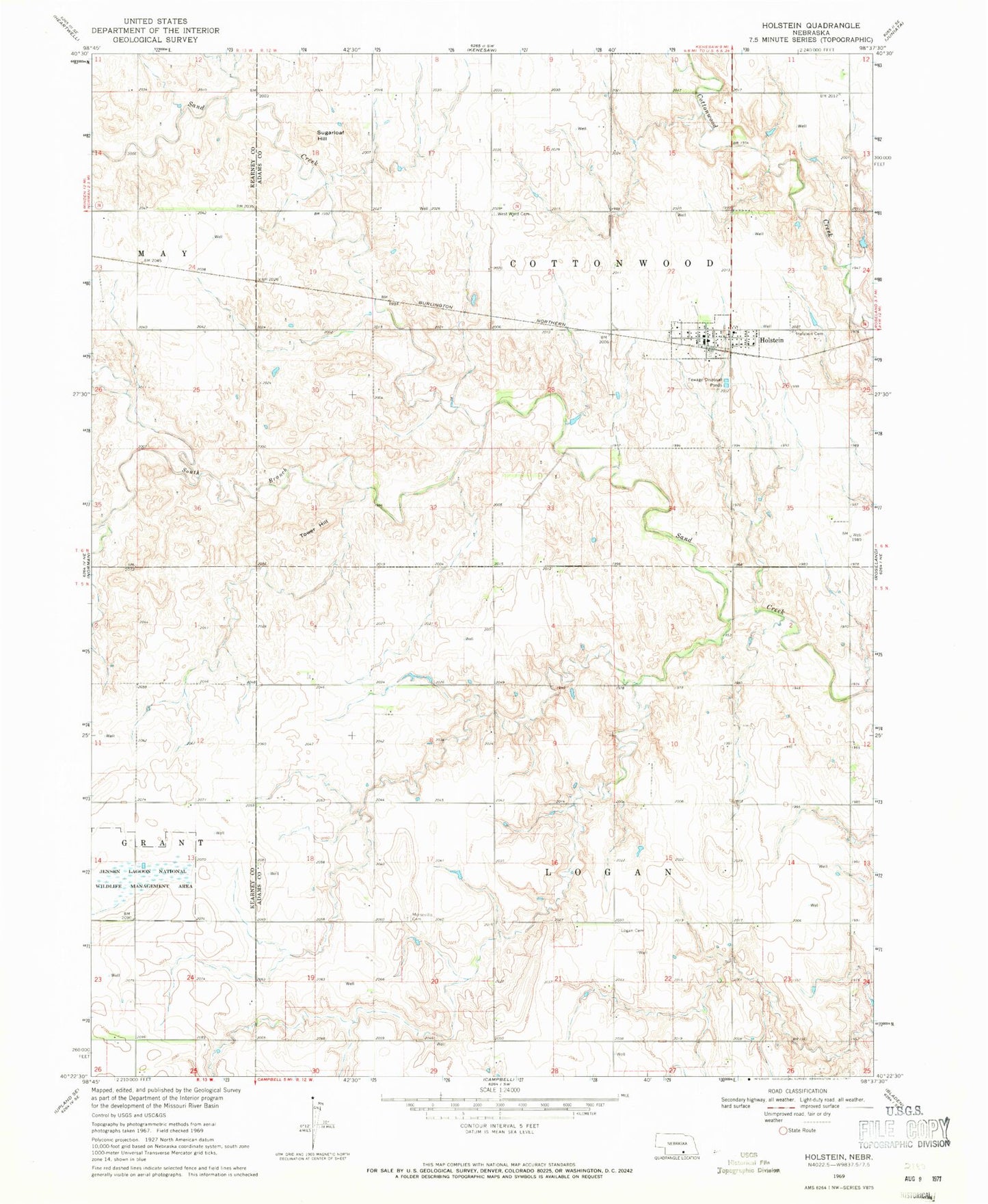
Classic USGS Holstein Nebraska 7.5'x7.5' Topo Map
Couldn't load pickup availability
Historical USGS topographic quad map of Holstein in the state of Nebraska. Map scale may vary for some years, but is generally around 1:24,000. Print size is approximately 24" x 27"
This quadrangle is in the following counties: Adams, Kearney.
The map contains contour lines, roads, rivers, towns, and lakes. Printed on high-quality waterproof paper with UV fade-resistant inks, and shipped rolled.
Contains the following named places: Danish Cemetery, Grace United Methodist Church, Heartland Co-op Elevator, Holstein, Holstein Cemetery, Holstein Post Office, Holstein Public School, Holstein Rural Fire Department, Jensen Lagoon National Wildlife Mgt Area, Logan Cemetery, Lukow Dam, Lukow Reservoir, Morseville Cemetery, Saint Paul Lutheran Church, South Branch Sand Creek, Sugarloaf Hill, Tower Hill, Township of Cottonwood, Township of Logan, Village of Holstein, ZIP Code: 68950