MyTopo
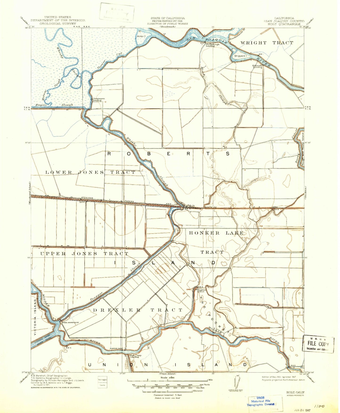
Classic USGS Holt California 7.5'x7.5' Topo Map
Couldn't load pickup availability
Historical USGS topographic quad map of Holt in the state of California. Map scale may vary for some years, but is generally around 1:24,000. Print size is approximately 24" x 27"
This quadrangle is in the following counties: San Joaquin.
The map contains contour lines, roads, rivers, towns, and lakes. Printed on high-quality waterproof paper with UV fade-resistant inks, and shipped rolled.
Contains the following named places: Acker Island, Black Slough, Blackslough Landing, Buckley Cove, Buckley Cove Park, Burns Cutoff, Christensen Landing, Drexler Tract, Eldorado Landing, Elmwood Tract, Fish Camp Landing, Gillis, Heritage Field, Holt, Holt Elementary School, Holt Union School, Honker Lake Tract, Kingston School, Lacto, Lower Jones Tract, McDonald Island Ferry, Mokelumne Aqueduct, Quito, Roberts Island, Stockton Division, The Pocket, Trapper Slough, Turner Cut, Union Point, Upper Jones Tract, Vulcan Island, Windmill Cove, Wright Tract, ZIP Code: 95206