MyTopo
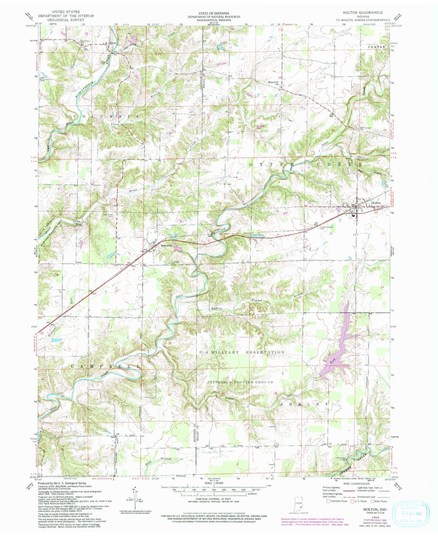
Classic USGS Holton Indiana 7.5'x7.5' Topo Map
Couldn't load pickup availability
Historical USGS topographic quad map of Holton in the state of Indiana. Map scale may vary for some years, but is generally around 1:24,000. Print size is approximately 24" x 27"
This quadrangle is in the following counties: Jennings, Ripley.
The map contains contour lines, roads, rivers, towns, and lakes. Printed on high-quality waterproof paper with UV fade-resistant inks, and shipped rolled.
Contains the following named places: Bear Branch, Brush Creek State Fish and Wildlife Area, Falling Timber Branch, Finch Branch, Holton, Holton Elementary School, Holton Police Department, Holton Post Office, Holton West Cemetery, Hopewell Church, Jackson, Leatherwood Creek, Leatherwood Lake Dam, Little Otter Creek, Little Otter Fork, Nebraska, Old Hopewell Cemetery, Old Timber Lake, Old Timber Lake Dam, Old Timbers Lodge, Otter Creek Cemetery, Otter Creek Township Volunteer Fire Department, Saint Bridget Cemetery, Sugar Creek, Town of Holton, Township of Columbia, Township of Otter Creek, West Zenas Cemetery, Zenas, Zenas Cemetery, Zenas Elementary School, ZIP Codes: 47023, 47223