MyTopo
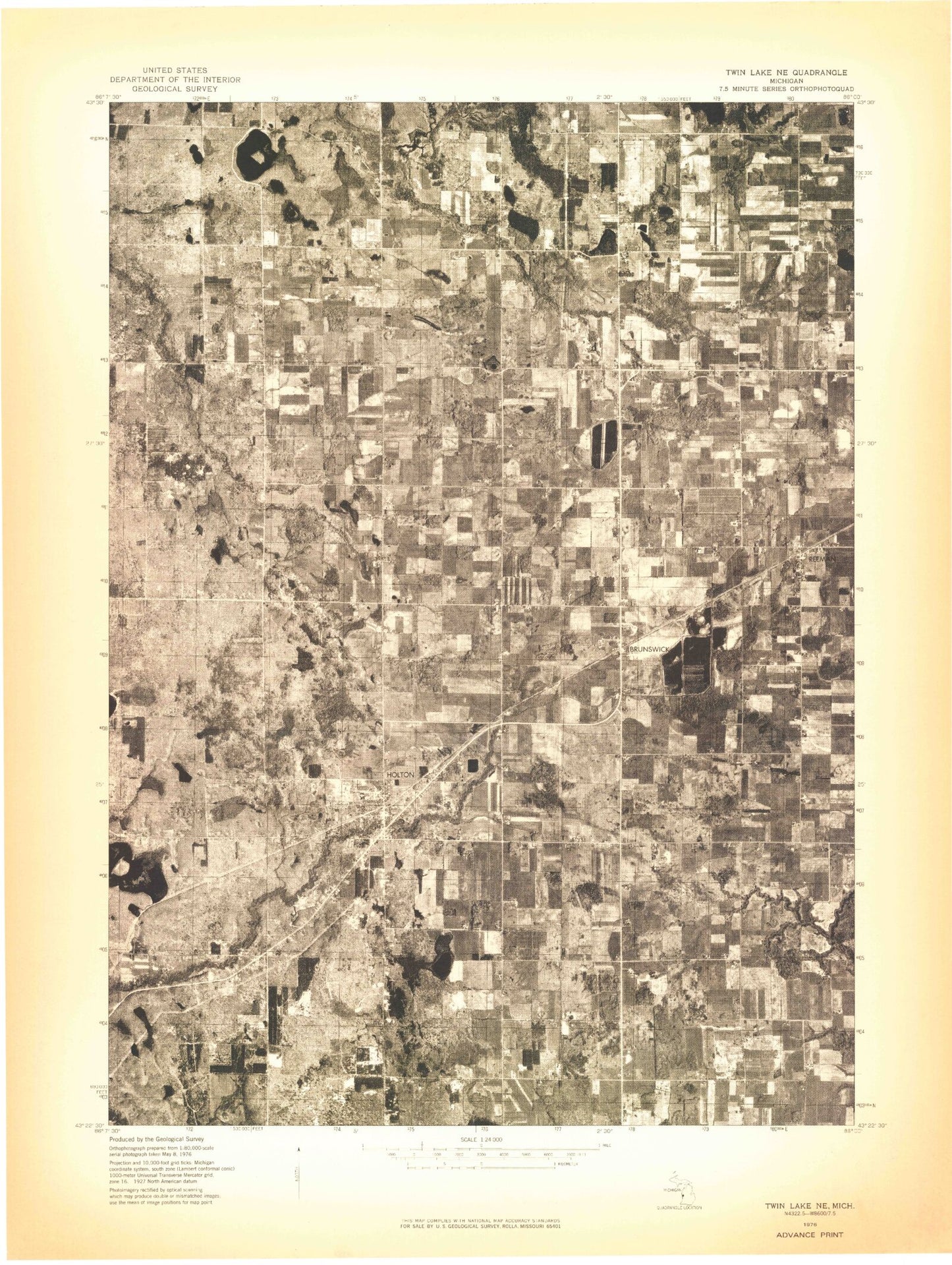
Classic USGS Holton Michigan 7.5'x7.5' Topo Map
Couldn't load pickup availability
Historical USGS topographic quad map of Holton in the state of Michigan. Map scale may vary for some years, but is generally around 1:24,000. Print size is approximately 24" x 27"
This quadrangle is in the following counties: Muskegon, Newaygo, Oceana.
The map contains contour lines, roads, rivers, towns, and lakes. Printed on high-quality waterproof paper with UV fade-resistant inks, and shipped rolled.
Contains the following named places: Acker Lake, Bowman Drain, Brayden Creek, Brunswick, Brunswick Post Office, Brunswick School, Bunce School, Clark Cemetery, Cornerstone Free Methodist Church, Dobie Drain, Dragoo Creek, Evans Lake, Evens Cemetery, Folsom Drain, Forest City Post Office, Hazel Grove Post Office, Hazel Grove School, Hoffman Drain, Holton, Holton Cemetery, Holton Elementary School, Holton Family Life Worship Center, Holton High School, Holton Lutheran Church, Holton Middle School, Holton Post Office, Holton Station, Holton Township Fire Department, Holton United Methodist Church, Horseshoe Lake, John Beem Drain, Kempf School, Knowles Lake, Little Martin Lake, Markle Drain, Martin Drain, McCallum School, Nelson Drain, Olson Lake, Olson School, Poll Drain, Reeman, Reeman Christian Reformed Church, Reeman Post Office, Reeman Station, Robinson Drain, Ruper Drain, Saint Michael Church of Brunswick, Saint Michael School, Saint Michaels Cemetery, Saint Michaels School, Sitka, Sitka Post Office, Township of Holton, Tyndall School, Unger Lake, Wilde Cemetery, ZIP Code: 49425