MyTopo
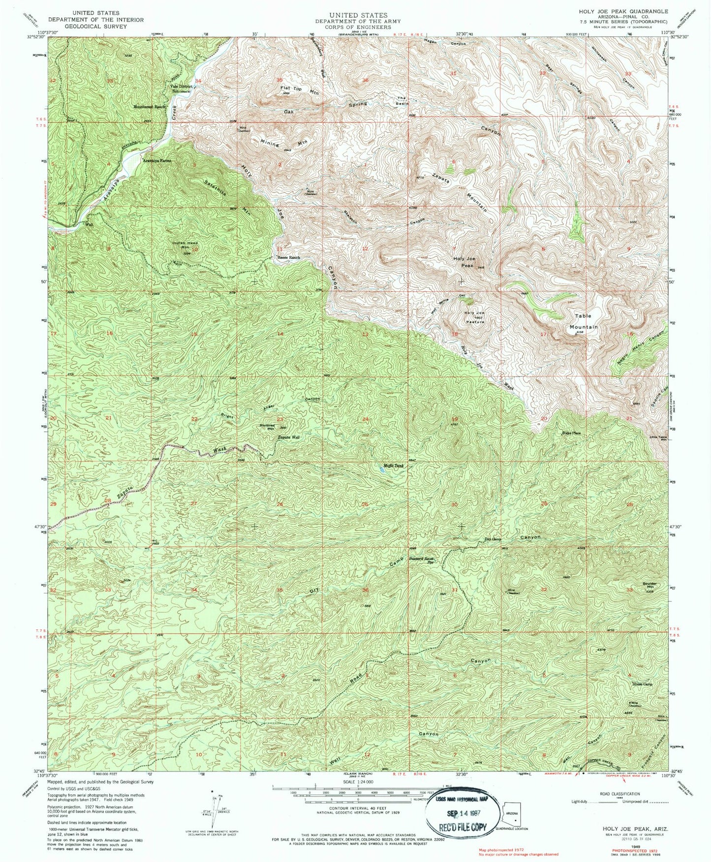
Classic USGS Holy Joe Peak Arizona 7.5'x7.5' Topo Map
Couldn't load pickup availability
Historical USGS topographic quad map of Holy Joe Peak in the state of Arizona. Map scale may vary for some years, but is generally around 1:24,000. Print size is approximately 24" x 27"
This quadrangle is in the following counties: Pinal.
The map contains contour lines, roads, rivers, towns, and lakes. Printed on high-quality waterproof paper with UV fade-resistant inks, and shipped rolled.
Contains the following named places: Aravaipa Farms, Blake Place, Boulder Mountain, Bright Angel Canyon, Buzzard Roost Spring, Dry Camp, Dry Camp Canyon, Flat Top Mountain, Holy Joe Canyon, Holy Joe Pasture, Holy Joe Peak, Holy Joe Wash, Horse Camp, Indian Head Mountain, KCDX-FM (Kearny), Martinez Mountain, Mining Mountain, Moffit Tank, Mounterest Ranch, Mud Spring Canyon, Oak Spring Canyon, Prospect Canyon, Reese Ranch, Road Canyon, Satathite Mountain, Skeleton Canyon, Table Mountain, The Basin, Vale District School, Well Canyon, Zapata Mountain, Zapata Well