MyTopo
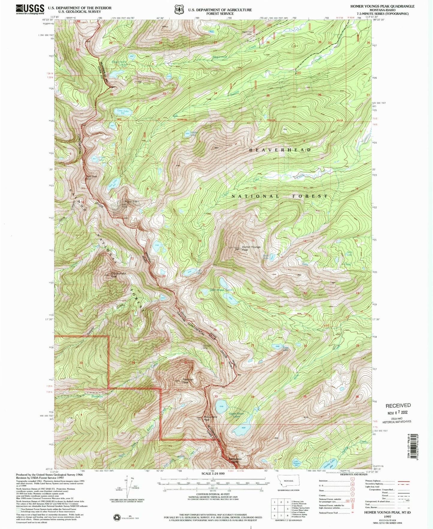
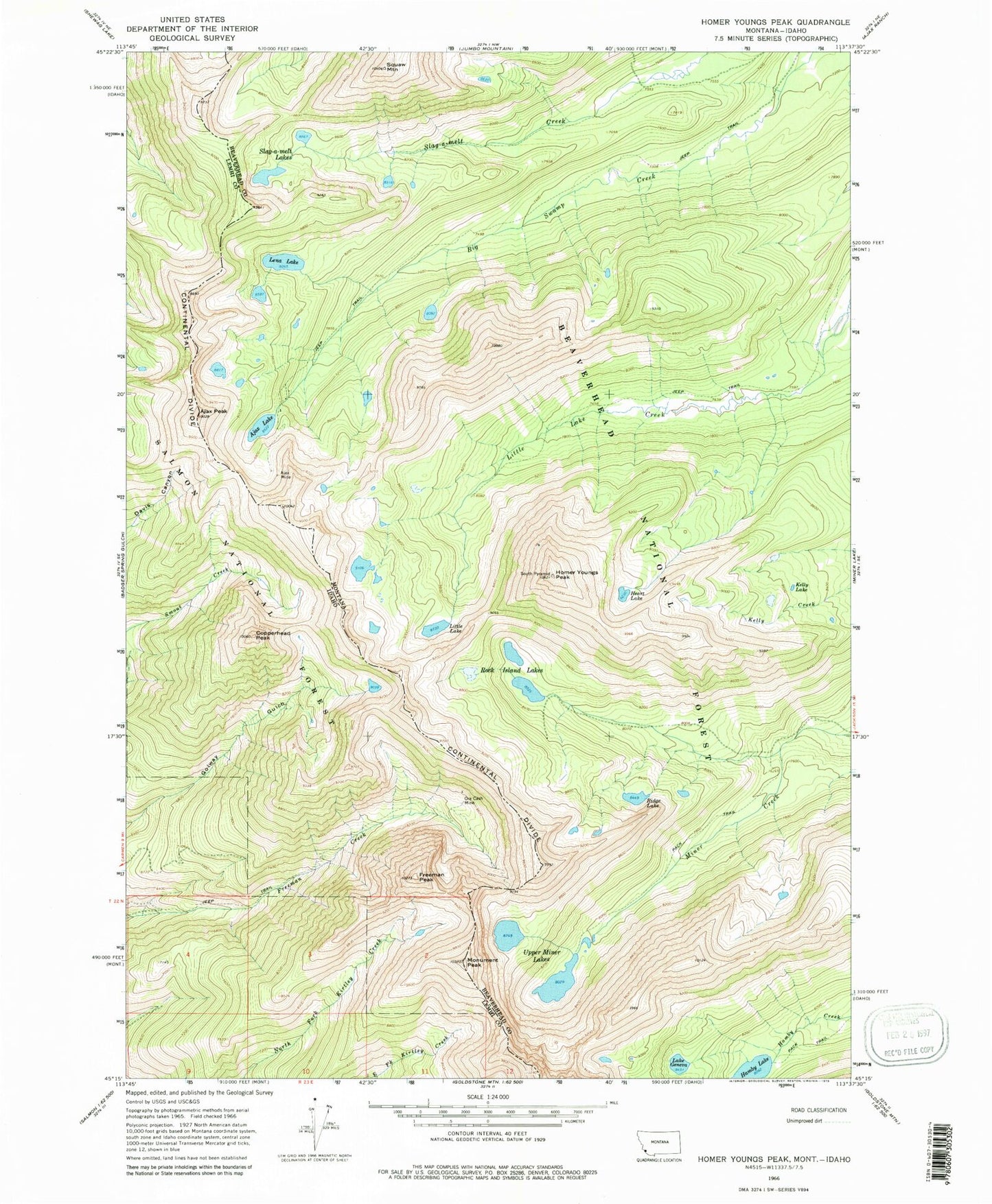
Classic USGS Homer Youngs Peak Montana 7.5'x7.5' Topo Map
Couldn't load pickup availability
Historical USGS topographic quad map of Homer Youngs Peak in the states of Montana, Idaho. Typical map scale is 1:24,000, but may vary for certain years, if available. Print size: 24" x 27"
This quadrangle is in the following counties: Beaverhead, Lemhi.
The map contains contour lines, roads, rivers, towns, and lakes. Printed on high-quality waterproof paper with UV fade-resistant inks, and shipped rolled.
Contains the following named places: Monument Peak, Ridge Lake, Ajax Lake, Ajax Mine, Lake Geneva, Hamby Lake, Heart Lake, Homer Youngs Peak, Kelly Lake, Lena Lake, Little Lake, Rock Island Lakes, Slag-a-melt Lakes, Hirschy Mountain, Upper Miner Lakes, Albino Lake, Hidden Lake, Ajax Mill, Slag-a-Melt Mine, Jackson/Miner Creek Mine, Slag-A-Melt Mine, Sacajawea Peaks, Copperhead Peak, Freeman Peak, Ore Cash Mine, Ajax Peak