
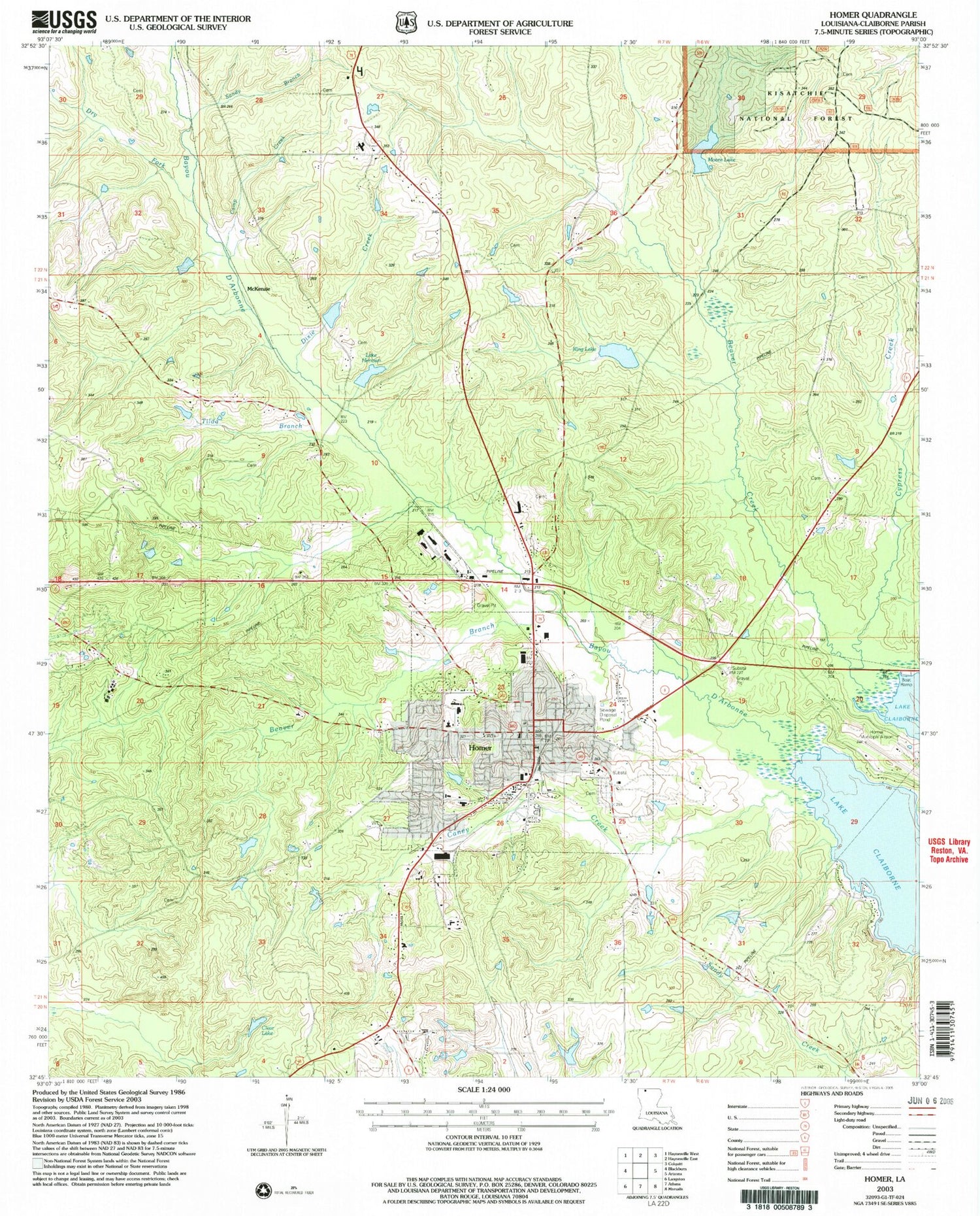
MyTopo
Classic USGS Homer Louisiana 7.5'x7.5' Topo Map
Couldn't load pickup availability
Historical USGS topographic quad map of Homer in the state of Louisiana. Map scale may vary for some years, but is generally around 1:24,000. Print size is approximately 24" x 27"
This quadrangle is in the following counties: Claiborne.
The map contains contour lines, roads, rivers, towns, and lakes. Printed on high-quality waterproof paper with UV fade-resistant inks, and shipped rolled.
Contains the following named places: Arlington Cemetery, Beaver Branch, Camp Creek, Caney Creek, Caney Ranger District Office, Claiborne Academy, Claiborne Alternative School, Claiborne Memorial Medical Center, Claiborne Parish Office of Family Support, Claiborne Parish Sheriff's Office, Clear Lake, Cypress Creek, Dixie Creek, Dry Fork, Homer, Homer Cemetery, Homer Elementary School, Homer High School, Homer Historic District, Homer Junior High School, Homer Municipal Airport, Homer Police Department, Homer Post Office, Homer Volunteer Fire Department, Homer Work Center, Kendrick Cemetery, King Lake, King Lake Dam, Lake Herman, Lake Herman Dam, Love Chapel, McKenzie, McKenzie Cemetery, Merritt Cemetery, Moore Lake, Moore Lake Dam, Mount Zion Cemetery, North Homer Gas Field, North Homer Oil Field, North Louisiana Experimental Station, North Louisiana Hill Farm Experiment Station, Northeast Homer Oil Field, Parish Governing Authority District 7, Rising Star Cemetery, Rising Star Church, Rising Star School, Sandy Branch, Sharon Cemetery, Sharon Church, Tilda Branch, Tinsley Cemetery, Town of Homer, Union / Meadows Cemetery, Union Grove Church, Walnut Grove Church, Ward Seven, White Oak Grove School, ZIP Code: 71040


