MyTopo
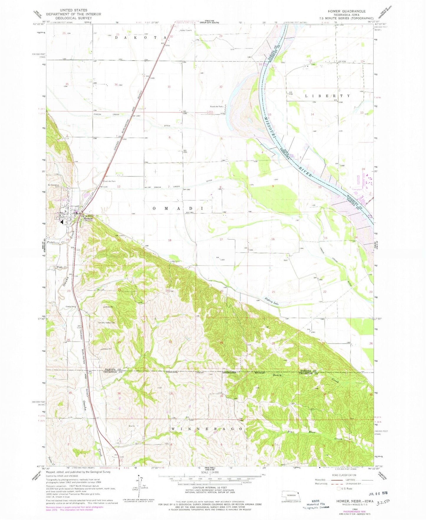
Classic USGS Homer Nebraska 7.5'x7.5' Topo Map
Couldn't load pickup availability
Historical USGS topographic quad map of Homer in the states of Nebraska, Iowa. Map scale may vary for some years, but is generally around 1:24,000. Print size is approximately 24" x 27"
This quadrangle is in the following counties: Dakota, Thurston, Woodbury.
The map contains contour lines, roads, rivers, towns, and lakes. Printed on high-quality waterproof paper with UV fade-resistant inks, and shipped rolled.
Contains the following named places: Blyburg Lake, Combs School, Fiddlers Creek, Homer, Homer Community Schools, Homer Post Office, Homer Volunteer Fire and Rescue, Mile Long Island Wildlife Management Area, O'Connor House Museum Complex, Omadi Election Precinct, Omaha Creek, Omaha Creek Ditch, Omaha Valley Cemetery, Overfelt Dam, Overfelt Reservoir, Pigeon Creek, Pigeon Creek Ditch, Saint Cornelius Catholic Church, Saint Cornelius Cemetery, Saint Pauls Lutheran Church, Tonwantonga Historical Marker, Township of Dakota, Township of Omadi, Village of Homer, Wigle Creek, ZIP Code: 68030