MyTopo
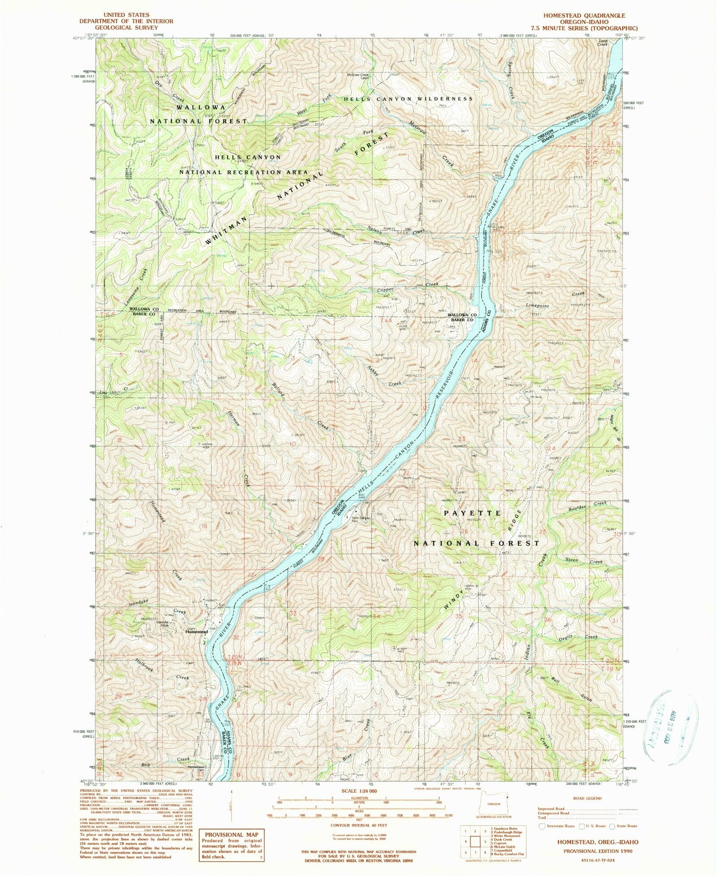
Classic USGS Homestead Oregon 7.5'x7.5' Topo Map
Couldn't load pickup availability
Historical USGS topographic quad map of Homestead in the states of Oregon, Idaho. Map scale may vary for some years, but is generally around 1:24,000. Print size is approximately 24" x 27"
This quadrangle is in the following counties: Adams, Baker, Wallowa.
The map contains contour lines, roads, rivers, towns, and lakes. Printed on high-quality waterproof paper with UV fade-resistant inks, and shipped rolled.
Contains the following named places: Ashby Creek, Ballard Creek, Ballard Landing, Bob Creek, Boulder Creek, Bull Gulch, Cattle Rapids, Copper Creek, Copperfield - Homestead Cemetery, Degits Creek, Eckels Creek, Elk Creek, Hale Creek, Hells Canyon Park, Hells Canyon Reservoir, Herman Creek, Hibble Gulch, Holbrook Creek, Homestead, Homestead Creek, Homestead Post Office, Irondyke Creek, Irondyke Mine, Kerrs Rapids, Landing Post Office, Leep Creek, Limepoint Creek, McDougal Creek, McGraw Creek, McGraw Creek Cabin, Negro Bill Gulch, Nelson Creek, Oxbow Airport, Radium, South Fork McGraw Creek, Spring Creek, Steen Creek, West Fork McGraw Creek, Windy Ridge