
MyTopo
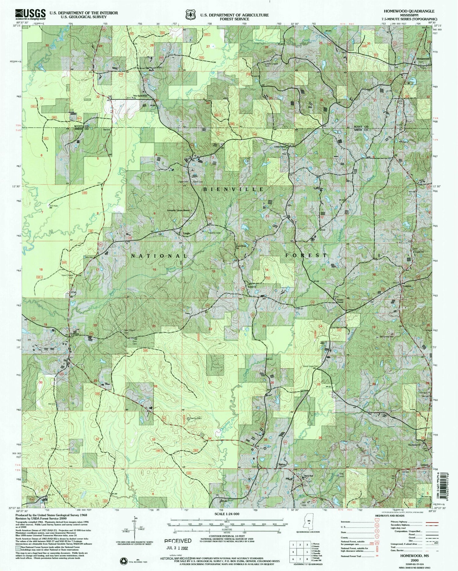
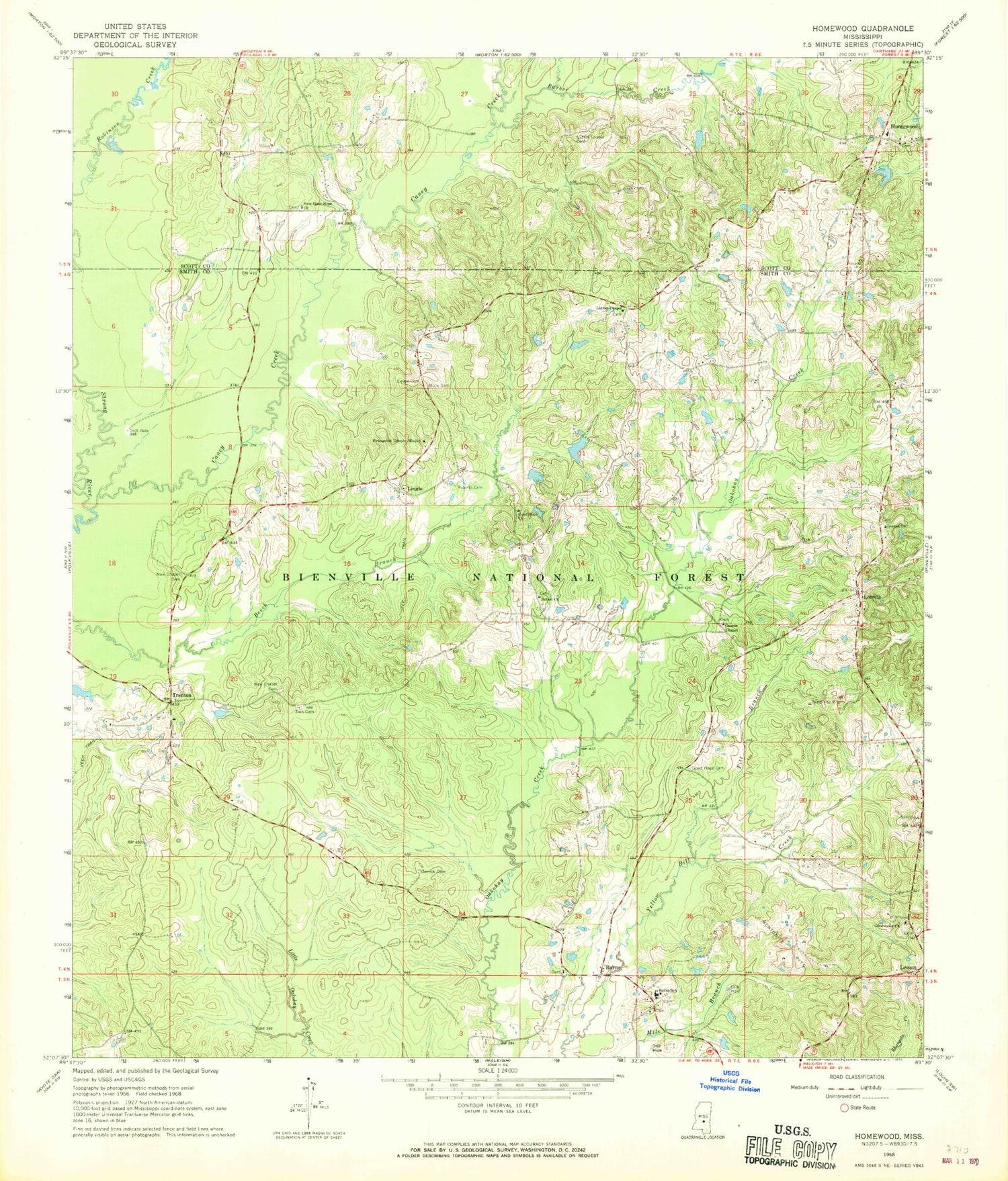
Classic USGS Homewood Mississippi 7.5'x7.5' Topo Map
Couldn't load pickup availability
Historical USGS topographic quad map of Homewood in the state of Mississippi. Map scale may vary for some years, but is generally around 1:24,000. Print size is approximately 24" x 27"
This quadrangle is in the following counties: Scott, Smith.
The map contains contour lines, roads, rivers, towns, and lakes. Printed on high-quality waterproof paper with UV fade-resistant inks, and shipped rolled.
Contains the following named places: Barber Cemetery, Barber Creek, Bethel Baptist Church Cemetery, Bethel Church, Black Cemetery, Burns, Burns Baptist Cemetery, Burns Methodist Cemetery, Burns Pit, Burns School, Caney Creek, Derrick Cemetery, E Y Mangum Lake Dam, Ellen Tadlock Pond Dam, Evangelist Temple Mission, Gasque Chapel, Gasque Chapel Cemetery, Good Hope Cemetery, Good Hope Church, Goodwater Baptist Church Cemetery, Goodwater Church, Homewood, Homewood Volunteer Fire Department, Lemon, Lingle, Lingle Cemetery, Lorena, Lorena Baptist Church Cemetery, Lorena Baptist Church Extension Cemetery, Lorena Church, Luther Chapel, Luther Chapel Cemetery, Luther Chapel Lutheran Church Cemetery, New Chapel Cemetery, New Good Hope Cemetery, New Good Hope Church, Pitt Branch, Providence Cemetery, Roberts Cemetery, Spinola School, Trenton, Wallace Epting Lake Dam, Wicker, Zion Lutheran Cemetery, ZIP Code: 39152


