MyTopo
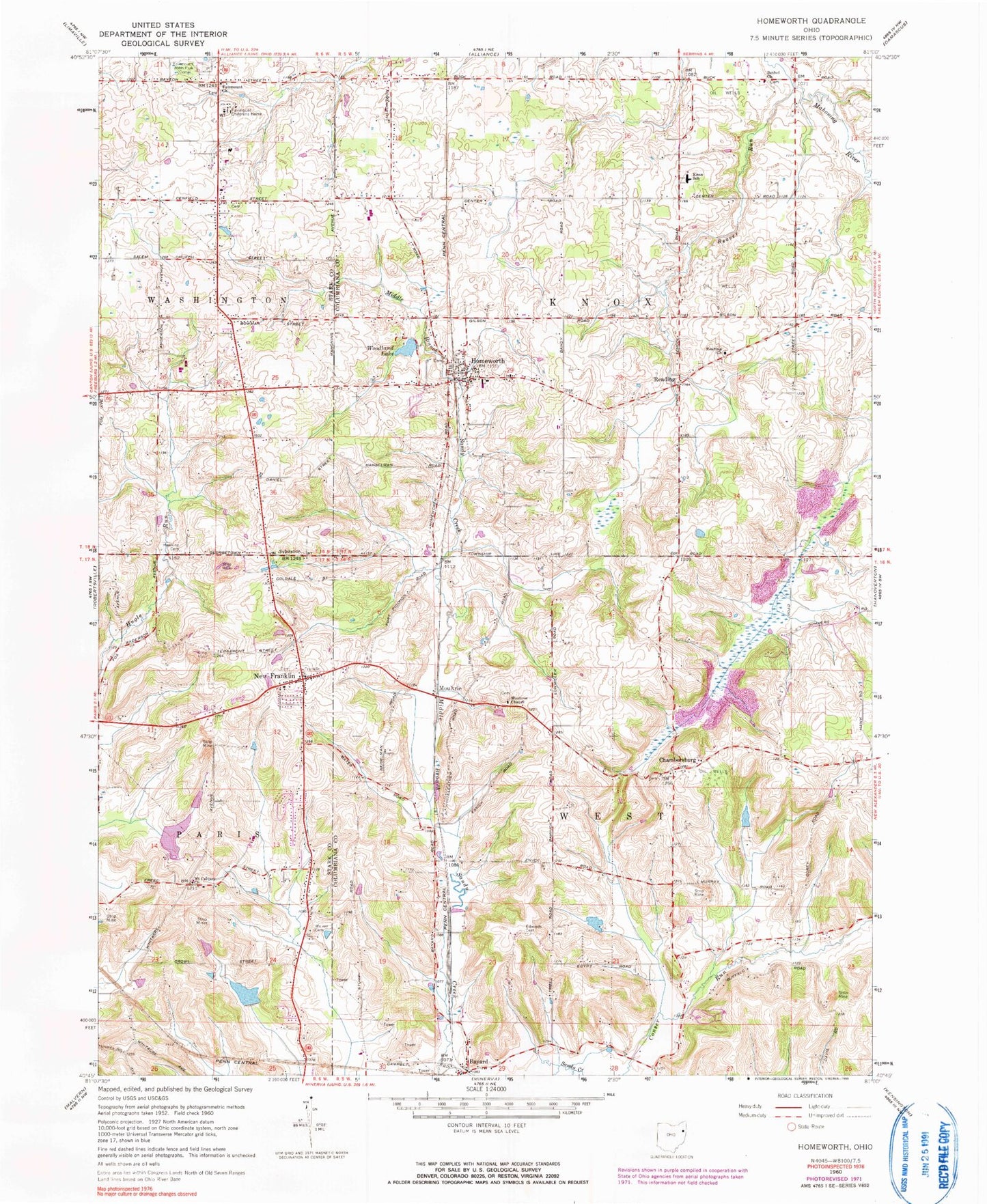
Classic USGS Homeworth Ohio 7.5'x7.5' Topo Map
Couldn't load pickup availability
Historical USGS topographic quad map of Homeworth in the state of Ohio. Map scale may vary for some years, but is generally around 1:24,000. Print size is approximately 24" x 27"
This quadrangle is in the following counties: Columbiana, Stark.
The map contains contour lines, roads, rivers, towns, and lakes. Printed on high-quality waterproof paper with UV fade-resistant inks, and shipped rolled.
Contains the following named places: Baker School, Bayard, Bayard Post Office, Beaver Lake, Beaver Run, Bethel Cemetery, Bethel Church, Brocklehurst Lake, Brocklehurst Lake Dam, Buckeye Lawn Farm, Bulick Field, Chambersburg, Chambersburg Cemetery, Crosswind Meadows Airport, Edwards Cemetery, Fairmount Childrens Home, Fairmount Children's Home Cemetery, Fairmount Church, Fairmount Grange Cemetery, Hawkins Cemetery, Homeworth, Homeworth Census Designated Place, Homeworth Post Office, Homeworth Volunteer Fire Department, Knox Elementary School, Middle Branch Sandy Creek, Middle Sandy United Presbyterian Church, Moultrie, Moultrie Chapel, Moultrie Chapel Cemetery, Mount Calvary Church, New Franklin, New Franklin Cemetery, New Franklin Methodist Church, New Franklin Post Office, New Franklin School, Pinch School, Prospect Hill School, Reading, Reading Cemetery, Reading Church, Saint Johns Evangelical Lutheran Church, Sleepy Hollow Airport, Township of Knox, Township of West, Vandergrift Lake, Vandergrift Lake Dam, Walker Cemetery, WDJQ-FM (Alliance), Woodland Lake, Woodland Lake Dam, Yeagleys Corners, ZIP Codes: 44625, 44634