MyTopo
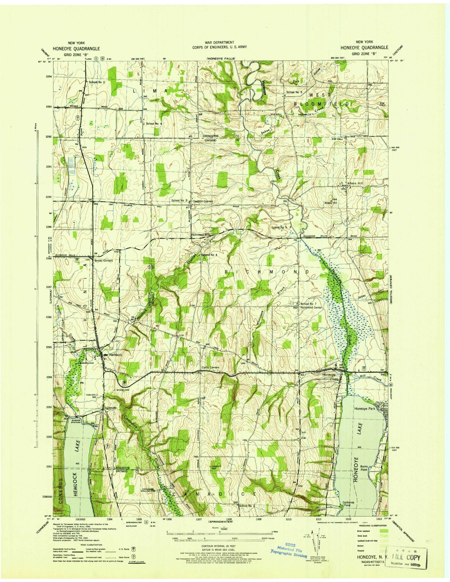
Classic USGS Honeoye New York 7.5'x7.5' Topo Map
Couldn't load pickup availability
Historical USGS topographic quad map of Honeoye in the state of New York. Map scale may vary for some years, but is generally around 1:24,000. Print size is approximately 24" x 27"
This quadrangle is in the following counties: Livingston, Ontario.
The map contains contour lines, roads, rivers, towns, and lakes. Printed on high-quality waterproof paper with UV fade-resistant inks, and shipped rolled.
Contains the following named places: Abbey Gulf, Affolter Gully, Allens Hill, Allens Hill Cemetery, Allens Hill Free Library, Bebee Creek, Bosley Corner, Bray Gully, Burns Point, California Point, Canadice Hollow Cemetery, Canadice Outlet, Central School, Coye Field, Curtis Corner, Denison Corner, Dennison Corners Cemetery, Elderberry Mobile Home Park, Frost Hollow, Glenville, Hemlock, Hemlock Baptist Church, Hemlock Cemetery, Hemlock Census Designated Place, Hemlock Fire Department, Hemlock High School, Hemlock Lake Park, Hemlock Outlet, Hemlock Post Office, Hemlock United Methodist Church, Hemlock Water Filtration Plant, Honeoye, Honeoye Census Designated Place, Honeoye Lake, Honeoye Lake County Wastewater Treatment Plant, Honeoye Mobile Home Park, Honeoye Park, Honeoye Post Office, Honeoye Public Library, Idaho, Jacksonville, Kinney Creek, Lakeview Cemetery, Lima Golf and Country Club, Mill Creek, Old Fort Farm Airport, Purcell Cemetery, Richmond Center, Richmond Center Cemetery, Richmond Mills, Richmond Volunteer Fire Department, Saint Marys Cemetery, School Number 2, School Number 3, School Number 4, School Number 5, School Number 7, Short Cemetery, Town of Richmond, Whetstone Brook, Wynn Farms, ZIP Code: 14466