MyTopo
Classic USGS Honey Creek Tennessee 7.5'x7.5' Topo Map
Couldn't load pickup availability
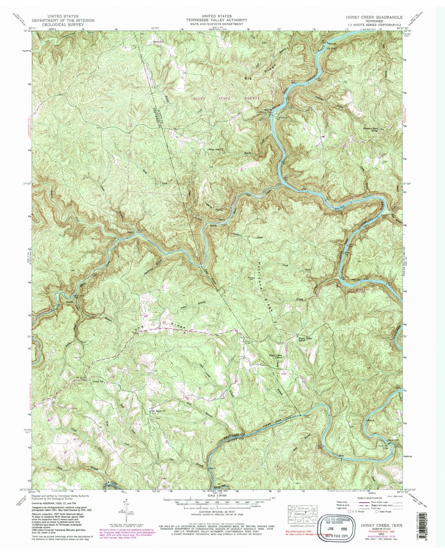
Historical USGS topographic quad map of Honey Creek in the state of Tennessee. Map scale may vary for some years, but is generally around 1:24,000. Print size is approximately 24" x 27"
This quadrangle is in the following counties: Fentress, Morgan, Scott.
The map contains contour lines, roads, rivers, towns, and lakes. Printed on high-quality waterproof paper with UV fade-resistant inks, and shipped rolled.
Contains the following named places: Anderson Branch, Bandy Creek, Bandy Creek Campground, Bear Branch, Big Ridge, Black Creek, Blevins Cemetery, Burnt Mill Bridge, Camp Branch, Caney Branch, Coyle Branch, Daughertys Mill, Deadening Branch, Double Falls, East Fork Joe Branch, Fall Branch, Fentress County Volunteer Fire Department Station 12 Honey Creek / Mount Helen, First Drop Rapids, Gernt, Goad, Goad School, Groom Branch, Groom Ridge, Gum Branch, Honey Creek, Honey Creek Church, Honey Creek Overlook, Honey Creek Pocket Wilderness Area, Honey Creek School, Hurricane Ridge, Jacks Branch, Jakes Hole, Joe Branch, Laurel Fork, Leatherwood Ford, Logging Hollow, Long Ridge, Mount Helen, Mount Helen Cemetery, Mount Helen Church, North Fork Fall Branch, North Fork Honey Creek, North Fork Rock Branch, North White Oak Creek, O and W Rapids, Opossum Rock Baptist Church, Opossum Rock School, Panther Branch, Panther Creek, Pine Creek, Potter Branch, Reed Branch, Rions Eddy, Rock Branch, Scott State Forest, Sebands Branch, Skull Creek, South Fork Camp Branch, Speck, Still Camp Branch, Sun Branch, The Ell, The Falls, The Narrows, Wagon Ford Branch, Washing Machine Rapids, West Fork Coyle Branch, West Fork Joe Branch, White Oak Creek, White Pine Church, Wolf Branch, Zenith, ZIP Code: 38504