MyTopo
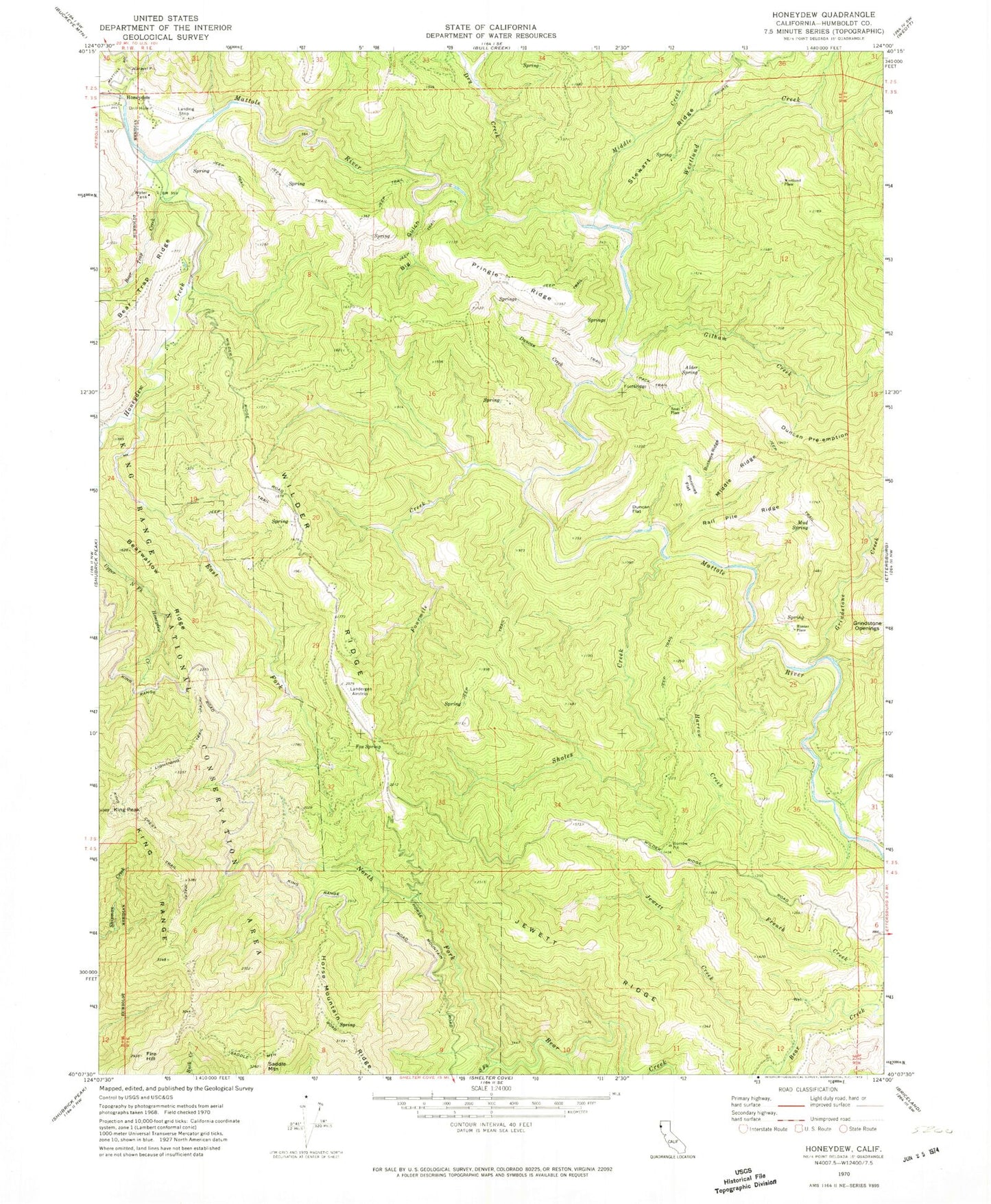
Classic USGS Honeydew California 7.5'x7.5' Topo Map
Couldn't load pickup availability
Historical USGS topographic quad map of Honeydew in the state of California. Map scale may vary for some years, but is generally around 1:24,000. Print size is approximately 24" x 27"
This quadrangle is in the following counties: Humboldt.
The map contains contour lines, roads, rivers, towns, and lakes. Printed on high-quality waterproof paper with UV fade-resistant inks, and shipped rolled.
Contains the following named places: Alder Spring, Bear Trap Creek, Bearwallow Ridge, Big Gulch, Buckeye Ridge, Dry Creek, Duncan Creek, Duncan Flat, Duncan Pre-emption, East Fork Honeydew Creek, Fire Hill, Fourmile Creek, Fox Spring, Gilham Creek, Grindstone Creek, Grindstone Openings, Harrow Creek, Honeydew, Honeydew Creek, Honeydew Pit, Honeydew Post Office, Honeydew Volunteer Fire Company Trower Station, Hunter Place, Jewett Creek, Jewett Ridge, King Peak, Lightning Trail, Mattole Canyon, Middle Creek, Middle Ridge, Mud Spring, North Fork Bear Creek, Phronies Flat, Pringle Ridge, Rail Pile Ridge, Saddle Mountain, Scott Place, Sholes Creek, South Fork Bear Creek, Stewart Ridge, Westlund Creek, Westlund Place, Wilder Ridge