
MyTopo
Classic USGS Honobia Oklahoma 7.5'x7.5' Topo Map
Couldn't load pickup availability
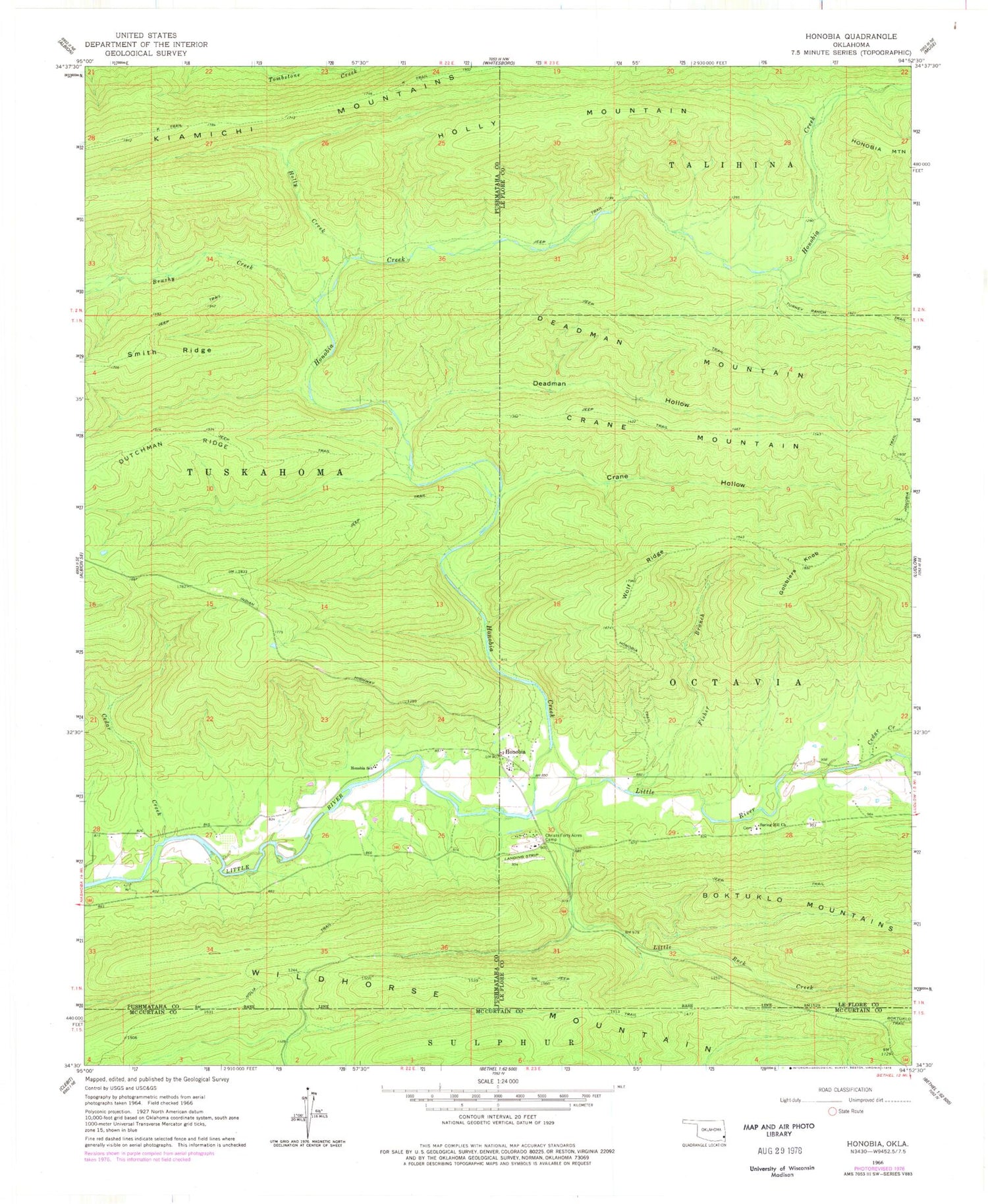
Historical USGS topographic quad map of Honobia in the state of Oklahoma. Map scale may vary for some years, but is generally around 1:24,000. Print size is approximately 24" x 27"
This quadrangle is in the following counties: Le Flore, McCurtain, Pushmataha.
The map contains contour lines, roads, rivers, towns, and lakes. Printed on high-quality waterproof paper with UV fade-resistant inks, and shipped rolled.
Contains the following named places: Brushy Creek, Cedar Creek, Christs Forty Acres Camp, Crane Hollow, Crane Mountain, Deadman Hollow, Dutchman Ridge, Fisher Branch, Gobblers Knob, Holly Creek, Holly Mountain, Honobia, Honobia Creek, Honobia School, Honobia Volunteer Fire Department, Kiamichi Mountains, Little Rock Creek, Rock Creek, Rock Creek Cemetery, Smith Ridge, Spring Hill Church, Springhill Cemetery, Turney Ranch Trail, Wolf Ridge, ZIP Code: 74549


