MyTopo
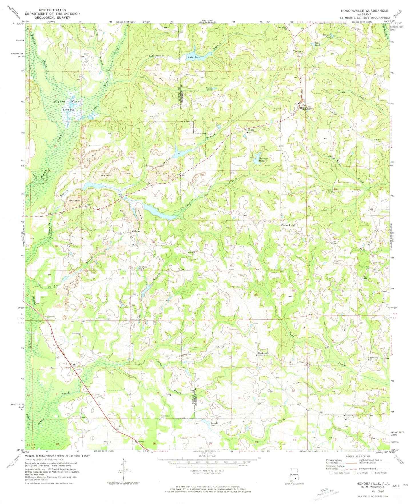
Classic USGS Honoraville Alabama 7.5'x7.5' Topo Map
Couldn't load pickup availability
Historical USGS topographic quad map of Honoraville in the state of Alabama. Map scale may vary for some years, but is generally around 1:24,000. Print size is approximately 24" x 27"
This quadrangle is in the following counties: Butler, Crenshaw.
The map contains contour lines, roads, rivers, towns, and lakes. Printed on high-quality waterproof paper with UV fade-resistant inks, and shipped rolled.
Contains the following named places: B C Massey Dam, Bethlehem Church, Bible Church, Black Rock, Black Rock Cemetery, Black Rock Primitive Baptist Church, Camp Creek, Center Ridge, Center Ridge School, Chapel Hill Church, Chapel Hill School, Chapel Hill Volunteer Fire Department, Church of Christ, County Line Church, Cumbies Pond, Damascus Baptist Church, Damascus Cemetery, Damascus Volunteer Fire Department, El Bethel Church, Fayette Branch, Friendship Church, Gravel Hill Church, Graydon Branch, Holy Tabernacle Church, Honoraville, Honoraville Church, Honoraville Junior High School, Honoraville Post Office, Honoraville Volunteer Fire Department, Kellys Store, L E Skipper Pond, L E Skipper Pond Dam, Lake Jane, Little Branch, Masseys Pond, Midway, Midway Church, Mount Zion Church, Oak Grove Church, R Killough Dam, Rattlesnake Branch, Rock Hill Church, Ropers Pond, Russells Pond, Sims Pond, Skipper Mill Branch, Three Run Creek, Tuckers Pond, Whiddon Farms, ZIP Code: 36042