MyTopo
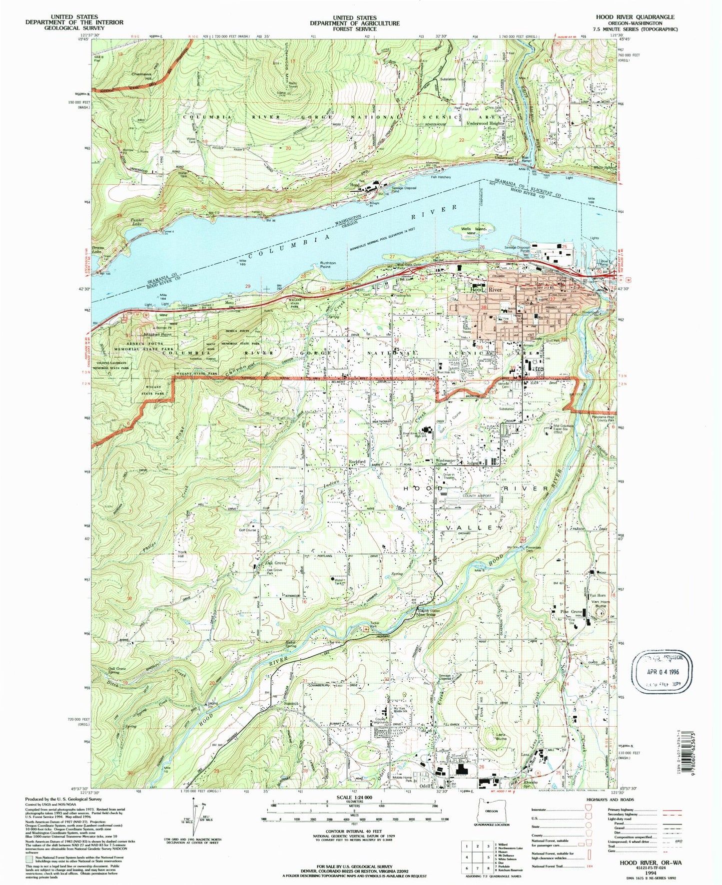
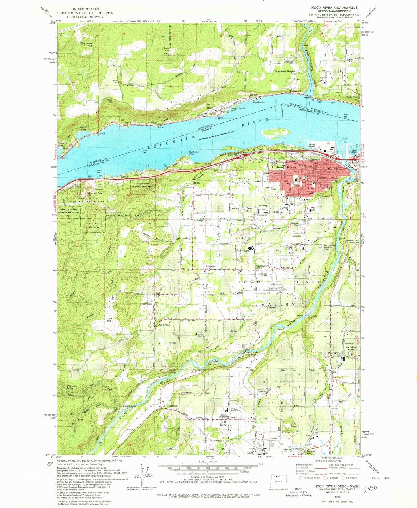
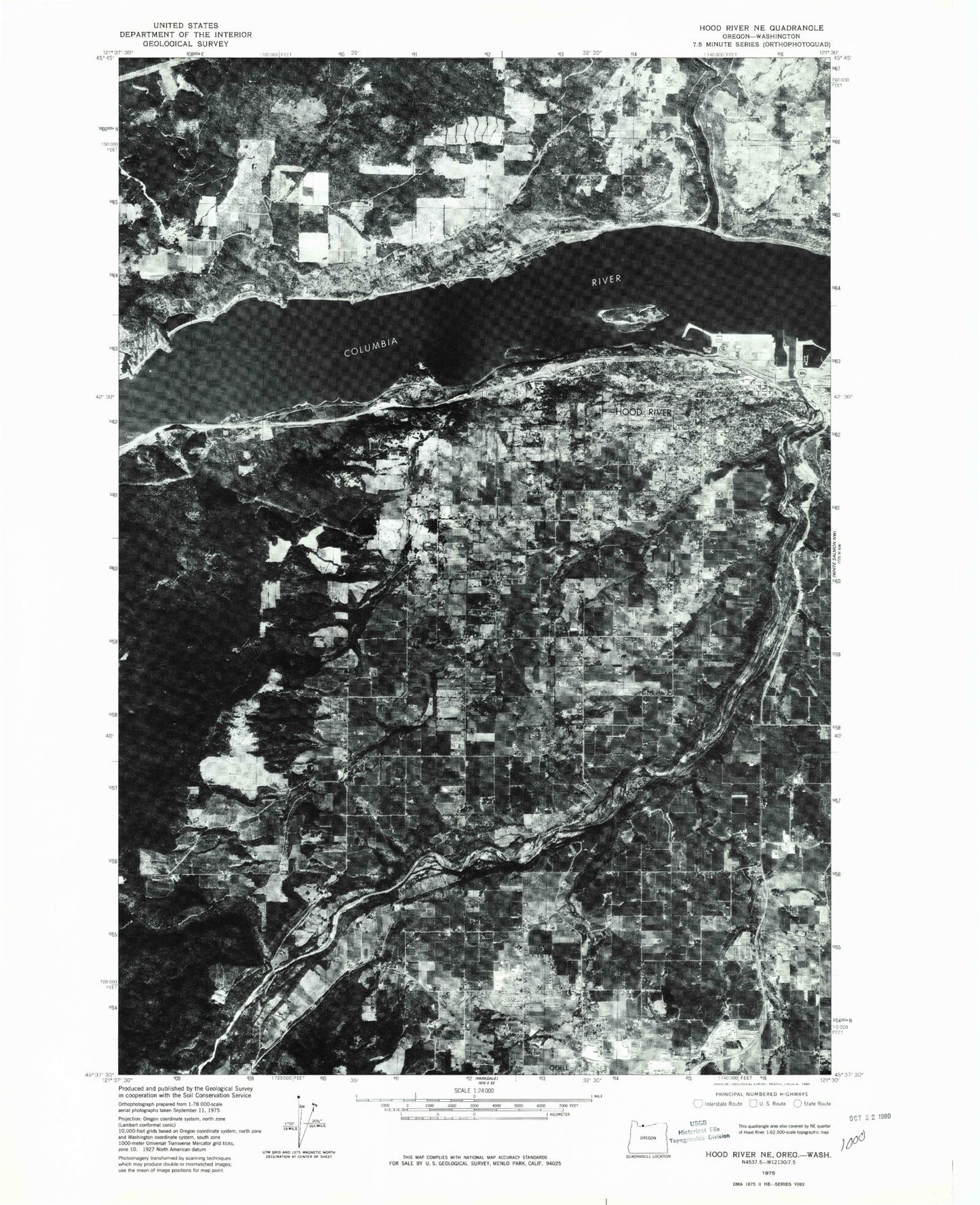
Classic USGS Hood River Oregon 7.5'x7.5' Topo Map
Couldn't load pickup availability
Historical USGS topographic quad map of Hood River in the states of Oregon, Washington. Typical map scale is 1:24,000, but may vary for certain years, if available. Print size: 24" x 27"
This quadrangle is in the following counties: Hood River, Klickitat, Skamania.
The map contains contour lines, roads, rivers, towns, and lakes. Printed on high-quality waterproof paper with UV fade-resistant inks, and shipped rolled.
Contains the following named places: Mitchell Point, Oak Grove, Post Canyon, Seneca Fouts Memorial State Natural Area, Summit, Tucker Bridge, Whiskey Creek, Pine Grove, Alder Brook, Saint Mary's Cemetery, Conway (historical), Duckwall Reservoir, Ferguson Creek, Frankton Cemetery, McGuire Spring, Smith Spring, Shelly Creek, Rhoades Creek, Power Canal, KCGB-FM, KIHR-AM, Green Acres Air Park, Ken Jernstedt Airfield, United Telephone System Airstrip (historical), Hakel Spring, Idlewilde Cemetery, May Street Elementary School, Hood River, Lenz, Rockford, Van Horn, Shelley Creek, Ditch Creek, Farmers Ditch, Hood River, Hood River Valley, Indian Creek, Neal Creek, Odell, Odell Creek, Phelps Creek, Flume Creek, Frankton School (historical), Mountain View Memorial Cemetery, Van Horn Butte, Panorama Point County Park, Hood River Valley High School, Wah Gwin Gwin Falls, Pine Grove Butte Cemetery, Powerdale Dam, Cedar Creek, Mid Columbia Agricultural Experiment Station, Windmaster Corner, Eliot Park, Jackson Park, Ruthton Point, Buehler Pond, Spring Creek, Waucoma Park, Bloucher (historical), Clifton, Sonny (historical), Powerdale (historical), Ruthton (historical), Lake Bonneville, Lenz Creek, Hood River Middle School, Wells Island, Henderson Creek, Menominee Post Office (historical), Hood River Post Office, Odell Post Office, Tucker Post Office (historical), Coe Park, Mann Park, Wilson Park, Providence Hood River Memorial Hospital, Port of Hood River Marina Park, Morrison Park, Ruthton Cove, Meno, Westside Elementary School, Waucoma Basin Marina, Winans Park, Ruthton County Park, Hood River Golf Course, Switchback, Sears (historical), Mohr (historical), Dukes Valley (historical), Davidson Hill, Ehrck Hill, Lenz Butte, Rhoades Spring, Hood River Division, Cushman's Pasture Cemetery, Saint Mark the Evangelist Church Columbarium, Frankton, Oak Grove County Park, Tucker County Park, Odell Census Designated Place, City of Hood River, Mid - Columbia Adventist Christian School, Wyeast Middle School, Hood River Alliance Church, Immanuel Lutheran Church, Tucker Road Baptist Church, First Baptist Church, Pine Grove-Odell United Methodist Church, Horizon Christian School, Odell Rural Fire Protection District, Hood River Fire and Emergency Medical Services, Pine Grove Rural Fire Protection District, Westside Rural Fire Protection District Station 2, Westside Rural Fire Protection District Station 1, Rasmussen Farms, Odell Sanitary District, Hood River Waste Water Treatment, Hood River Public Works Department, Columbia Area Transit Office Dispatch and Garage, Columbia Center for the Arts, Hood River City Hall, Hood River County Fairgrounds, Hood River County Library, Hood River County Public Works Department, Hood River Fire Department Heliport, Hood River Municipal Court, Hood River Public Health Department, Hood River Waterfront Park Amphitheatre, The History Museum of Hood River County, Western Antique Aeroplane and Automobile Museum, Port of Hood River Boat Ramp, Port of Hood River Marina Park, Hood River County Sheriff's Office, Hood River City Police Department, Hood River County Cemetery, Hood, Hood View Tracts, Chemawa Hill, Underwood, Underwood Heights, Ericson View Tracts, Underwood Mountain, White Salmon River, Underwood Treaty Fishing Access Site, Tunnel No. 1, Tunnel No. 2, Tunnel No. 3, Tunnel No. 4, Tunnel No. 5, Skamania County Fire District 3 Underwood, Spring Creek National Fish Hatchery, Underwood Post Office, Mitchell Point, Oak Grove, Post Canyon, Seneca Fouts Memorial State Natural Area, Summit, Tucker Bridge, Whiskey Creek, Pine Grove, Alder Brook, Saint Mary's Cemetery, Conway (historical), Duckwall Reservoir, Ferguson Creek, Frankton Cemetery, McGuire Spring, Smith Spring, Shelly Creek, Rhoades Creek, Power Canal, KCGB-FM, KIHR-AM, Green Acres Air Park, Ken Jernstedt Airfield, United Telephone System Airstrip (historical), Hakel Spring, Idlewilde Cemetery, May Street Elementary School, Hood River, Lenz, Rockford, Van Horn, Shelley Creek, Ditch Creek, Farmers Ditch, Hood River, Hood River Valley, Indian Creek, Neal Creek, Odell, Odell Creek, Phelps Creek, Flume Creek, Frankton School (historical), Mountain View Memorial Cemetery, Van Horn Butte, Panorama Point County Park, Hood River Valley High School, Wah Gwin Gwin Falls, Pine Grove Butte Cemetery, Powerdale Dam, Cedar Creek, Mid Columbia Agricultural Experiment Station, Windmaster Corner, Eliot Park, Jackson Park, Ruthton Point, Buehler Pond, Spring Creek, Waucoma Park, Bloucher (historical), Clifton, Sonny (historical), Powerdale (historical), Ruthton (historical), Lake Bonneville, Lenz Creek, Hood River Middle School, Wells Island, Henderson Creek, Menominee Post Office (historical), Hood River Post Office, Odell Post Office, Tucker Post Office (historical), Coe Park, Mann Park, Wilson Park, Providence Hood River Memorial Hospital, Port of Hood River Marina Park, Morrison Park, Ruthton Cove, Meno, Westside Elementary School, Waucoma Basin Marina