MyTopo
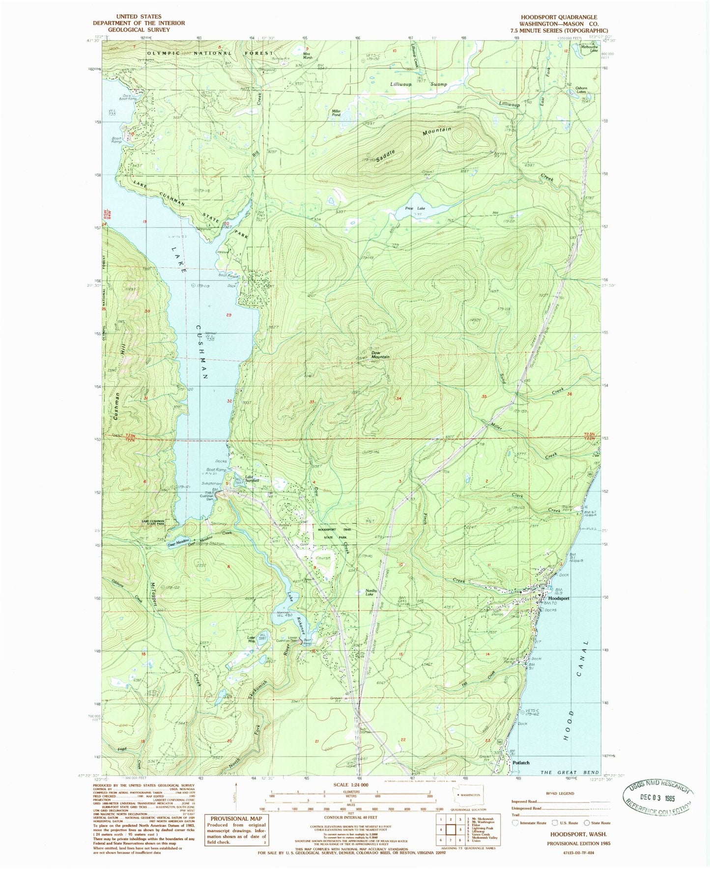
Classic USGS Hoodsport Washington 7.5'x7.5' Topo Map
Couldn't load pickup availability
Historical USGS topographic quad map of Hoodsport in the state of Washington. Map scale may vary for some years, but is generally around 1:24,000. Print size is approximately 24" x 27"
This quadrangle is in the following counties: Mason.
The map contains contour lines, roads, rivers, towns, and lakes. Printed on high-quality waterproof paper with UV fade-resistant inks, and shipped rolled.
Contains the following named places: Big Creek, Big Creek Campground, Clark Creek, Cushman Dam, Cushman Hill, Deer Meadow, Deer Meadow Creek, Dow Creek, Dow Mountain, Dow Mountain Lookout, East Fork Lilliwaup Creek, Finch Creek, Gibbons Creek, Hill Creek, Hood Canal Community Church, Hood Canal Ranger Station, Hood Canal Salmon Hatchery, Hoodsport, Hoodsport Census Designated Place, Hoodsport Hatchery, Hoodsport Post Office, Hoodsport Timberland Library, Hoodsport Trail State Park, Lake Cushman State Park, Lake Cushman State Park Campground, Lake Kokanee, Lake May, Lake Standstill, Lilliwaup Swamp, Lower Cushman Dam, Mason County Fire District 1, Mason County Fire District 18, Miller Pond, Mint Marsh, No Name Creek, Nordby Lake, Osborn Lakes, Potlatch, Price Lake, Saddle Mountain, Saint Germains Church