MyTopo
Classic USGS Hooker California 7.5'x7.5' Topo Map
Couldn't load pickup availability
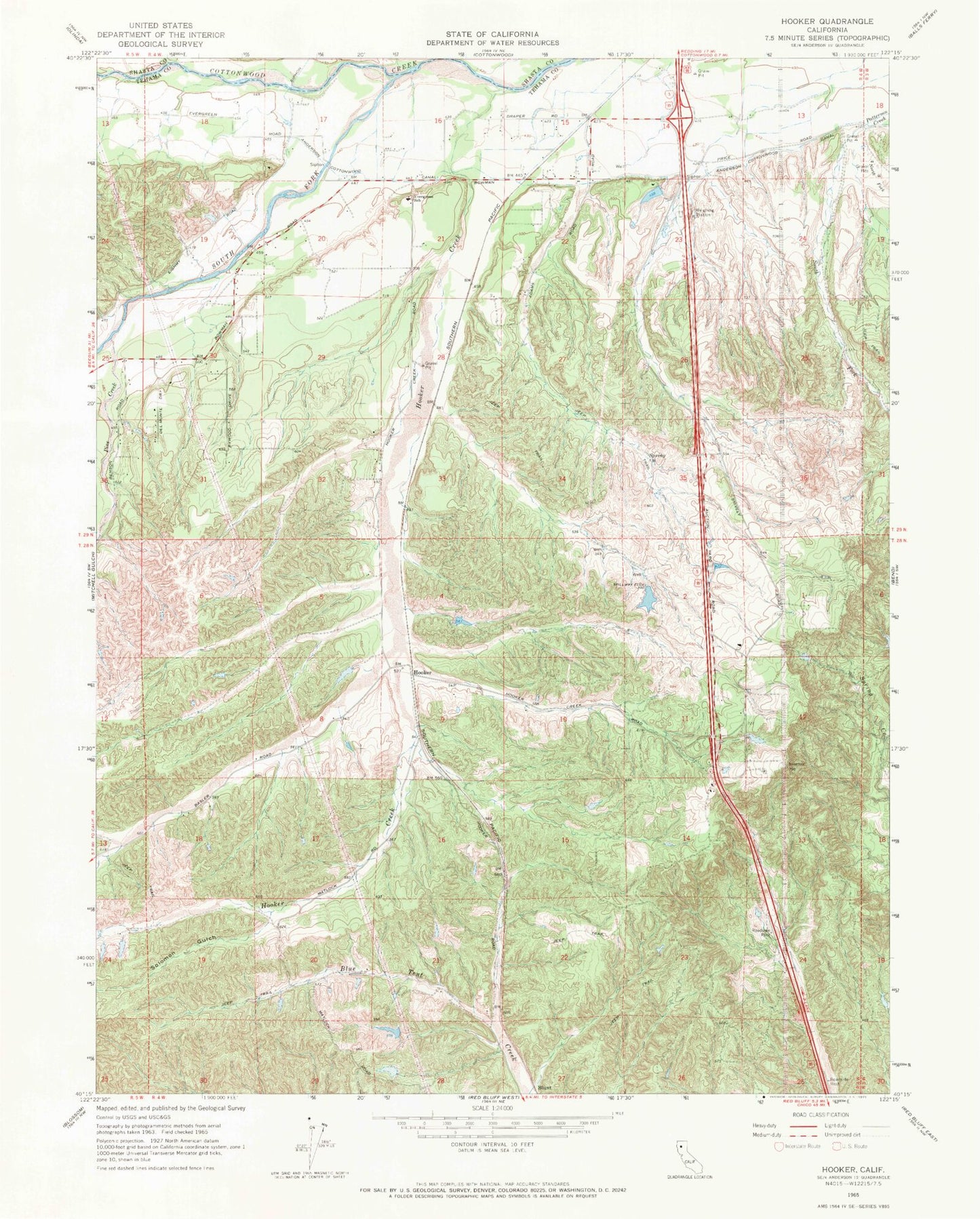
Historical USGS topographic quad map of Hooker in the state of California. Map scale may vary for some years, but is generally around 1:24,000. Print size is approximately 24" x 27"
This quadrangle is in the following counties: Shasta, Tehama.
The map contains contour lines, roads, rivers, towns, and lakes. Printed on high-quality waterproof paper with UV fade-resistant inks, and shipped rolled.
Contains the following named places: Cottonwood Creek Pit Number 3, Cottonwood School, Evergreen Elementary School, Flying N Ranch Airport, Hooker, Hooker Creek, Hooker School, Ninemile, North Fork Patterson Creek, Pine Creek, Solomon Gulch, South Fork Cottonwood Creek, South Fork Patterson Creek, Tehama County Fire Department Station 3 Bowman