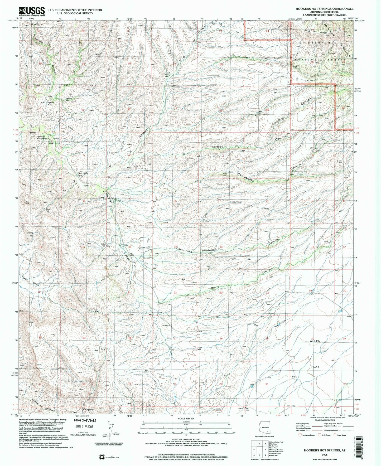
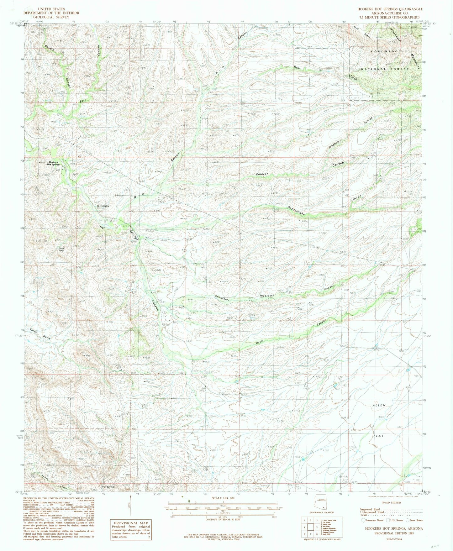
MyTopo
Classic USGS Hookers Hot Springs Arizona 7.5'x7.5' Topo Map
Couldn't load pickup availability
Historical USGS topographic quad map of Hookers Hot Springs in the state of Arizona. Map scale may vary for some years, but is generally around 1:24,000. Print size is approximately 24" x 27"
This quadrangle is in the following counties: Cochise.
The map contains contour lines, roads, rivers, towns, and lakes. Printed on high-quality waterproof paper with UV fade-resistant inks, and shipped rolled.
Contains the following named places: Antelope Ranch, Bald Ridge Number Two Tank, Bear Creek, Bear Tank, Carruthers Canyon, Cement Dam Tank, Davis Canyon, Double R Canyon, Hackberry Canyon, Hookers Hot Springs, Javelina Canyon, Muleshoe Ranch, N-O Canyon, N-O Spring, Polecat Canyon, Rattlesnake Canyon, Riggs Seep, V-F Spring