MyTopo
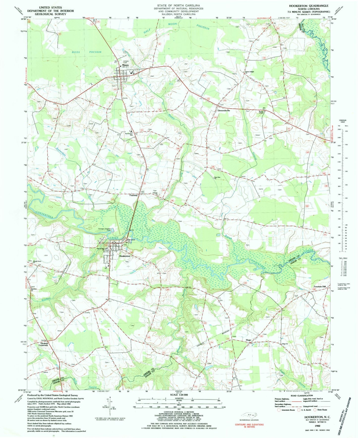
Classic USGS Hookerton North Carolina 7.5'x7.5' Topo Map
Couldn't load pickup availability
Historical USGS topographic quad map of Hookerton in the state of North Carolina. Map scale may vary for some years, but is generally around 1:24,000. Print size is approximately 24" x 27"
This quadrangle is in the following counties: Greene, Lenoir, Pitt.
The map contains contour lines, roads, rivers, towns, and lakes. Printed on high-quality waterproof paper with UV fade-resistant inks, and shipped rolled.
Contains the following named places: Antioch Church, Beaverdam Run, Calvert School, Chase Field, Darewood Estates - Mobile Home Park, East Green School, Eastern Correctional Institution, Fountain Hill, Fourway, Glenfield Crossroads, Greene Correctional Institution, Half Moon Pocosin, Hookerton, Hookerton Post Office, Hookerton Volunteer Fire Department and Emergency Medical Services, Hugo, Hugo Church, Hugo Volunteer Fire Department - Station 1, Maury, Maury Census Designated Place, Maury Correctional Institution, Maury Post Office, Maury Volunteer Fire and Rescue, Mount Calvary Church, Mussel Run, New Zion Church, Ormondsville, Patsy Bran Mobile Home Park, Polecat Branch, Rainbow Cemetery, Rainbow Creek, Rainbow Methodist Church, Rices Pocosin, Rouses Chapel, Saints Delight Church, Scuffleton Rural Fire Department, Shady Grove Church, Star of Zion, Town of Hookerton, Township of Hookerton, Township of Ormonds, Union Chapel, Water Branch School, Wheat Swamp, ZIP Codes: 28538, 28554