MyTopo
Classic USGS Hoop Lake Utah 7.5'x7.5' Topo Map
Regular price
$16.95
Regular price
Sale price
$16.95
Unit price
per
Couldn't load pickup availability
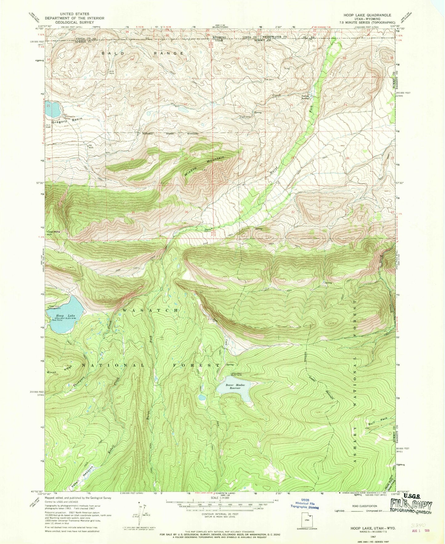
Historical USGS topographic quad map of Hoop Lake in the states of Utah, Wyoming. Typical map scale is 1:24,000, but may vary for certain years, if available. Print size: 24" x 27"
This quadrangle is in the following counties: Daggett, Summit, Sweetwater, Uinta.
The map contains contour lines, roads, rivers, towns, and lakes. Printed on high-quality waterproof paper with UV fade-resistant inks, and shipped rolled.
Contains the following named places: Beaver Meadow Reservoir, Bull Park, Gregory Basin, Hoop Lake, Hoop Lake Campground, Indian Creek, Indian Spring, Kabell Meadows, Lost Creek, Widdop Mountain, Kabell Creek, Thompson Creek, Telephone Hollow, Lost Creek Park, Bald Range