MyTopo
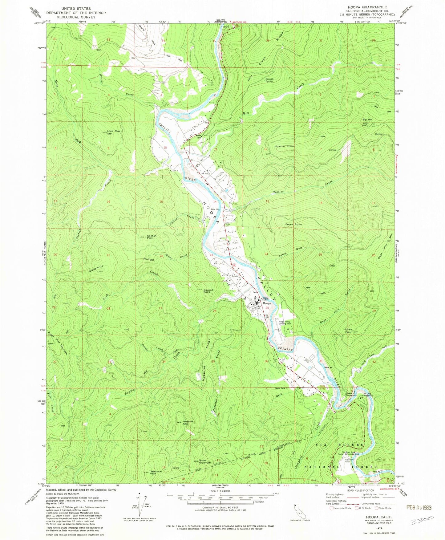
Classic USGS Hoopa California 7.5'x7.5' Topo Map
Couldn't load pickup availability
Historical USGS topographic quad map of Hoopa in the state of California. Map scale may vary for some years, but is generally around 1:24,000. Print size is approximately 24" x 27"
This quadrangle is in the following counties: Humboldt.
The map contains contour lines, roads, rivers, towns, and lakes. Printed on high-quality waterproof paper with UV fade-resistant inks, and shipped rolled.
Contains the following named places: Beaver Creek, Big Hill, Brown Creek, Campbell Creek, Campbell Creek Guard Station, Captain John Gulch, Captain John Mountain, Ferry Gulch, Ferry Point, Heck Creek, Hoopa, Hoopa Airport, Hoopa Campground, Hoopa Census Designated Place, Hoopa Post Office, Hoopa Valley, Hoopa Valley Elementary School, Hoopa Valley High School, Hoopa Valley Reservation, Hoopa Valley Tribe Fire Department, Hoopa Valley Volunteer Fire Department, Hospital Creek, Hospital Mountain, Hospital Ridge, Hostler Creek, Hostler Point, Humboldt County Sheriff's Office Hoopa Station, Jones Point, KIDE-FM (Hoopa), K'ima W Ambulance, Lone Pine Mountain, Mill Creek, North Fork Soctish Creek, Rock Creek, Sawmill Point, Sawmill Ridge, Sixmile Spring, Snow Mountain, Soctish Creek, Soctish Point, Spring Creek, Sugar Bowl Ranch, Supply Creek, Telescope Peak, The Rain Rock, Tish Tang a Tang Creek, Tish Tang Campground, Twomile Creek, ZIP Code: 95546