MyTopo
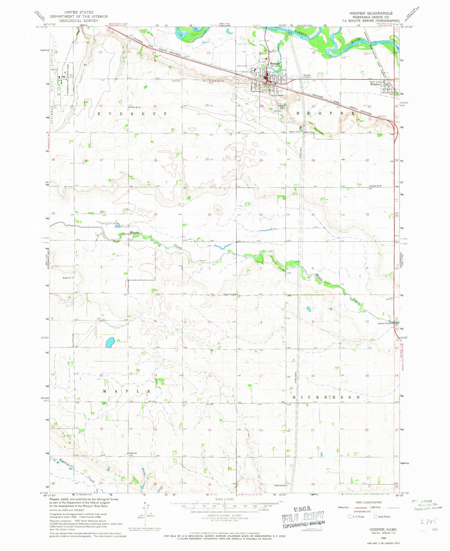
Classic USGS Hooper Nebraska 7.5'x7.5' Topo Map
Couldn't load pickup availability
Historical USGS topographic quad map of Hooper in the state of Nebraska. Map scale may vary for some years, but is generally around 1:24,000. Print size is approximately 24" x 27"
This quadrangle is in the following counties: Dodge.
The map contains contour lines, roads, rivers, towns, and lakes. Printed on high-quality waterproof paper with UV fade-resistant inks, and shipped rolled.
Contains the following named places: Bellevue School, Bethel Church, Bluffs Church, City of Hooper, Elkhorn Valley Golf Course, Faith United Methodist Church, Hooper, Hooper Care Center, Hooper Cemetery, Hooper Dam, Hooper Elementary School, Hooper Fire and Rescue, Hooper Medical Clinic, Hooper Memorial Park, Hooper Memorial Park Campground, Hooper Police Department, Hooper Post Office, Hooper Public Library, Hooper Reservoir, Jalapa Post Office, Kerstein Reservoir, Luther-Broadview Public School, Redeemer Evangelical Lutheran Church, Saint John Lutheran Church, Saint Rose of Lima Cemetery, Saint Rose of Lima Church, School Number 48, School Number 88, Scribner Air Base Dam, Scribner State Airport, Township of Everett, Township of Hooper, Township of Maple, Village of Winslow, Winslow, Winslow City Park, Winslow City Park Campground, Winslow Fire and Rescue, Winslow Post Office, ZIP Code: 68072